Dinwiddie County, Virginia
| Dinwiddie County, Virginia | ||
|---|---|---|
|
| ||
| ||
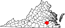 Location in the U.S. state of Virginia | ||
 Virginia's location in the U.S. | ||
| Founded | 1752 | |
| Named for | Robert Dinwiddie | |
| Seat | Dinwiddie | |
| Largest town | McKenney | |
| Area | ||
| • Total | 507 sq mi (1,313 km2) | |
| • Land | 504 sq mi (1,305 km2) | |
| • Water | 3.5 sq mi (9 km2), 0.7% | |
| Population (est.) | ||
| • (2015) | 28,001 | |
| • Density | 55/sq mi (21/km²) | |
| Congressional district | 4th | |
| Time zone | Eastern: UTC-5/-4 | |
| Website |
www | |

Dinwiddie County is a county located in the Commonwealth of Virginia. As of the 2010 census, the population was 28,001.[1] Its county seat is Dinwiddie.[2]
Dinwiddie County is part of the Richmond, VA Metropolitan Statistical Area.
History

The first inhabitants of the area were Paleo-Indians, prior to 8000 BC. They are believed to have been nomadic hunter-gatherers following animal migrations. Early stone tools have been discovered in various fields within the county. At the time of European contact, Native Americans had territory in the region.
Dinwiddie County was formed May 1, 1752, from Prince George County. The county is named for Robert Dinwiddie, Lieutenant Governor of Virginia, 1751–58. The county raised several militia units that would fight in the American Revolution.
Dinwiddie County was the birthplace of Elizabeth (Burwell) Hobbs Keckly, a free black dressmaker who worked for two presidents' wives: Mrs. Jefferson Davis and later Mary Todd Lincoln. Thomas Day was also a native; he was well known later at Milton, North Carolina, as a free black cabinetmaker. Another native son was Dr. Thomas Stewart, perhaps America's first free black 18th-century rural physician.[3]
During the Civil War the Battle of Lewis's Farm was fought along Quaker Road [Rt. 660]. It took place on March 29, 1865. This was the first in several attempts by Union General Ulysses S. Grant to cut Robert E. Lee's final supply line—the Southside Railroad—in the spring of 1865. Here the Union forces led by Brig. Gen. Joshua L. Chamberlain engaged Confederates under Maj. Gen. Bushrod R. Johnson. After sharp fighting, the Union troops entrenched nearby along the Boydton Plank Road, and Johnson withdrew to his lines at White Oak Road. The Union army cut the rail line four days later, after capturing Five Forks on April 1, 1865, at the Battle of Five Forks. Several other engagements were fought in Dinwiddie County, including the Battle of Dinwiddie Court House, Battle of Sutherland's Station, and Battle of White Oak Road.
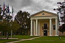
The Dinwiddie County Historical Society currently occupies the historic Dinwiddie County Court House.
Civil War battles
- Battle of Peebles' Farm
- Battle of Lewis's Farm
- Battle of Dinwiddie Court House
- Battle of White Oak Road
- Battle of Five Forks
- Battle of Sutherland's Station
Geography
Dinwiddie is located in southern Virginia, southwest of the city of Petersburg. According to the U.S. Census Bureau, the county has a total area of 507 square miles (1,310 km2), of which 504 square miles (1,310 km2) is land and 3.5 square miles (9.1 km2) (0.7%) is water.[4] It is located between two US Army forts, Fort Lee to the east and Fort Pickett to the west.
Adjacent counties
- Chesterfield County - north
- Petersburg City - northeast
- Prince George County - east
- Sussex County - southeast
- Greensville County - south
- Brunswick County - southwest
- Nottoway County - west
- Amelia County - northwest
National protected area
Major highways
Demographics
| Historical population | |||
|---|---|---|---|
| Census | Pop. | %± | |
| 1790 | 13,934 | — | |
| 1800 | 15,374 | 10.3% | |
| 1810 | 18,190 | 18.3% | |
| 1820 | 20,482 | 12.6% | |
| 1830 | 21,901 | 6.9% | |
| 1840 | 22,558 | 3.0% | |
| 1850 | 25,118 | 11.3% | |
| 1860 | 30,198 | 20.2% | |
| 1870 | 30,702 | 1.7% | |
| 1880 | 32,870 | 7.1% | |
| 1890 | 13,515 | −58.9% | |
| 1900 | 15,374 | 13.8% | |
| 1910 | 15,442 | 0.4% | |
| 1920 | 17,949 | 16.2% | |
| 1930 | 18,492 | 3.0% | |
| 1940 | 18,166 | −1.8% | |
| 1950 | 18,839 | 3.7% | |
| 1960 | 22,183 | 17.8% | |
| 1970 | 25,046 | 12.9% | |
| 1980 | 22,602 | −9.8% | |
| 1990 | 20,960 | −7.3% | |
| 2000 | 24,533 | 17.0% | |
| 2010 | 28,001 | 14.1% | |
| Est. 2015 | 27,852 | [5] | −0.5% |
| U.S. Decennial Census[6] 1790-1960[7] 1900-1990[8] 1990-2000[9] 2010-2015[1] | |||
As of the census[10] of 2000, there were 24,533 people, 9,107 households, and 6,720 families residing in the county. The population density was 49 people per square mile (19/km²). There were 9,707 housing units at an average density of 19 per square mile (7/km²). The racial makeup of the county was 64.55% White, 33.66% Black or African American, 0.22% Native American, 0.31% Asian, 0.04% Pacific Islander, 0.40% from other races, and 0.82% from two or more races. 0.97% of the population were Hispanic or Latino of any race.
There were 9,107 households out of which 32.10% had children under the age of 18 living with them, 54.80% were married couples living together, 13.90% had a female householder with no husband present, and 26.20% were non-families. 22.20% of all households were made up of individuals and 8.50% had someone living alone who was 65 years of age or older. The average household size was 2.58 and the average family size was 3.01.
In the county, the population was spread out with 24.00% under the age of 18, 6.70% from 18 to 24, 30.90% from 25 to 44, 26.20% from 45 to 64, and 12.20% who were 65 years of age or older. The median age was 38 years. For every 100 females there were 98.80 males. For every 100 females age 18 and over, there were 96.00 males.
The median income for a household in the county was $41,582, and the median income for a family was $47,961. Males had a median income of $32,860 versus $24,346 for females. The per capita income for the county was $19,122. About 6.60% of families and 9.30% of the population were below the poverty line, including 11.60% of those under age 18 and 12.60% of those age 65 or over.
Government
Board of Supervisors
- District 1: Harrison A. Moody (D)
- District 2: Mark E. Moore (I)
- District 3: William D. Chavis (I)
- District 4: Daniel D. Lee (I)
- District 5: Brenda K. Ebron-Bonner (D)
Constitutional officers
- Clerk of the Circuit Court: John Barrett Chappell, Jr. (D)
- Commissioner of the Revenue: Lori K. Stevens (R)
- Commonwealth's Attorney: Ann Cabell Baskervill (I)
- Sheriff: D.T. "Duck" Adams (D)
- Treasurer: Jennifer Caraway Perkins (D)
Dinwiddie is represented by Republican Frank M. Ruff, Jr. and Democrat Henry L. Marsh, III in the Virginia Senate, Democrats Rosalyn R. Dance and Roslyn C. Tyler in the Virginia House of Delegates, and Republican J. Randy Forbes in the U.S. House of Representatives.
In 2009 the Dinwiddie Republican party acting vice-chairman Jerry Dyson III ran against Petersburg Republican party chairman Susan McCammon for the Republican nomination for the 63rd district of the House of Delegates. This was the first time in decades a Republican from Dinwiddie ran for the 63rd nomination, challenging Democrat Rosalyn R. Dance for the first time since she was elected delegate in 2005. Jerry Dyson III later dropped out of the election in April leaving the nomination for Susan McCammon, who later dropped out in September leaving the Republican Party without a candidate.
Communities
The Bureau of Economic Analysis combines the independent cities of the City of Petersburg and the City of Colonial Heights with Dinwiddie County for statistical purposes.
Town
Unincorporated communities
|
Education
Appomattox Regional Library serves as the public library for the area.
References
- 1 2 "State & County QuickFacts". United States Census Bureau. Retrieved January 2, 2014.
- ↑ "Find a County". National Association of Counties. Retrieved 2011-06-07.
- ↑ Virginia Gazette Nov. 1778 as found in Freeafricanamericans.com
- ↑ "US Gazetteer files: 2010, 2000, and 1990". United States Census Bureau. 2011-02-12. Retrieved 2011-04-23.
- ↑ "County Totals Dataset: Population, Population Change and Estimated Components of Population Change: April 1, 2010 to July 1, 2015". Retrieved July 2, 2016.
- ↑ "U.S. Decennial Census". United States Census Bureau. Retrieved January 2, 2014.
- ↑ "Historical Census Browser". University of Virginia Library. Retrieved January 2, 2014.
- ↑ "Population of Counties by Decennial Census: 1900 to 1990". United States Census Bureau. Retrieved January 2, 2014.
- ↑ "Census 2000 PHC-T-4. Ranking Tables for Counties: 1990 and 2000" (PDF). United States Census Bureau. Retrieved January 2, 2014.
- ↑ "American FactFinder". United States Census Bureau. Retrieved 2011-05-14.
External links
Coordinates: 37°05′N 77°38′W / 37.08°N 77.63°W
 |
Amelia County | Chesterfield County | City of Petersburg | |
| Nottoway County | |
Prince George County | ||
| ||||
| | ||||
| Brunswick County | Greensville County | Sussex County |
Municipalities and communities of Dinwiddie County, Virginia, United States | ||
|---|---|---|
| Town | | |
| Unincorporated communities | ||