King William County, Virginia
| King William County, Virginia | ||
|---|---|---|
|
King William County Courthouse | ||
| ||
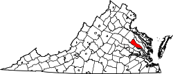 Location in the U.S. state of Virginia | ||
 Virginia's location in the U.S. | ||
| Founded | 1702 | |
| Named for | William III | |
| Seat | King William | |
| Largest town | West Point | |
| Area | ||
| • Total | 286 sq mi (741 km2) | |
| • Land | 274 sq mi (710 km2) | |
| • Water | 12 sq mi (31 km2), 4.1% | |
| Population (est.) | ||
| • (2015) | 16,269 | |
| • Density | 47/sq mi (18/km²) | |
| Congressional district | 1st | |
| Time zone | Eastern: UTC-5/-4 | |
| Website |
www | |


King William County is a county located in the U.S. state of Virginia. As of the 2010 census, the population was 15,935.[1] Its county seat is King William.[2]
King William County is located in the Middle Peninsula and is included in the Greater Richmond Region.
History
For thousands of years before European contact, indigenous peoples of North America lived in the Tidewater area of present-day Virginia. At the time of the founding of Jamestown, 30 Virginia Native American tribes comprised the Powhatan paramountcy, numbering 14,000-21,000 people. The Algonquian-speaking Mattaponi Indian Tribe and Upper Mattaponi tribe, among the 11 tribes recognized by the state of Virginia, are located in the county. The Mattaponi are one of two Virginia Indian tribes who still occupy reservation land first allocated by the English under treaty in the 17th century.
One prominent family during Colonial Virginia times was that of William Aylett. The Tobacco Inspection Act of 1730 established a tobacco inspection warehouse at Aylett's. Aylett's daughters intermarried with other Northern Neck families.
English colonists formed King William County in 1702 out of King and Queen County. The county is named for William of Orange, King of England.[3] The Courthouse, built in 1725, is the oldest courthouse in continuous use in the United States.
Geography
According to the U.S. Census Bureau, the county has a total area of 286 square miles (740 km2), of which 274 square miles (710 km2) is land and 12 square miles (31 km2) (4.1%) is water.[4] King William County is bounded by the Mattaponi River to the north and the Pamunkey River to the south. The two rivers combine to form the York River, at West Point, the county's largest town.
Adjacent counties
- Caroline County - northwest
- King and Queen County - northeast
- New Kent County - south
- Hanover County - southwest
Major Highways
Demographics
| Historical population | |||
|---|---|---|---|
| Census | Pop. | %± | |
| 1790 | 8,128 | — | |
| 1800 | 9,055 | 11.4% | |
| 1810 | 9,285 | 2.5% | |
| 1820 | 9,697 | 4.4% | |
| 1830 | 9,812 | 1.2% | |
| 1840 | 9,258 | −5.6% | |
| 1850 | 8,779 | −5.2% | |
| 1860 | 8,530 | −2.8% | |
| 1870 | 7,515 | −11.9% | |
| 1880 | 8,751 | 16.4% | |
| 1890 | 9,605 | 9.8% | |
| 1900 | 8,380 | −12.8% | |
| 1910 | 8,547 | 2.0% | |
| 1920 | 8,739 | 2.2% | |
| 1930 | 7,929 | −9.3% | |
| 1940 | 7,855 | −0.9% | |
| 1950 | 7,589 | −3.4% | |
| 1960 | 7,563 | −0.3% | |
| 1970 | 7,497 | −0.9% | |
| 1980 | 9,334 | 24.5% | |
| 1990 | 10,913 | 16.9% | |
| 2000 | 13,146 | 20.5% | |
| 2010 | 15,935 | 21.2% | |
| Est. 2015 | 16,269 | [5] | 2.1% |
| U.S. Decennial Census[6] 1790-1960[7] 1900-1990[8] 1990-2000[9] 2010-2013[1] | |||
As of the 2010 United States Census, there were 15,935 people residing in the county. 77.2% were White, 17.7% Black or African American, 1.4% Native American, 0.7% Asian, 0.6% of some other race and 2.3% of two or more races. 2.0% were Hispanic or Latino (of any race). 18.6% were of English, 16.5% American, 8.7% German and 7.6% Irish ancestry.[10]
As of the census[11] of 2000, there were 13,146 people, 4,846 households, and 3,784 families residing in the county. The population density was 48 people per square mile (18/km²). There were 5,189 housing units at an average density of 19 per square mile (7/km²). The racial makeup of the county was 73.81% White, 22.81% Black or African American, 1.54% Native American, 0.37% Asian, 0.33% from other races, and 1.15% from two or more races. 0.91% of the population were Hispanic or Latino of any race.
There were 4,846 households out of which 36.40% had children under the age of 18 living with them, 63.90% were married couples living together, 10.20% had a female householder with no husband present, and 21.90% were non-families. 18.30% of all households were made up of individuals and 7.60% had someone living alone who was 65 years of age or older. The average household size was 2.69 and the average family size was 3.06.
In the county, the population was spread out with 26.10% under the age of 18, 5.90% from 18 to 24, 31.50% from 25 to 44, 24.80% from 45 to 64, and 11.70% who were 65 years of age or older. The median age was 37 years. For every 100 females there were 96.90 males. For every 100 females age 18 and over, there were 93.90 males.
The median income for a household in the county was $49,876, and the median income for a family was $54,037. Males had a median income of $34,616 versus $25,578 for females. The per capita income for the county was $21,928. About 4.40% of families and 5.50% of the population were below the poverty line, including 6.00% of those under age 18 and 9.00% of those age 65 or over.
Two Indian reservations exist in the county. They are the only ones in the Commonwealth of Virginia
Government
Board of Supervisors
First District: William L. Hodges (I)
Second District: Travis J. Moskalski (I)
Third District: Stephen K. Greenwood (I)
Fourth District: David E. Hansen (I)
Fifth District: Robert W. Ehrhart (I)[12]
Constitutional Officers
Clerk of the Circuit Court: Patricia M. Norman (I)
Commissioner of the Revenue: Sally W. Pearson (I)
Commonwealth's Attorney: Matthew R. Kite (I)
Sheriff: J.S. "Jeff" Walton (I)
Treasurer: Harry L. Whitt (I)
King William is represented by Republican Thomas K. "Tommy" Norment, Jr. in the Virginia Senate, Republicans Christopher K. "Chris" Peace and M. Keith Hodges in the Virginia House of Delegates, and Republican Robert J. "Rob" Wittman.
Communities
Town
Unincorporated communities
See also
- King William County Sheriff’s Office
- National Register of Historic Places listings in King William County, Virginia
References
- 1 2 "State & County QuickFacts". United States Census Bureau. Retrieved January 3, 2014.
- ↑ "Find a County". National Association of Counties. Retrieved 2011-06-07.
- ↑ Gannett, Henry (1905). The Origin of Certain Place Names in the United States. Govt. Print. Off. p. 176.
- ↑ "US Gazetteer files: 2010, 2000, and 1990". United States Census Bureau. 2011-02-12. Retrieved 2011-04-23.
- ↑ "County Totals Dataset: Population, Population Change and Estimated Components of Population Change: April 1, 2010 to July 1, 2015". Retrieved July 2, 2016.
- ↑ "U.S. Decennial Census". United States Census Bureau. Retrieved January 3, 2014.
- ↑ "Historical Census Browser". University of Virginia Library. Retrieved January 3, 2014.
- ↑ "Population of Counties by Decennial Census: 1900 to 1990". United States Census Bureau. Retrieved January 3, 2014.
- ↑ "Census 2000 PHC-T-4. Ranking Tables for Counties: 1990 and 2000" (PDF). United States Census Bureau. Retrieved January 3, 2014.
- ↑ "American FactFinder"
- ↑ "American FactFinder". United States Census Bureau. Retrieved 2011-05-14.
- ↑ http://kingwilliamcounty.us/government-overview/boards-commissions/board-of-supervisors/
 |
Caroline County | King and Queen County | | |
| |
||||
| ||||
| | ||||
| Hanover County | New Kent County |
Coordinates: 37°42′N 77°06′W / 37.70°N 77.10°W