Greene County, Virginia
| Greene County, Virginia | ||
|---|---|---|
|
Courthouse, built 1838, in Stanardsville | ||
| ||
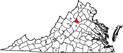 Location in the U.S. state of Virginia | ||
 Virginia's location in the U.S. | ||
| Founded | 1838 | |
| Named for | Nathanael Greene | |
| Seat | Stanardsville | |
| Largest town | Stanardsville | |
| Area | ||
| • Total | 157 sq mi (407 km2) | |
| • Land | 156 sq mi (404 km2) | |
| • Water | 0.7 sq mi (2 km2), 0.4% | |
| Population (est.) | ||
| • (2015) | 19,162 | |
| • Density | 122/sq mi (47/km²) | |
| Congressional district | 5th | |
| Time zone | Eastern: UTC-5/-4 | |
| Website |
www | |
%2C_Stanardsville%2C_(Greene_County%2C_Virginia).jpg)

Greene County is a county in central Virginia in the eastern United States. As of the 2010 census, the population was 18,403.[1] Its county seat is Stanardsville.[2]
Greene County is part of the Charlottesville, VA Metropolitan Statistical Area.
History
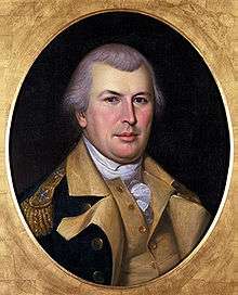
Greene County was established in 1838 from Orange County. The county is named for American Revolutionary War hero Nathanael Greene.[3]
A major incident occurred on October 24, 1979, when a natural gas main ruptured, causing an explosion. The resulting fire destroyed the bell tower of the county courthouse and county office building. However, quick action by the firemen on the scene saved the county records which were secured in the vault.
Geography
According to the U.S. Census Bureau, the county has a total area of 156.8 square miles (406.1 km2), of which 156.1 square miles (404.3 km2) is land and 0.7 square miles (1.8 km2) (0.4%) is water.[4] It is the second-smallest county in Virginia by total area.
Adjacent counties
- Rockingham County, Virginia - west
- Page County, Virginia - northwest
- Madison County, Virginia - northeast
- Orange County, Virginia - southeast
- Albemarle County, Virginia - south
National protected areas
- Shenandoah National Park (part)
Major highways
Demographics
| Historical population | |||
|---|---|---|---|
| Census | Pop. | %± | |
| 1840 | 4,232 | — | |
| 1850 | 4,400 | 4.0% | |
| 1860 | 5,022 | 14.1% | |
| 1870 | 4,634 | −7.7% | |
| 1880 | 5,830 | 25.8% | |
| 1890 | 5,622 | −3.6% | |
| 1900 | 6,214 | 10.5% | |
| 1910 | 6,937 | 11.6% | |
| 1920 | 6,369 | −8.2% | |
| 1930 | 5,980 | −6.1% | |
| 1940 | 5,218 | −12.7% | |
| 1950 | 4,745 | −9.1% | |
| 1960 | 4,715 | −0.6% | |
| 1970 | 5,248 | 11.3% | |
| 1980 | 7,625 | 45.3% | |
| 1990 | 10,297 | 35.0% | |
| 2000 | 15,244 | 48.0% | |
| 2010 | 18,403 | 20.7% | |
| Est. 2015 | 19,162 | [5] | 4.1% |
| U.S. Decennial Census[6] 1790-1960[7] 1900-1990[8] 1990-2000[9] 2010-2012[1] | |||
As of the census[10] of 2010, there are 18,403 people, 6,780 households, and 5,072 families residing in the county. The population density is 117.8 people per square mile (38/km²). There are 7,509 housing units at an average density of 48.1 per square mile (15/km²). The racial makeup of the county is 87.6% White, 6.3% Black or African American, 0.19% Native American, 0.45% Asian, 0.2% Pacific Islander, 0.64% from other races, and 2.2% from two or more races. 4.2% of the population are Hispanic or Latino of any race.
There are 6,780 households out of which 32.2% have children under the age of 18 living with them, 59% are married couples living together, 11.1% have a female householder with no husband present, and 25.2% are non-families. 20.1% of all households are made up of individuals and 6.6% have someone living alone who is 65 years of age or older. The average household size is 2.69 and the average family size is 3.08. The median age for all individuals in the county is 59.3 years.
The median income for a household in the county is $54,307 and median family income is $60,414. The per capita income for the county is $24,696. 8.4% of the population and 4.9% of families are below the poverty line. Out of the total population, 8.6% of those under the age of 18 and 11.8% of those 65 and older are living below the poverty line.
Government
Board of Supervisors
At-Large District: Dale Herring (I)
Midway District: Jim Frydl (I)
Monroe District: David L. Cox (I)
Ruckersville District: Michelle Flynn (I)
Stanardsville District: Bill Martin (I)
Constitutional Officers
Clerk of the Circuit Court: Marie C. Durrer (I)
Commissioner of the Revenue: Larry V. "Percy" Snow (I)
Commonwealth's Attorney: Ronald L. Morris (I)
Sheriff: Steven S. Smith (R)
Treasurer: Stephanie Allen Deal (I)
Greene is represented by Republican Emmett E. Hanger, Jr. in the Virginia Senate, Republican Robert B. Bell, III in the Virginia House of Delegates and Republican Robert J. Hurt in the U.S. House of Representatives.
Public Services
Jefferson-Madison Regional Library is the regional library system that provides services to the citizens of Greene.
Communities
Towns
Census-designated places
Unincorporated communities
See also
- Greene County Sheriff's Office
- National Register of Historic Places listings in Greene County, Virginia
References
- 1 2 "State & County QuickFacts". United States Census Bureau. Retrieved January 2, 2014.
- ↑ "Find a County". National Association of Counties. Retrieved 2011-06-07.
- ↑ Gannett, Henry (1905). The Origin of Certain Place Names in the United States. Govt. Print. Off. p. 143.
- ↑ "US Gazetteer files: 2010, 2000, and 1990". United States Census Bureau. 2011-02-12. Retrieved 2011-04-23.
- ↑ "County Totals Dataset: Population, Population Change and Estimated Components of Population Change: April 1, 2010 to July 1, 2015". Retrieved July 2, 2016.
- ↑ "U.S. Decennial Census". United States Census Bureau. Retrieved January 2, 2014.
- ↑ "Historical Census Browser". University of Virginia Library. Retrieved January 2, 2014.
- ↑ "Population of Counties by Decennial Census: 1900 to 1990". United States Census Bureau. Retrieved January 2, 2014.
- ↑ "Census 2000 PHC-T-4. Ranking Tables for Counties: 1990 and 2000" (PDF). United States Census Bureau. Retrieved January 2, 2014.
- ↑ "American FactFinder". United States Census Bureau. Retrieved 2011-05-14.
External links
- Greene County Economic Development & Tourism
- Welcome to the County of Greene County, Virginia
- Greene County Record Newspaper
- Local Weather
- Greene County Historical Society
 |
Page County | Madison County | | |
| Rockingham County | |
|||
| ||||
| | ||||
| Albemarle County | Orange County |
Municipalities and communities of Greene County, Virginia, United States | ||
|---|---|---|
| Town | | |
| CDPs | ||
| Unincorporated communities | ||
Coordinates: 38°18′N 78°28′W / 38.30°N 78.47°W