Carroll County, Virginia
| Carroll County, Virginia | ||
|---|---|---|
 Carroll County Courthouse | ||
| ||
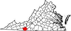 Location in the U.S. state of Virginia | ||
 Virginia's location in the U.S. | ||
| Founded | 1842 | |
| Named for | Charles Carroll | |
| Seat | Hillsville | |
| Largest town | Hillsville | |
| Area | ||
| • Total | 478 sq mi (1,238 km2) | |
| • Land | 475 sq mi (1,230 km2) | |
| • Water | 3 sq mi (8 km2), 0.6% | |
| Population (est.) | ||
| • (2015) | 29,724 | |
| • Density | 62/sq mi (24/km²) | |
| Congressional district | 9th | |
| Time zone | Eastern: UTC-5/-4 | |
| Website |
www | |

Carroll County is a United States county located in the southwestern part of the Commonwealth of Virginia. Roughly one fifth of the county lies in the Virginia Piedmont region, while the rest is part of the Appalachian Mountains. The Carroll county seat and largest town is Hillsville.[1]
The county was established in 1842 from part of Grayson County, and was officially named in honor of Charles Carroll, a signer of the Declaration of Independence. The borders of Carroll County were later expanded by including land from Patrick County.
The total size of the county is 478 square miles (1,238 km2), and, as of the 2010 census, the population was 30,042.[2] Carroll, along with other Appalachian counties, is among the poorest parts of Virginia.
History
The first European settlers arrived in the region in the mid 18th century. These were primarily Scotch-Irish pioneers, who were used to high mountain altitudes. However, early settlement was slow, mostly due to the poor agricultural soil of the area. As a result, lead mining was one of the first economic activities in the region.[3]
As the area's population density increased, Carroll County was created in 1842 from part of Grayson County. The new county was officially named for Charles Carroll, a signer of the Declaration of Independence, from Maryland.[4] However, other accounts assert that John Carroll, a Virginia state legislator, had named the county in his own honor, but was blocked by a political rival who had it officially named for Charles Carroll instead.[3][5]
Parts of Patrick County were added later to increase the size of Carroll County. The first piece was taken in 1845, and another part, which would later become the Fancy Gap District, was added in 1854.[3]
Geography
It is the only county in Virginia with Piedmont topography of roughly one fifth in the southeast part of the county and mountain topography of roughly four fifths elsewhere of the county. The Blue Ridge escarpment usually defines the county lines in both North Carolina and Virginia. The CDP community of Cana is in the Virginia Piedmont while the rest of the county is in the Appalachian Mountains.
According to the U.S. Census Bureau, the county has a total area of 478 square miles (1,240 km2), of which 475 square miles (1,230 km2) is land and 3 square miles (7.8 km2) (0.6%) is water.[6]
Adjacent counties / Independent city
- Galax, Virginia - west
- Grayson County, Virginia - west
- Wythe County, Virginia - northwest
- Pulaski County, Virginia - north
- Floyd County, Virginia - northeast
- Patrick County, Virginia - southeast
- Surry County, North Carolina - south
National protected areas
- Blue Ridge Parkway (part)
- Jefferson National Forest (part)
- Mount Rogers National Recreation Area (part)
Major highways
Demographics
| Historical population | |||
|---|---|---|---|
| Census | Pop. | %± | |
| 1850 | 5,909 | — | |
| 1860 | 8,012 | 35.6% | |
| 1870 | 9,147 | 14.2% | |
| 1880 | 13,323 | 45.7% | |
| 1890 | 15,497 | 16.3% | |
| 1900 | 19,303 | 24.6% | |
| 1910 | 21,116 | 9.4% | |
| 1920 | 21,283 | 0.8% | |
| 1930 | 22,141 | 4.0% | |
| 1940 | 25,904 | 17.0% | |
| 1950 | 26,695 | 3.1% | |
| 1960 | 23,178 | −13.2% | |
| 1970 | 23,092 | −0.4% | |
| 1980 | 27,270 | 18.1% | |
| 1990 | 26,594 | −2.5% | |
| 2000 | 29,245 | 10.0% | |
| 2010 | 30,042 | 2.7% | |
| Est. 2015 | 29,724 | [7] | −1.1% |
| U.S. Decennial Census[8] 1790-1960[9] 1900-1990[10] 1990-2000[11] 2010-2013[2] | |||
As of the census[12] of 2000, there were 29,245 people, 12,186 households, and 8,786 families residing in the county. The population density was 61 people per square mile (24/km²). There were 14,680 housing units at an average density of 31 per square mile (12/km²). The racial makeup of the county was 97.97% White, 0.44% Black or African American, 0.14% Native American, 0.10% Asian, 0.82% from other races, and 0.53% from two or more races. 1.64% of the population were Hispanic or Latino of any race.
There were 12,186 households out of which 27.80% had children under the age of 18 living with them, 59.70% were married couples living together, 8.60% had a female householder with no husband present, and 27.90% were non-families. 25.40% of all households were made up of individuals and 12.20% had someone living alone who was 65 years of age or older. The average household size was 2.36 and the average family size was 2.80.
In the county, the population was spread out with 21.10% under the age of 18, 7.20% from 18 to 24, 28.00% from 25 to 44, 26.70% from 45 to 64, and 17.00% who were 65 years of age or older. The median age was 41 years. For every 100 females there were 97.20 males. For every 100 females age 18 and over, there were 94.10 males.
The median income for a household in the county was $30,597, and the median income for a family was $36,755. Males had a median income of $25,907 versus $19,697 for females. The per capita income for the county was $16,475. About 8.70% of families and 12.50% of the population were below the poverty line, including 15.70% of those under age 18 and 14.10% of those age 65 or over.
Government
Board of Supervisors
Fancy Gap District: Phil D. McCraw (Vice Chairman) (R)
Laurel Fork District: Joshua A. Hendrick (R)
Pine Creek District: R.J. "Bob" Martin, Jr. (R)
Pipers Gap District: Thomas W. Littrell (R)
Sulphur Springs District: David V. Hutchins (Chairman) (R)
At Large: W.S. Sam Dickinson (D)
Constitutional Officers
Clerk of the Circuit Court: Gerald Ray Goad (D)
Commissioner of the Revenue: Fran McPherson (R)
Commonwealth's Attorney: Nathan H. Lyons (R)
Sheriff: John B. Gardner (R)
Treasurer: Bonita M. Williams (R)
Carroll County is represented by Republicans Ralph K. Smith and William M. "Bill" Stanley, Jr. in the Virginia Senate, Republican Anne B. Crockett-Stark in the Virginia House of Delegates, and Republican H. Morgan Griffith in the U.S. House of Representatives.
Education
Public High Schools
Carroll County High School, in Hillsville, serves the county. Home of the Cavaliers, CCHS is a 9-12 comprehensive high school. The school was created by the consolidation of Woodlawn High School (Woodlawn, Virginia) and Hillsville High School (Hillsville, Virginia).
Communities
Town
Unincorporated communities
- Austinville
- Cana
- Dugspur
- Fancy Gap
- Lambsburg
- Laurel Fork
- Woodlawn
- Sylvatus
Notable residents
- Floyd Allen (1856-1913) – landowner and chief patriarch of the powerful Allen clan; convicted and executed for murder after sensational 1912 Hillsville courthouse shootout that killed five people including Circuit Judge Thornton Massie, Commonwealth's Attorney William Foster, and sheriff Lewis Webb.
- Doc Ayers – Major League Baseball pitcher, Washington Senators, Detroit Tigers
- Kylene Barker – Miss America 1979
- Frank Beamer – Head football coach at Virginia Tech - List of college football coaches with 200 wins
- George Lafayette Carter – land, railroad entrepreneur, instrumental in the establishment of East Tennessee State University
- Charles B. Morris (1931-1996) – U.S. Army, Awarded the Medal of Honor, December 14, 1967
- Ernest Stoneman (1893–1968) – early country music recording artist
See also
References
- ↑ "Find a County". National Association of Counties. Archived from the original on 2011-05-31. Retrieved 2011-06-07.
- 1 2 "State & County QuickFacts". United States Census Bureau. Retrieved January 1, 2014.
- 1 2 3 Willis, Ninevah. "A Brief History Of Carroll County, Virginia". The Journal of Mountain Life (October, 1984). Retrieved 20 March 2015.
- ↑ Gannett, Henry (1905). The Origin of Certain Place Names in the United States. Govt. Print. Off. p. 70.
- ↑ Tennis, Joe (2004). Southwest Virginia Crossroads: An Almanac of Place Names and Places to See. Johnson City, Tenn.: Overmountain Press. p. 91. ISBN 978-1570722561.
- ↑ "US Gazetteer files: 2010, 2000, and 1990". United States Census Bureau. 2011-02-12. Retrieved 2011-04-23.
- ↑ "County Totals Dataset: Population, Population Change and Estimated Components of Population Change: April 1, 2010 to July 1, 2015". Retrieved July 2, 2016.
- ↑ "U.S. Decennial Census". United States Census Bureau. Archived from the original on May 11, 2015. Retrieved January 1, 2014.
- ↑ "Historical Census Browser". University of Virginia Library. Retrieved January 1, 2014.
- ↑ "Population of Counties by Decennial Census: 1900 to 1990". United States Census Bureau. Retrieved January 1, 2014.
- ↑ "Census 2000 PHC-T-4. Ranking Tables for Counties: 1990 and 2000" (PDF). United States Census Bureau. Retrieved January 1, 2014.
- ↑ "American FactFinder". United States Census Bureau. Archived from the original on 2013-09-11. Retrieved 2011-05-14.
External links
 Geographic data related to Carroll County, Virginia at OpenStreetMap
- Grayson Carroll Galax VA Directory
- County government website
 |
Wythe County | Pulaski County | Floyd County | |
| City of Galax and Grayson County | |
|||
| ||||
| | ||||
| Surry County, North Carolina | Patrick County |
Municipalities and communities of Carroll County, Virginia, United States | ||
|---|---|---|
| Town | | |
| CDPs | ||
| Unincorporated communities | ||
Coordinates: 36°44′N 80°44′W / 36.73°N 80.73°W