List of Virginia state parks

Breaks Canyon, located in Breaks Interstate Park.
This is a list of state parks and reserves in the Virginia state park system.
Virginia opened its entire state park system on June 15, 1936 as a six-park system. The six originals state parks were Seashore State Park (now First Landing State Park), Westmoreland State Park, Staunton River State Park, Douthat State Park, Fairy Stone State Park, and Hungry Mother State Park. The park system now oversees 37 parks.[1]
State parks

Douthat Lake, located in Douthat State Park.
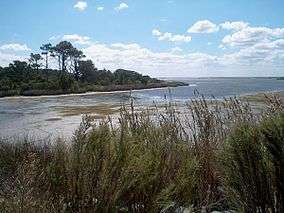
False Cape State Park's Back Bay.

Fog on a lake in Hungry Mother State Park.

View from Sky Meadows State Park.
| Name | Web- site |
Location | Size[1] | Established[1] | Status | Remarks |
|---|---|---|---|---|---|---|
| Bear Creek Lake State Park | Cumberland | 562 acres (2.27 km2) | 1939 | Open | ||
| Belle Isle State Park | Lancaster County | 747 acres (3.02 km2) | 1993 | Open | ||
| Breaks Interstate Park | Breaks | 4,500 acres (18 km2) | 1954 | Open | ||
| Caledon Natural Area | King George | 2,608 acres (10.55 km2) | 1974 | Open | ||
| Chippokes Plantation State Park | Surry | 1,945 acres (7.87 km2) | 1967 | Open | ||
| Claytor Lake State Park | Dublin | 476 acres (1.93 km2) | 1951 | Open | ||
| Douthat State Park | Millboro | 4,545 acres (18.39 km2) | 1933 | Open | ||
| Fairy Stone State Park | Stuart | 4,678 acres (18.93 km2) | 1933 | Open | ||
| False Cape State Park | Virginia Beach | 4,321 acres (17.49 km2) | 1968 | Open | ||
| First Landing State Park | Virginia Beach | 3,598 acres (14.56 km2) | 1933 | Open | Originally Seashore State Park[1] | |
| Grayson Highlands State Park | Mouth of Wilson | 4,857 acres (19.66 km2) | 1965 | Open | ||
| High Bridge Trail State Park | Farmville | 608 acres (2.46 km2) | 2006 | Open | ||
| Holliday Lake State Park | Appomattox | 250 acres (1.0 km2) | 1939 | Open | ||
| Hungry Mother State Park | Marion | 2,345 acres (9.49 km2) | 1933 | Open | ||
| James River State Park | Gladstone | 1,568 acres (6.35 km2) | 1993 | Open | ||
| Kiptopeke State Park | Cape Charles | 536 acres (2.17 km2) | 1992 | Open | ||
| Lake Anna State Park | Spotsylvania County | 2,469 acres (9.99 km2) | 1972 | Open | ||
| Leesylvania State Park | Woodbridge | 511 acres (2.07 km2) | 1975 | Open | ||
| Mason Neck State Park | Lorton | 1,863 acres (7.54 km2) | 1967 | Open | ||
| Middle Peninsula State Park | 408 acres (1.65 km2) | 2006 | Closed | |||
| Natural Tunnel State Park | Duffield | 881 acres (3.57 km2) | 1967 | Open | ||
| New River Trail State Park | Fosters Falls | 1,224 acres (4.95 km2) | 1987 | Open | ||
| Occoneechee State Park | Clarksville | 2,690 acres (10.9 km2) | 1968 | Open | ||
| Pocahontas State Park | Chesterfield | 7,691 acres (31.12 km2) | 1946 | Open | ||
| Powhatan State Park | Powhatan | 1,563 acres (6.33 km2) | 2003 | Open | ||
| Sailor's Creek Battlefield State Park | Rice | 324 acres (1.31 km2) | 1937 | Open | ||
| Seven Bends State Park | 1,067 acres (4.32 km2) | 2004 | Closed | |||
| Shenandoah River Raymond R. "Andy" Guest Jr. State Park | Bentonville | 1,704 acres (6.90 km2) | 1994 | Open | ||
| Shot Tower Historical State Park | Austinville | 7 acres (0.028 km2) | 1964 | Open | ||
| Sky Meadows State Park | Delaplane | 1,618 acres (6.55 km2) | 1975 | Open | ||
| Smith Mountain Lake State Park | Huddleston | 1,506 acres (6.09 km2) | 1967 | Open | ||
| Southwest Virginia Museum Historical State Park | Big Stone Gap | 2 acres (0.0081 km2) | 1943 | Open | ||
| Staunton River State Park | Scottsburg | 2,563 acres (10.37 km2) | 1933 | Open | ||
| Staunton River Battlefield State Park | Randolph | 345 acres (1.40 km2) | 1955 | Open | ||
| Tabb Monument | Amelia County | 1 acre (0.0040 km2) | 1936 | Open | ||
| Twin Lakes State Park | Green Bay | 484 acres (1.96 km2) | 1939 | Open | ||
| Westmoreland State Park | Montross | 1,387 acres (5.61 km2) | 1933 | Open | ||
| Widewater State Park | 1,089 acres (4.41 km2) | 2006 | Closed | |||
| Wilderness Road State Park | Ewing | 192 acres (0.78 km2) | 1993 | Open | ||
| York River State Park | Williamsburg | 2,553 acres (10.33 km2) | 1969 | Open |
See also
References
- 1 2 3 4 "History of Virginia State Parks". Virginia.gov. Richmond, VA: Virginia Department of Conservation and Recreation. September 29, 2009. Retrieved September 8, 2011.
External links
This article is issued from Wikipedia - version of the 11/18/2016. The text is available under the Creative Commons Attribution/Share Alike but additional terms may apply for the media files.