Dawson River (Queensland)
| Dawson | |
| River | |
 Dawson River near Moura | |
| Name origin: In honour of Robert Dawson[1] | |
| Country | Australia |
|---|---|
| State | Queensland |
| Region | Central Queensland |
| Part of | Fitzroy River |
| Tributaries | |
| - right | Don River (Central Queensland) |
| Towns | Baralaba, Theodore, Taroom |
| Source | Carnarvon Range |
| - location | northwest of Upper Dawson |
| - elevation | 642 m (2,106 ft) |
| - coordinates | 25°17′52″S 148°34′03″E / 25.29778°S 148.56750°E |
| Mouth | confluence with the Mackenzie River to form the Fitzroy River |
| - location | northeast of Duaringa |
| - elevation | 55 m (180 ft) |
| - coordinates | 24°57′50″S 150°04′23″E / 24.96389°S 150.07306°ECoordinates: 24°57′50″S 150°04′23″E / 24.96389°S 150.07306°E |
| Length | 735 km (457 mi) |
| Basin | 50,800 km2 (19,614 sq mi) |
| National parks | Carnarvon National Park; Expedition National Park; Precipice National Park |
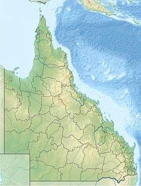 Location of Dawson River mouth in Queensland
| |
| Wikimedia Commons: Dawson River (Queensland) | |
| [2] | |
The Dawson River is a river located in Central Queensland, Australia.
Course and features
The Dawson River rises in the Carnarvon Range, draining through the Carnarvon National Park, northwest of the settlement of Upper Dawson. The flows generally south by east, crossed by the Carnarvon Highway and then flows generally east through the settlement of Taroom where the river is crossed by the Leichhardt Highway. The river then flows in a northerly direction through the settlement of Theodore where the river is again crossed by the Leichhardt Highway. The river flows north through the settlement of Baralaba and towards Duaringa, crossed by the Capricorn Highway. A little further north, the Dawson River forms confluence with the Mackenzie River to form the Fitzroy River. From source to mouth, the river is joined by sixty-four tributaries, including the Don River, and descends 587 metres (1,926 ft) over its 735-kilometre (457 mi) course.[2] Several weirs have been constructed along the river to provide water for cotton and dairy farming in the region. The river catchment covers an area of 50,800 square kilometres (19,600 sq mi).[3]
Expedition National Park and the Precipice National Park are protected areas along the Dawson River.
The Dawson River was one of a number of Queensland rivers affected by the 2010–2011 Queensland floods. As the river inundated the town of Theodore it was completely evacuated, a first in Queensland's history.[4]
History
Ludwig Leichhardt explored the area in 1844 and named the river in honour of Robert Dawson, one of Leichhardt's financial backers.[1]
In the 1920s, shortly after the First World War, Australian Labor Party politician Ted Theodore (1884-1950) launched an irrigation program on the Dawson River for returning soldiers.[5] His intentions was to provide them with arable land along the river for them to take up farming, thus eschewing a post-war recession.[5] After the 1922 Irrigation Act was passed, he started irrigation schemes on the Dawson River, for an initial 8,000 new farmers.[5] However, the scheme was abandoned after he realized the soil was unsuitable for farming and the returning soldiers had no agrarian skills.[5]
See also
References
- 1 2 "Dawson River (entry 9457)". Queensland Place Names. Queensland Government. Retrieved 19 November 2015.
- 1 2 "Map of Dawson River, QLD". Bonzle Digital Atlas of Australia. Retrieved 19 November 2015.
- ↑ "Dawson River". Department of Environment and Resource Management. 28 September 2009. Retrieved 27 September 2011.
- ↑ Barrett, Roseanne (8 January 2011). "Returning home to mud and memories lost". The Australian. News Limited. Retrieved 27 September 2011.
- 1 2 3 4 Katter, Bob (2012). An Incredible Race of People: A Passionate History of Australia. Millers Point, New South Wales: Murdoch Books Australia. p. 52.
Rivers of Queensland | |||||||||||||||||||||||||
|---|---|---|---|---|---|---|---|---|---|---|---|---|---|---|---|---|---|---|---|---|---|---|---|---|---|
| |||||||||||||||||||||||||
| |||||||||||||||||||||||||
| |||||||||||||||||||||||||
| |||||||||||||||||||||||||
| |||||||||||||||||||||||||
| |||||||||||||||||||||||||