Calvert River
| Calvert | |
| River | |
| Name origin: John Calvert | |
| Country | Australia |
|---|---|
| Territory | Northern Territory |
| Source | |
| - elevation | 273 m (896 ft) |
| Mouth | |
| - location | Gulf of Carpentaria, Australia |
| - elevation | 0 m (0 ft) |
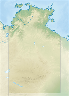
| - coordinates | 16°17′54″S 137°43′57″E / 16.29833°S 137.73250°ECoordinates: 16°17′54″S 137°43′57″E / 16.29833°S 137.73250°E |
| Length | 222 km (138 mi) |
| Basin | 10,333 km2 (3,990 sq mi) |
| Discharge | |
| - average | 31.7 m3/s (1,119 cu ft/s) |
 | |
| [1] | |
The Calvert River is a river in the Northern Territory of Australia.
Course
The headwaters rise on a plain between the Calvert Hills and China Wall and flow northward through mostly uninhabited lands and pastoral leases such as Calvert Hills Station before finally discharging into the Gulf of Carpentaria 150 kilometres (93 mi) east of Borroloola, not far from the border with Queensland in the Gulf Coastal bioregion. It has a mean annual outflow of 1,000 gigalitres (1.308×10⁹ cu yd),[2] Before reaching the sea it flows through the Australian Wildlife Conservancy’s Pungalina-Seven Emu Sanctuary.
Fourteen tributaries feed the river including; Bloodwood Creek, Tobacco Creek, Goanna Creek, Pungalina Creek and the Little Calvert River.
Catchment
The river’s catchment area is 10,033 square kilometres (3,874 sq mi), wedged between the watersheds for the Robinson River to the west, Settlement Creek to east and the Nicholson River to the south.[3] It contains no major towns and the population was 103 in 2001, 45% of whom are Aboriginal people. The river is not dammed, nor used for irrigation. The main economic activity is cattle grazing.[4][2]
A total of 34 species of fish are found in the river including; the Glassfish, Barred Grunter, Sonub nosed Garfish, Milkfish, Fly-specked Hardyhead, Treadfin Silver Biddy, Flathead Goby, Spangled Perch, Barramundi, Oxeye Herring, Rainbowfish, Black-banded Rainbowfish, Northern Trout Gudgeon, Bony Bream, Catfish, Spotted Scat, Hyrtl's Tandan, Freshwater Longtom, Seven-spot Archerfish and the Giant Gudgeon.[5] The endangered Gulf snapping turtle has been found in the upper reaches of the river.[6]
History
The traditional owners of the area are the Garawa peoples.[7]
The river was named by Ludwig Leichhardt when on expedition from Queensland to Darwin in 1845. He named the river for another member of his party, John Calvert, in acknowledgement of his good service to the expedition.[8]
See also
References
- ↑ "Map of Calvert River, NT". Bonzle Digital Atlas of Australia. Retrieved 19 May 2015.
- 1 2 "Calvert River" (PDF). TRaCK. 2009. Retrieved 12 May 2015.
- ↑ "Drainage Divisions" (PDF). Commonwealth of Australia. 2005. Archived from the original (PDF) on 1 April 2015. Retrieved 2 May 2015.
- ↑ "Calvert River Basin summary" (PDF). Australian Government, Bureau of Rural Sciences. Retrieved 2 May 2015.
- ↑ "Calvert River catchment". Fish Atlas of North Australia. Retrieved 23 May 2015.
- ↑ "Gulf snapping turtle". Queensland Government. 29 August 2012. Retrieved 23 May 2015.
- ↑ "Garawa". AusAnthrop Australian Aboriginal tribal database. Ausanthrop. Retrieved 19 May 2015.
- ↑ "Place Names Register Extract - Calvert River". NT Place Names Register. Northern Territory Government. Retrieved 19 May 2015.
River systems and rivers of the Northern Territory, Australia | |
|---|---|
| Floodplains | |
| Rivers |
|
| |