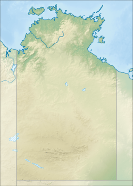
Walker River (Northern Territory)
| Walker | |
| River | |
| Name origin: Thomas Walker | |
| Country | Australia |
|---|---|
| Territory | Northern Territory |
| Tributaries | |
| - left | Strawbridge Creek, Laurie Creek, Marura River |
| - right | Conway Creek |
| Source | Mitchell Ranges |
| - location | Arnhem Land, Australia |
| - elevation | 315 m (1,033 ft) |
| Mouth | Blue Mud Bay |
| - location | Gulf of Carpentaria, Australia |
| - coordinates | 13°35′21″S 135°49′58″E / 13.58917°S 135.83278°ECoordinates: 13°35′21″S 135°49′58″E / 13.58917°S 135.83278°E |
| Length | 119 km (74 mi) |
| Basin | 9,731 km2 (3,757 sq mi) |
| Discharge | |
| - average | 106 m3/s (3,743 cu ft/s) |
 | |
| [1] | |
The Walker River is a river in the Northern Territory, Australia.
Course
The headwaters of the river are in the Mitchell Ranges and the river flows in a southerly direction between Mount Ramsay and Mount Fleming and through Fairy Glen then down onto a plain then cuts though Bath Range under Mount Rankine and veering eastward. The river then passes the Aboriginal communities of Marrkalawa and Andanangki the past the Coast Range and discharges into Blue Mud Bay and the Gulf of Carpentaria and the Arafura Sea.
The river catchment occupies an area of 9,731 square kilometres (3,757 sq mi) and is wedged between the Koolatong River catchment to the north, the Goyder River catchment to the west and the Roper River catchment to the south.[2] It has a mean annual outflow of 3,350 gigalitres (4.382×10⁹ cu yd),[3]
The estuary formed at the river mouth is in near pristine condition with a tidal delta.[4] The estuary at the river mouth occupies an area of 29.5 hectares (73 acres) of open water. It is river dominated in nature with a tide dominated delta with a single channel and is surrounded by an area of 30.9 hectares (76 acres) covered with mangroves.[5]
History
The traditional owners of the area are the Nunggubuju peoples,[6] who have inhabited the area for thousands of years.
Named by the explorer, David Lindsay, during his expedition through Arnhem Land in 1883. Lindsay named it after Thomas Walker, the leader of the Blue Mud Bay prospecting party, who was murdered by Aborigines in the area in 1875.[7]
See also
References
- ↑ "Map of Walker River, NT". Bonzle Digital Atlas of Australia. Retrieved 11 May 2015.
- ↑ "Drainage Divisions" (PDF). Commonwealth of Australia. 2005. Retrieved 11 May 2015.
- ↑ "Walker River" (PDF). TRaCK. 2009. Retrieved 12 May 2015.
- ↑ "Australian Catchment, River and Estuary Assessment" (PDF). Natural Heritage Trust. 2002. Retrieved 11 May 2015.
- ↑ "Walker River, NT". Australian online Coastal Information. Commonwealth of Australia. Retrieved 24 May 2015.
- ↑ "Nunggubuju". AusAnthrop Australian Aboriginal tribal database. Ausanthrop. Retrieved 11 May 2015.
- ↑ "Place Names Register Extract – Walker River". NT Place Names Register. Northern Territory Government. Retrieved 11 May 2015.
River systems and rivers of the Northern Territory, Australia | |
|---|---|
| Floodplains | |
| Rivers |
|
| |