Victoria River (Northern Territory)
| Victoria | |
| River | |
 Victoria River access, near the roadhouse Victoria River crossing | |
| Name origin: Queen Victoria[1] | |
| Country | Australia |
|---|---|
| Territory | Northern Territory |
| Region | Victoria Bonaparte (IBRA) |
| Source | Mount Farquharson |
| - elevation | 364 m (1,194 ft) |
| Mouth | Joseph Bonaparte Gulf |
| - elevation | 0 m (0 ft) |
| - coordinates | 14°56′50″S 129°33′15″E / 14.94722°S 129.55417°ECoordinates: 14°56′50″S 129°33′15″E / 14.94722°S 129.55417°E |
| Length | 560 km (348 mi) |
| Basin | 87,900 km2 (33,938 sq mi) |
| Discharge | |
| - average | 158.4 m3/s (5,594 cu ft/s) |
| National park | Judbarra / Gregory NP |
 | |
| [2][3] | |
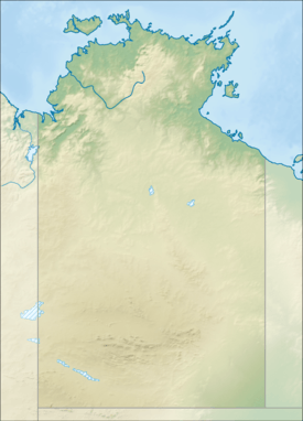
The Victoria River is a river in the Victoria Bonaparte bioregion of the Northern Territory, Australia.
Location and features
.jpg)
Flowing for 560 kilometres (350 mi) from its source, south of the Judbarra / Gregory National Park, until it enters Joseph Bonaparte Gulf in the Timor Sea, the Victoria River is the longest singularly named permanent river in the Northern Territory.[4] Part of the area adjoining the river mouth has been identified as the Legune (Joseph Bonaparte Bay) Important Bird Area because of its importance for waterbirds.[5]
However, the longest permanent river in the Northern Territory, as defined by international standards, is the Katherine/Daly River. This is a single river with two separating (at the Flora River tributary) European names. This great river was, until recently, deemed as two separate rivers due to the European naming conventions of the time. Its journey begins just south of Jabiru, high in the Arnhem Land escarpment as a trickle until it flows into the Timor Sea some 690 kilometres (430 mi) later, thus making it 130 kilometres (81 mi) longer than the Victoria River.
The river has 56 tributaries including the Camfield River, Wickham River, Battle Creek, Angalarri River, Gidyea Creek and Armstrong River. The river also flows through several waterholes such as Catfish waterhole and Four Mile Waterhole.[2] It has a mean annual outflow of 5,000 gigalitres (6.540×10⁹ cu yd),[6]
Important wetlands are found in the lower reaches of the river with forming suitable habitat for waterfowl breeding colonies and roosting sites for migratory shorebirds. Large areas of rice-grass floodplain grasslands are also found along the river.[7]
Several large cattle stations are found along the length of the river including Riveren where the river originates,[3] Victoria River Downs, Wave Hill[8] and Coolibah Station.[9]
History
On 12 September 1819, Philip Parker King became the first European to discover the mouth of the Victoria and, twenty years later, in 1839, Captain J. C. Wickham arrived at the same spot in the HMS Beagle and named the river after Queen Victoria. Crew members of the Beagle followed the river upstream into the interior for more than 200 kilometres (120 mi).[1]
In August 1855 Augustus Gregory sailed from Moreton Bay and at the end of September reached the estuary of the Victoria River. He sailed up the river and carried out extensive exploration.[10]
In 1847 Edmund Kennedy went on an expedition to trace the route of the "River Victoria" of Thomas Mitchell with a view to finding whether there was a practical route to the Gulf of Carpentaria. This "River Victoria" was later renamed the Barcoo River.[11]
See also
References
- 1 2 "Discovery of Victoria River". South Australian History site. Retrieved 2 September 2013.
- 1 2 "Map of Victoria River, NT". Bonzle Digital Atlas of Australia. 2013. Retrieved 29 September 2014.
- 1 2 "Overview of the Victoria River Catchment" (PDF). Top End Waterways Project. 2005. Retrieved 29 September 2014.
- ↑ "Longest rivers by State and Territory". Geoscience Australia. Australian Government. Retrieved 17 February 2013.
- ↑ "IBA: Legune (Joseph Bonaparte Bay)". Birdata. Birds Australia. Retrieved 5 August 2011.
- ↑ "Victoria River" (PDF). TRaCK. 2009. Retrieved 12 May 2015.
- ↑ "Victoria Bonaparte Bioregional Description". Northern Territory Government. Retrieved 3 May 2015. line feed character in
|title=at position 19 (help) - ↑ "National Heritage Places - Wave Hill Walk-Off Route". Government of Australia. 2011. Retrieved 29 November 2013.
- ↑ "Its our chopper and we'll ski if we want to". NT News. March 2012. Retrieved 29 November 2013.
- ↑ Waterson, D. B. (1972). "Gregory, Sir Augustus Charles (1819–1905)". Australian Dictionary of Biography. Canberra: Australian National University. Retrieved 20 June 2012.
- ↑ Beale, Edgar (1983). Kennedy The Barcoo and Beyond 1847. Hobart: Blubber Head Press. ISBN 0-908528-11-6.
River systems and rivers of the Northern Territory, Australia | |
|---|---|
| Floodplains | |
| Rivers |
|
| |