Goyder River
| Goyder | |
| River | |
 Goyder River Crossing | |
| Name origin: George Goyder | |
| Country | Australia |
|---|---|
| Territory | Northern Territory |
| Tributaries | |
| - left | Annie Creek |
| - right | Sheridan Creek, Gulbuwangay River |
| Source | Mitchell Ranges |
| - elevation | 63 m (207 ft) |
| Mouth | Glyde river |
| - elevation | 1 m (3 ft) |
| - coordinates | 12°28′58″S 134°57′58″E / 12.48278°S 134.96611°ECoordinates: 12°28′58″S 134°57′58″E / 12.48278°S 134.96611°E |
| Length | 171 km (106 mi) |
| Basin | 10,391 km2 (4,012 sq mi) |
| Discharge | |
| - average | 25 m3/s (883 cu ft/s) |
| - max | 1,413 m3/s (49,900 cu ft/s) |
| - min | 0.001 m3/s (0 cu ft/s) |
 | |
| [1][2] | |
The Goyder River is a river in the Northern Territory, Australia.
Description
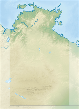
The headwaters of the river rise at the base of the Mitchell Ranges and are fed by spring discharge from an extensive dolomite aquifer[3] that supports areas of rainforest along the banks. The river then flows north west before crossing the Central Arnhem Road then veering north and later forming multiple braided channels and feeding the Arafura Swamp[4] before eventually discharging into the Glyde River which in turn empties into Castlereagh Bay and the Arafura Sea.
The swamp area occupies an area of 700 square kilometres (270 sq mi) in the dry season and is of great cultural significance to the Yolngu people, in particular the Ramingining community which is located on the edge of the swamp.[5]
The river catchment occupies an area of 10,391 square kilometres (4,012 sq mi) and is wedged between the Blyth River catchment to the west, the Walker and Roper River catchments to the south and the Buckingham and Koolatong River catchments to the east.[2]
Three tributaries discharge into the Goyder; Annie Creek, Sheridan Creek and the Gulbuwangay River.
The Goyder has a mean average discharge of 788,940 megalitres (1.032×10⁹ cu yd) with a maximum flow of 1,413 cubic metres (49,900 cu ft) per second and a minimum flow of 1,830 litres (483 US gal) per second.[6] It is the ninth largest river system in the Northern Territory but has the second highest end of dry season flow-rate.[7]
Fauna
A range of Fauna are found in the river, there are 39 species of fish including; Macleay's Glassfish, Barred Grunter, Fly-specked Hardyhead, Freshwater Sole, Golden Goby, Northern Trout Gudgeon, Gulf Saratoga, Barramundi, Oxeye Herring, Rainbowfish, Black-banded Rainbowfish, Bony Bream, Salmon Catfish, Berney's Catfish, Freshwater Longtom, Seven-spot Archerfish and the Sleepy Cod.[8]
History
The traditional owners of the area are the Dalabon, Daikui and Djinba peoples,[9] who have inhabited the area for thousands of years.
Thought to have been named in 1868 by Captain Francis Cadell during his expedition on HMS Firefly, the river is named for George Goyder, the then Surveyor General of South Australia.[10]
The explorer, David Lindsay, named the Glyde Inlet in 1883 while on expedition in Arnhem Land.[10]
The MacCartney family started the Florida cattle station in the 1880s, but after constant clashes with local Aboriginal peoples the station was abandoned in 1893. The Arafura cattle station was established in 1903 by the Eastern, African and Cold Store Company on the 50,000 square kilometres (19,305 sq mi) lease along the Goyder and Glyde Rivers. Joseph Bradshaw overlanded 5,000 cattle to stock the station from further south but five years later the station was abandoned also.[11]
See also
References
- ↑ "Map of Goyder River, NT". Bonzle Digital Atlas of Australia. Retrieved 10 May 2015.
- 1 2 "Drainage Divisions" (PDF). Commonwealth of Australia. 2005. Retrieved 10 May 2015.
- ↑ "NT waterwatch education kit - Part 3; Aquatic ecosystems and habitats" (PDF). Department of Infrastructure, Planning and Environment. Retrieved 10 May 2015.
- ↑ Anthony Knapton (2009). "Gulf Water Study". Northern Territory Government. Retrieved 10 May 2015.
- ↑ Australian Nature Conservation Agency. (1996). A Directory of Important Wetlands in Australia (Second Edition). ANCA: Canberra. pp. 154–155. ISBN 0-642-21378-X
- ↑ "Pacific Aluminium: Proposed Katherine to Gove Gas Pipeline" (PDF). Retrieved 10 May 2015.
- ↑ "Sites of Conservation Significance - Arafura Swamp" (PDF). Northern Territory Government. Retrieved 10 May 2015.
- ↑ "Goyder River catchment". Fish Atlas of North Australia. Retrieved 10 May 2015.
- ↑ "Djinba". AusAnthrop Australian Aboriginal tribal database. Ausanthrop. Retrieved 10 May 2015.
- 1 2 "Goyder river". NT Place Names Register. Northern Territory Government. Retrieved 10 May 2015.
- ↑ "Ramingining Community". Arnhem Land Progress Aboriginal Corporation. Retrieved 10 May 2015.
River systems and rivers of the Northern Territory, Australia | |
|---|---|
| Floodplains | |
| Rivers |
|
| |