Moyle River
| Moyle | |
| River | |
| Country | Australia |
|---|---|
| Territory | Northern Territory |
| Source | |
| - elevation | 342 m (1,122 ft) |
| Mouth | Hyland Bay |
| - elevation | 0 m (0 ft) |
| - coordinates | 13°58′31″S 129°44′41″E / 13.97528°S 129.74472°ECoordinates: 13°58′31″S 129°44′41″E / 13.97528°S 129.74472°E |
| Length | 133 km (83 mi) |
| Basin | 7,085 km2 (2,736 sq mi) |
| Discharge | |
| - average | 20.3 m3/s (717 cu ft/s) |
 | |
| [1] | |
The Moyle River is a river in the Northern Territory, Australia.
Course
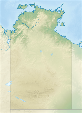
The river rises on a plateau area near the Wingate Mountains and flows in a north westerly direction through mostly uninhabited country through a narrow valley then across the Moyle Plain and eventually discharging about 30 kilometres (19 mi) north east of Port Keats into Hyland Bay and then the Timor Sea.
A 801 square kilometres (309 sq mi) floodplain region exists along Hyland Bay formed by the Moyle and Little Moyle River. The area is dominated by seasonally inundated grassland and sedgeland with areas of paperbark swamp. Mangroves are found along the stretches of the river, creeks and channels that are often backed by saline flats.[2] The Anson Bay, Daly and Reynolds River Floodplains, an important bird area, is situated immediately to the north of the site.
Tom Turners Creek is the only tributary to the river.
The estuary formed at the river mouth is in near pristine condition with a tidal delta.[3] The estuary at the river mouth occupies an area of 7.8 hectares (19 acres) of open water. It is river dominated in nature with a wave dominated delta having single channel and is surrounded by an area of 28 hectares (69 acres) covered with mangroves.[4]
Catchment
The catchment occupies an area of 7,085 square kilometres (2,736 sq mi) and is situated between the Daly River catchment to the north, the Fitzmaurice River catchment to the south.[5] It has a mean annual outflow of 640 gigalitres (837,100,000 cu yd),[6]
Fauna
A total of 25 species of fish are found in the river including; the Sailfin Glassfish, Barred Grunter, Sooty Grunter, Fly-specked Hardyhead, Empire Gudgeon, Northern Trout Gudgeon, Pennyfish, Barramundi, Oxeye Herring, Western Rainbowfish, Black-banded Rainbowfish, Bony Bream, Black Catfish, Short-finned Catfish, Seven-spot Archerfish and the Primitive Archerfish.[7]
History
The traditional owners of the area are the Muringura, Nanggikorongo and the Magatige peoples.[8] The river was named in the 1930s after another Aboriginal group that lived in the area.[9]
See also
References
- ↑ "Map of Moyle River, NT". Bonzle Digital Atlas of Australia. Retrieved 5 May 2015.
- ↑ "Hyland Bay and associated coastal floodplains" (PDF). Northern Territory Government. Retrieved 6 May 2015.
- ↑ "Australian Catchment, River and Estuary Assessment" (PDF). Natural Heritage Trust. 2002. Retrieved 5 May 2015.
- ↑ "Moyle River, NT". Australian online Coastal Information. Commonwealth of Australia. Retrieved 24 May 2015.
- ↑ "Drainage Divisions" (PDF). Commonwealth of Australia. 2005. Retrieved 5 May 2015.
- ↑ "Moyle River" (PDF). TRaCK. 2009. Retrieved 12 May 2015.
- ↑ "Moyle River catchment". Fish Atlas of North Australia. Retrieved 10 May 2015.
- ↑ "Magatige". AusAnthrop Australian Aboriginal tribal database. Ausanthrop. Retrieved 6 May 2015.
- ↑ "Moyle river". NT Place Names Register. Northern Territory Government. Retrieved 6 May 2015.
River systems and rivers of the Northern Territory, Australia | |
|---|---|
| Floodplains | |
| Rivers |
|
| |