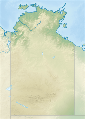
Goomadeer River
| Goomadeer | |
| River | |
| Country | Australia |
|---|---|
| Territory | Northern Territory |
| Tributaries | |
| - right | Gumardir River |
| Source | |
| - elevation | 274 m (899 ft) |
| Mouth | Junction Bay |
| - elevation | 0 m (0 ft) |
| - coordinates | 11°50′56″S 133°49′30″E / 11.84889°S 133.82500°ECoordinates: 11°50′56″S 133°49′30″E / 11.84889°S 133.82500°E |
| Length | 138 km (86 mi) |
| Basin | 5,684 km2 (2,195 sq mi) |
| Discharge | |
| - average | 36.1 m3/s (1,275 cu ft/s) |
 | |
| [1][2] | |
The Goomadeer River is a river in the Northern Territory, Australia.
Description
The headwaters are located on the sandstone plateau fed by springs[3] in Arnhem Land at an elevation of 274 metres (899 ft) and flows in a northerly direction through mostly uninhabited lands and eventually discharges into Junction Bay and the Arafura Sea. The only tributary of the river is the Gumardir River.
The estuary formed at the river mouth is in near pristine condition and occupies an area of 24.9 hectares (62 acres) of open water. It is riverdominated in nature with a tide dominated delta having a single channel and is surrounded by an area of 11.2 square kilometres (4 sq mi) covered with mangroves.[4]
The catchment occupies an area of 5,684 square kilometres (2,195 sq mi) and is situated between the East Alligator River catchment to the west and the Liverpool River catchment to the east.[2] It has an annual discharge of 1,140 gigalitres (1.491×10⁹ cu yd).[5]
Flora and fauna
The riparian vegetation of the river is in good condition but are declining as a result of the proliferation of feral pigs and buffalo and the invasion of some weed species.[6]
19 species of fish are found in the river including; the Macleay's Glassfish, Barred Grunter, Sooty Grunter, Fly-specked Hardyhead, Northern Trout Gudgeon, Gulf Saratoga, Barramundi, Oxeye Herring, Rainbowfish, Black-banded Rainbowfish, Bony Bream, Catfish, Freshwater Longtom, Seven-spot Archerfish and the Sleepy Cod.[7]
The pig-nosed turtle, a threatened species of turtle, is known to inhabit sections of the river, but only in small populations.[8]
See also
References
- ↑ "Map of Goomadeer River, NT". Bonzle Digital Atlas of Australia. Retrieved 9 May 2015.
- 1 2 "Drainage Divisions" (PDF). Commonwealth of Australia. 2005. Retrieved 9 May 2015.
- ↑ U. Zaar (2003). "Water Resources of West Arnhem Land" (PDF). Department of Infrastructure, Planning and Environment. Retrieved 9 May 2015.
- ↑ "Goomadeer River, NT". Australian online Coastal Information. Commonwealth of Australia. Retrieved 24 May 2015.
- ↑ S. Larson and K. Alexandridis (2009). "Goomadeer River" (PDF). TRaCK. Retrieved 9 May 2015.
- ↑ "Arnhem Coast - Bioregional description". Northern Territory Government. Retrieved 10 May 2015.
- ↑ "Goomadeer River catchment". Fish Atlas of North Australia. Retrieved 10 May 2015.
- ↑ "Pig-nosed Turtle (Carettochelys insculpta)". Department of the Environment. 13 July 2005. Retrieved 10 May 2015.
River systems and rivers of the Northern Territory, Australia | |
|---|---|
| Floodplains | |
| Rivers |
|
| |