Fitzmaurice River
| Fitzmaurice | |
| River | |
| Name origin: Lewis Roper Fitzmaurice | |
| Country | Australia |
|---|---|
| Territory | Northern Territory |
| Source | |
| - location | Wombungi, Australia |
| - elevation | 181 m (594 ft) |
| Mouth | |
| - location | Joseph Bonaparte Gulf, Australia |
| - elevation | 0 m (0 ft) |
| - coordinates | 14°49′29″S 129°50′10″E / 14.82472°S 129.83611°ECoordinates: 14°49′29″S 129°50′10″E / 14.82472°S 129.83611°E |
| Length | 276 km (171 mi) |
| Basin | 10,375 km2 (4,006 sq mi) |
 | |
| [1] | |
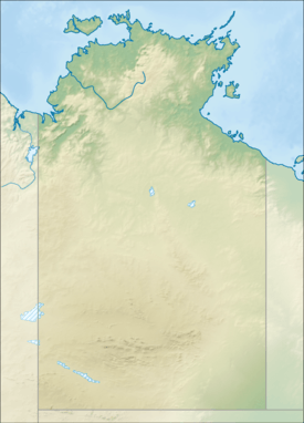
The Fitzmaurice River is a river in Australia's Northern Territory.
Course
The river drains into the Joseph Bonaparte Gulf in the Timor Sea from a source just north of the Wombungi homestead. The river flows in a westerly direction between the Wingate mountains to the north and the Yamberra Mountains to the south. The area is quite remote and largely unsettled, and the river itself forms the southern boundary of the Daly River Port Keats Aboriginal Reserve.
The estuary formed at the river mouth is tidal in nature and in near pristine condition.[2]
Catchment
The drainage basin occupies an area of 10,375 square kilometres (4,006 sq mi) and is wedged between the catchment areas for Victoria River to the south and Moyle River to the north.[3] The river has a mean annual outflow of 1,600 gigalitres (2.093×10⁹ cu yd),[4]
Fauna
A total of 16 species of fish are found in the river including; the Glassfish, Macleay's Glassfish, Fork talked catfish, Fly-specked Hardyhead, Mouth Almighty, Spangled Perch, Barramundi, Oxeye Herring, Rainbowfish, Exquisite Rainbowfish, Northern Trout Gudgeon, Bony Bream, Catfish, Bony Bream and the Seven-spot Archerfish.[5]
A large number of crocodiles — both saltwater and fresh — inhabit the river. Wild cattle and bush pigs can be found in the surrounding countryside.
History
It was first charted in 1839 by European explorers aboard the HMS Beagle under the command of John Lort Stokes. It was named after Lewis Roper Fitzmaurice, a mate and assistant surveyor on the Beagle.
In 1977, Australian bushman Rodney Ansell was stuck for months on the river, after his boat capsized in the estuary and he ventured upstream for a source of fresh water.
See also
References
- ↑ "Map of Fitzmaurice River, NT". Bonzle Digital Atlas of Australia. Retrieved 20 May 2015.
- ↑ "Australian Catchment, River and Estuary Assessment" (PDF). Natural Heritage Trust. 2002. Retrieved 2 May 2015.
- ↑ "Drainage Divisions" (PDF). Commonwealth of Australia. 2005. Retrieved 2 May 2015.
- ↑ "Fitzmaurice River" (PDF). TRaCK. 2009. Retrieved 12 May 2015.
- ↑ "Fitzmaurice River catchment". Fish Atlas of North Australia. Retrieved 23 May 2015.
External links
River systems and rivers of the Northern Territory, Australia | |
|---|---|
| Floodplains | |
| Rivers |
|
| |