Susan River (Queensland)
| Susan | |
| River | |
| Country | Australia |
|---|---|
| State | Queensland |
| Region | Wide Bay–Burnett |
| Local government area | Fraser Coast |
| Part of | Mary River |
| Tributaries | |
| - right | Bunya Creek |
| Source | |
| - location | south of Hervey Bay |
| - elevation | 14 m (46 ft) |
| - coordinates | 25°24′57″S 152°45′02″E / 25.41583°S 152.75056°E |
| Mouth | confluence with the Mary River |
| - location | River Heads |
| - elevation | 279 m (915 ft) |
| - coordinates | 25°25′45″S 152°55′06″E / 25.42917°S 152.91833°ECoordinates: 25°25′45″S 152°55′06″E / 25.42917°S 152.91833°E |
| Length | 20 km (12 mi) |
| Islands | Kangaroo Island; Susan Island |
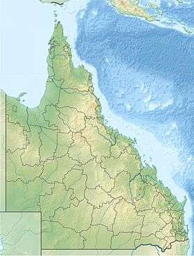 Location of Susan River mouth in Queensland | |
| [1] | |
The Susan River is a river located in the Wide Bay–Burnett region of Queensland, Australia.
Course and features
The river rises south of Hervey Bay and west of the Maryborough Hervey Bay Road between the towns of Susan River and Walliebum. The river flows generally in an east by south direction, joined by the Bunya Creek, before reaching its confluence and emptying into the Mary River at River Heads in the Great Sandy Strait.
Along the banks of the Susan River is one of the largest remaining Blue Gum forests within the Mary River catchment area, together with melaleuca forests. At the river mouth, mangrove forests dominate the intertidal areas.[2]
The Susan River Bridge carries the road that links Maryborough and Hervey Bay and was built in 1977. The bridged carries more than 10,000 vehicles each day. It remained unnamed until 2009.[3]
In 2007, an unusual angler fish was found by a local fisherman. The fish was the first of its kind to have its genetic data recorded in an international fish catalog called the Fish Barcode of Life (FISH-BOL) using DNA barcoding.[4]
Large saltwater crocodiles are occasionally seen the river and surrounding area, as well as dugongs, dolphins and sea turtles.
See also
References
- ↑ "Map of Susan River, QLD". Bonzle Digital Atlas of Australia. Retrieved 14 November 2015.
- ↑ Pointon, S. M.; Collins, A. W. (2000). "Mary River Catchment Resource Atlas" (PDF). Department of Natural Resources. Queensland Government. p. 12. ISBN 0-7345-1699-1. Retrieved 15 November 2015.
- ↑ "Q150 celebrations - Susan River bridge naming" (Press release). Department of the Premier and Cabinet. 8 April 2009. Retrieved 19 May 2009.
- ↑ "International project to record rare fish DNA". ABC News. Australia. 27 November 2007. Retrieved 19 May 2009.
Rivers of Queensland | |||||||||||||||||||||||||
|---|---|---|---|---|---|---|---|---|---|---|---|---|---|---|---|---|---|---|---|---|---|---|---|---|---|
| |||||||||||||||||||||||||
| |||||||||||||||||||||||||
| |||||||||||||||||||||||||
| |||||||||||||||||||||||||
| |||||||||||||||||||||||||
| |||||||||||||||||||||||||