Mackenzie River (Queensland)
| Mackenzie | |
| River | |
| Country | Australia |
|---|---|
| State | Queensland |
| Region | Central Queensland |
| Part of | Fitzroy River |
| Tributaries | |
| - left | Isaac River, Connors River, Funnel Creek |
| Township | Rolleston; Comet |
| Source | Expedition Range |
| Source confluence | Comet River and Nogoa River |
| - location | north of Comet |
| - elevation | 144 m (472 ft) |
| - coordinates | 23°33′21″S 148°32′11″E / 23.55583°S 148.53639°E |
| Mouth | confluence with the Dawson River to form the Fitzroy River |
| - location | east of Duaringa |
| - elevation | 65 m (213 ft) |
| - coordinates | 23°37′39″S 149°46′02″E / 23.62750°S 149.76722°ECoordinates: 23°37′39″S 149°46′02″E / 23.62750°S 149.76722°E |
| Length | 275 km (171 mi) |
| Basin | 12,992 km2 (5,016 sq mi) |
| National park | Goodedulla National Park |
| Reservoirs | Bingegang Weir; Bedford Weir; Tartrus Weir |
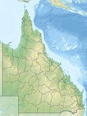 Location of Mackenzie River mouth in Queensland | |
| [1][2][3][4] | |
The Mackenzie River is a river located in Central Queensland, Australia. The Mackenzie River is a major tributary of the Fitzroy River, part of the largest river catchment flowing to the eastern coast of Australia.[5]
Course and features
Formed by the confluence of the Comet and Nogoa rivers flowing from the Expedition Range, the river rises north of Comet and flows generally north by east towards the Broadsound Range. North of the settlement of Royles, the river flows south by east and west of the Goodedulla National Park towards Duaringa and splits as an anabranch on multiple occasions. The river is joined by twenty-four tributaries including the Isaac and Connors rivers and Funnel Creek.[6] Northeast of Duaringa, the Mackenzie is joined by the Dawson River and together they form the Fitzroy River. From source to mouth, the Mackenzie River descends 79 metres (259 ft) over its 275-kilometre (171 mi) course.[2][3][4][7]
The Bingegang Weir near Middlemount contains barramundi, southern saratoga and golden perch.[6] The Bedford Weir and Tartrus Weir are also stocked with barramundi. Bedford Weir is popular with water-skiers and camping is permitted adjacent to the reservoir.[6]
History
The river was discovered by colonial Europeans in 1844 by Ludwig Leichhardt, a German explorer who explored many parts of Queensland and the Northern Territory.[8]
See also
References
- ↑ "Comet, Nogoa and Mackenzie rivers". State of the Rivers report. Department of Environment and Resource Management, Queensland Government. 23 October 2008. Retrieved 20 May 2009.
- 1 2 "Map of Mackenzie River, QLD (1)". Bonzle Digital Atlas of Australia. Retrieved 17 November 2015.
- 1 2 "Map of Mackenzie River, QLD (2)". Bonzle Digital Atlas of Australia. Retrieved 17 November 2015.
- 1 2 "Map of Mackenzie River, QLD (3)". Bonzle Digital Atlas of Australia. Retrieved 17 November 2015.
- ↑ Fitzroy Basin Association (2005). Central Queensland Strategy for Sustainability: 2004 and beyond. Rockhampton, Qld.: The Fitzroy Basin Association Inc. ISBN 0-9758172-0-5.
- 1 2 3 Harrison, Rod; Ernie James; Chris Sully; Bill Classon; Joy Eckermann (2008). Queensland Dams. Bayswater, Victoria: Australian Fishing Network. p. 157. ISBN 978-1-86513-134-4.
- ↑ "Mackenzie River". Britannica. Retrieved 31 October 2006.
- ↑ "Ludwig Leichhardt". David Reilly. Retrieved 18 March 2010.
External links
- Fitzroy Basin water planning area (PDF) (Map). Department of Natural Resources and Mines, Queensland Government. 11 September 2015.
- "Fitzroy Basin Resource Operations Plan" (PDF). Department of Natural Resources and Water. Brisbane: Queensland Government. September 2015.
Rivers of Queensland | |||||||||||||||||||||||||
|---|---|---|---|---|---|---|---|---|---|---|---|---|---|---|---|---|---|---|---|---|---|---|---|---|---|
| |||||||||||||||||||||||||
| |||||||||||||||||||||||||
| |||||||||||||||||||||||||
| |||||||||||||||||||||||||
| |||||||||||||||||||||||||
| |||||||||||||||||||||||||