Barron River (Queensland)
| Barron (Bibhoora) | |
| River | |
 The Barron Falls near Kuranda | |
| Name origin: In honour of Thomas Barron, a Brisbane chief clerk of police.[1] | |
| Country | Australia |
|---|---|
| State | Queensland |
| Region | Far North Queensland |
| Tributaries | |
| - left | Granite Creek (Queensland), Flaggy Creek |
| - right | Peterson Creek (Queensland), Timaroo Creek, Clohessy River |
| Landmark | Barron Gorge |
| Source | Atherton Tablelands |
| - location | below Mount Hypipamee |
| - elevation | 1,200 m (3,937 ft) |
| - coordinates | 17°25′48″S 145°30′48″E / 17.43000°S 145.51333°E |
| Mouth | Coral Sea |
| - location | Machans Beach/Aeroglen |
| - elevation | 0 m (0 ft) |
| - coordinates | 16°51′41″S 145°46′15″E / 16.86139°S 145.77083°ECoordinates: 16°51′41″S 145°46′15″E / 16.86139°S 145.77083°E |
| Length | 165 km (103 mi) |
| Basin | 2,138 km2 (825 sq mi) |
| National parks | Mount Hypipamee National Park; Barron Gorge National Park |
| Reservoirs | Lake Tinaroo |
| Waterfalls | Barron Falls; Dinner Falls |
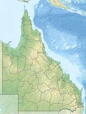 Location of Barron River river mouth in Queensland
| |
| Wikimedia Commons: Barron River | |
| [2][3][4][5][6] | |
The Barron River (Indigenous: Bibhoora) is located on the Atherton Tablelands inland from Cairns in northern Queensland, Australia. With its headwaters below Mount Hypipamee, the 165-kilometre (103 mi)-long river with a catchment area of approximately 2,138 square kilometres (825 sq mi) forms through run off from the Mount Hypipamee National Park, flows through Lake Tinaroo, and eventually empties into the Coral Sea near Smithfield.
Geography


Over time, some of the Mitchell River's former headwaters were diverted by natural forces into the Barron. These include the Clohesy River and other tributaries that used to flow northwest to the Gulf of Carpentaria. With the extra water now flowing over the 260-metre (850 ft)-high Barron Falls, the steep, narrow Barron Gorge was formed. Much of the water that used to flow over the falls has now been diverted in upstream dams and used to generate electricity at the Barron Gorge Hydroelectric Power Station.[7]
The Barron's headwaters start in the Mount Hypipamee National Park near Mount Hypipamee at an elevation of 1,200 metres (3,900 ft). The river then flows north 65 kilometres (40 mi) across the Atherton Tablelands before finally turning east after Mareeba towards Kuranda. After passing under the Kuranda Range Highway's bridge and through Kuranda proper, it descends down the 260-metre (850 ft)-high Barron Falls and reaches the Cairns floodplains near Smithfield. The Dinner Falls are located along the upper Barron River.

The river's catchment area includes the major tributaries flowing into Lake Tinaroo including Kauri, Mazlin, McLean, Maroobi, Peterson and Severin Creeks. It also absorbs most of the major tributaries on the Atherton Tableland, including Emerald Creek, Granite Creek, the Clohesy River and Stoney Creek.[6] This also includes Thomatis Creek, which has only been connected to the Barron since 1932 and has been responsible for diverting part of the flow from the river. Freshwater Creek joins the Barron River below the Gorge and drains Lake Morris and the Lamb and Whitfield Ranges.
Before entering the Coral Sea, the river's delta splits into three distributaries, the main river channel, Thomatis/Richters Creek and Redden Creek. During times of flooding two other distributaries also operate – Barr Creek and Half Moon Creek.
The river is the sole source of sand for the beaches to the north of Cairns.[8] Sand and gravel extraction from the river bed has supplied growing demand in the Cairns area. In the 1970s and 80s extraction rates reached 90,000 cubic metres (3,200,000 cu ft) per year, which was twice the replenishment rate at the mouth.[8] This has resulted in considerable beach erosion to the north.
History
The river's original Aboriginal name is Bibhoora. The river gained its current name in 1875 when two police sub-inspectors, Johnstone[9] and Douglas, named it after Thomas Henry Bowman Barron (circa 1835 – 24 June 1882), chief clerk of police in Brisbane.[1] The European discovery of the river was by James Venture Mulligan in 1874. Barron River gives its name to the electoral district of Barron River, a division of the Queensland Legislative Assembly formed in 1971.
Flooding
The lower reaches of the Barron River have a well-documented history of flooding dating from early last century.[10] Tinaroo Falls Dams has little effect on the mitigation of floods. Both agricultural and residential areas can be affected. A network of rainfall and river height field stations was established in 1995 to provide a flood warning system for the Cairns City Council.[10]
Heavy rain associated with a cyclone early in 1939 caused substantial flooding on the Barron River and resulted in the river changing its course. The mouth of the Barron moved about 2 kilometres (1.2 mi) north from Casuarina Point on the northern Cairns esplanade to Ellie Point.[8]
Some of the river's worst flooding occurred in 1950. This was due to a major tropical cyclone following the contour of the Queensland coast for over a week.
Fauna
The stocking of exotic sports fish into the river has led to a serious decline in the diversity and abundance of native fish.[11]
A total of 63 species of fish have been found in the river, including the glassfish, barred grunter, Snub-nosed Garfish, Fly-specked hardyhead, Mouth almighty, Bigeye Trevally, Goby, Jungle Perch, oxeye herring, eastern rainbowfish, Bony bream, Spotted scat, Giant gudgeon, Freshwater Longtom and Seven-spot Archerfish.[12]
See also
References
- 1 2 "Barron River (entry 1763)". Queensland Place Names. Queensland Government. Retrieved 28 June 2014.
- ↑ "Map of Barron River, QLD". Bonzle Digital Atlas of Australia. Retrieved 17 June 2015.
- ↑ "Map of Barron River (1), QLD". Bonzle Digital Atlas of Australia. Retrieved 22 October 2015.
- ↑ "Map of Barron River (2), QLD". Bonzle Digital Atlas of Australia. Retrieved 22 October 2015.
- ↑ "Map of Barron River (3), QLD". Bonzle Digital Atlas of Australia. Retrieved 22 October 2015.
- 1 2 "Water resources – Overview – Queensland – Basin & Surface Water Management Area: Barron River". Australian Natural Resources Atlas. Department of the Environment, Water, Heritage and the Arts. Archived from the original on 22 June 2009. Retrieved 23 May 2009.
- ↑ Shilton, Peter (2005). Natural areas of Queensland. Mount Gravatt, Queensland: Goldpress. p. 45. ISBN 0-9758275-0-2.
- 1 2 3 Johnson, David (2009). The Geology of Australia. Cambridge University Press. pp. 197, 224–5. ISBN 1107393728. Retrieved 8 September 2015.
- ↑ "Stratford Heritage Trail". The Stratford and Freshwater Community Association (SAFCA). Retrieved 13 December 2012.
- 1 2 "Flood Warning System for the Barron River". Bureau of Meteorology (Australia). Retrieved 23 May 2009.
- ↑ Low, Tim. (2003). The New Nature. Penguin: Sydney. ISBN 0-14-300194-9
- ↑ "Barron River catchment". Fish Atlas of North Australia. Retrieved 28 June 2015.
Rivers of Queensland | |||||||||||||||||||||||||
|---|---|---|---|---|---|---|---|---|---|---|---|---|---|---|---|---|---|---|---|---|---|---|---|---|---|
| |||||||||||||||||||||||||
| |||||||||||||||||||||||||
| |||||||||||||||||||||||||
| |||||||||||||||||||||||||
| |||||||||||||||||||||||||
| |||||||||||||||||||||||||