Loders Creek
| Loders | |
| Creek | |
 The Loders Creek mouth, 2015 | |
| Country | Australia |
|---|---|
| State | Queensland |
| Region | South East Queensland |
| Source | |
| - location | Ashmore |
| Mouth | Gold Coast Broadwater |
| - location | Southport |
| - elevation | 0 m (0 ft) |
| - coordinates | 27°57′18″S 153°24′38″E / 27.9549°S 153.4105°ECoordinates: 27°57′18″S 153°24′38″E / 27.9549°S 153.4105°E |
| Length | 8.3 km (5 mi) |
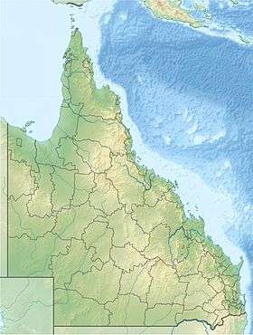 Location of the Loders Creek mouth within Queensland | |
The Loders Creek is a stream and tidal creek which flows through the suburbs of the Gold Coast of South East Queensland, Australia.[1] The creek is 8.3 kilometres (5.2 mi) long, and forms part of The Broadwater estuary catchment area.[2]
Course and catchment
The creek is formed from two small unnamed streams that converge to the west of Southport. Both of these tributaries have been substantially modified to provide storm water drainage for the suburb of Ashmore, and consist mainly of concrete lined channels. The northern tributary does have some areas of natural channel, with pool-and-riffle channel morphology. These areas provide a significant habitat for the vulnerable Wallum froglet.[2]
From the confluence of the two tributaries, the creek flows in a north-easterly direction bordering the Southport State High School, before passing under the Gold Coast Highway to reach the Broadwater at Len Fox Park, between Southport and Labrador.[1]
The drainage basin of the creek lies between that of the Biggera Creek to the north, and that of the Nerang River to the south and west.[1]
Catchment group
The Loders Creek was the first for which a formal community catchment management group was established on the Gold Coast.[3] Since their formation in 1994, the group which aims to enhance the creek and its environs has created a nature trail and butterfly garden. They have also produced educational resources about the creek, carried out restoration work, and completed wildlife surveys in the catchment.[3]
Flora and fauna
Although degraded by the removal of native vegetation along its length for flood control, the creek does contain areas of freshwater and tidal wetlands, with some dry eucalyptus forest in the catchment. Wildlife includes native species such as bandicoots, koala, and lace monitor.[4]
See also
References
- 1 2 3 Microsoft; Nokia (27 August 2014). "Loders Creek" (Map). Bing Maps. Microsoft. Retrieved 27 August 2014.
- 1 2 "Broadwater Catchment". City of Gold Coast. Retrieved 27 August 2014.
- 1 2 "Loders Catchment Management Group". City of Gold Coast. Retrieved 27 August 2014.
- ↑ "Loders Creek". gecko.org.au. Retrieved 27 August 2014.
External links
Rivers of Queensland | |||||||||||||||||||||||||
|---|---|---|---|---|---|---|---|---|---|---|---|---|---|---|---|---|---|---|---|---|---|---|---|---|---|
| |||||||||||||||||||||||||
| |||||||||||||||||||||||||
| |||||||||||||||||||||||||
| |||||||||||||||||||||||||
| |||||||||||||||||||||||||
| |||||||||||||||||||||||||