Bohle River
| Bohle | |
| River | |
| Name origin: drover Henry Mackinnon Bohle[1] | |
| Country | Australia |
|---|---|
| State | Queensland |
| Region | North Queensland |
| Source | Great Dividing Range |
| - location | below Round Mountain |
| - elevation | 76 m (249 ft) |
| - coordinates | 19°24′33″S 146°40′22″E / 19.40917°S 146.67278°E |
| Mouth | Halifax Bay, Coral Sea |
| - location | near Bushland Beach |
| - elevation | 1 m (3 ft) |
| - coordinates | 19°11′01″S 146°41′57″E / 19.18361°S 146.69917°ECoordinates: 19°11′01″S 146°41′57″E / 19.18361°S 146.69917°E |
| Length | 37 km (23 mi) |
| Basin | 368 km2 (142 sq mi) |
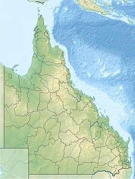 Location of Bohle River mouth in Queensland
| |
| [2] | |
The Bohle River is a river located in North Queensland, Australia.
Course and features
The headwaters of the river rise in the Great Dividing Range below Round Mountain and flow north along the coastal plain past Lake Ross and then north, parallel with Ross River. The Hervey Range Developmental Road crosses the river east of Thuringowa and then the Ingham Connection Road crosses the river east of Townsville. It then enters the Bohle River Fish Habitat Area and the Townsville Town Common conservation Park and discharges into the Halifax Bay near Bushland Beach, and then empties into the Coral Sea. Tributaries include Middle Creek, Stony Creek, Stag Creek, the Little Bohle River and Garner Creek. The river descends 75 metres (246 ft) over its 37-kilometre (23 mi) course.[2]
The catchment area of the river occupies an 368 square kilometres (142 sq mi) of which an area of 26 square kilometres (10 sq mi) is composed of estuarine wetlands.[3] The river drains most of the coastal plain west of Townsville.[4]
The river supports recreational fishing, particularly of barramundi.[5] The Bohle is located approximately 10 kilometres (6 mi) east of Townsville. Popular for river fishing, the Bohle River is also good for collecting bait. Yabbies are found from time to time in the muddy banks. Typical fish species found in the river are barramundi, red bream, mangrove jack and grunter.[5]
The rivers is named after the drover Henry Mackinnon Bohle who worked for a pioneer of the area John Melton Black. Bohle overlanded a mob of cattle to Fanning Downs in 1863 and moved stock to the Cleveland Bay area in 1864 for Black.[1]
Major flooding of the river occurred in 1991, 1997, 1998, 2000, 2007, 2008 and in 2014.[4]
See also
References
- 1 2 "Bohle River (entry 3478)". Queensland Place Names. Queensland Government. Retrieved 19 July 2015.
- 1 2 "Map of Bohle River, QLD". Bonzle Digital Atlas of Australia. Retrieved 19 July 2015.
- ↑ "Barratta Creek drainage basin". WetlandInfo. Queensland Government. Retrieved 19 July 2015.
- 1 2 "Flood Warning System For The Ross, Bohle & Black Rivers". Bureau of Meteorology. Retrieved 18 February 2014.
- 1 2 "The Bohle River Area". Explore Townsville. 2011. Retrieved 19 July 2015.
External links
Rivers of Queensland | |||||||||||||||||||||||||
|---|---|---|---|---|---|---|---|---|---|---|---|---|---|---|---|---|---|---|---|---|---|---|---|---|---|
| |||||||||||||||||||||||||
| |||||||||||||||||||||||||
| |||||||||||||||||||||||||
| |||||||||||||||||||||||||
| |||||||||||||||||||||||||
| |||||||||||||||||||||||||