Dark River, Minnesota
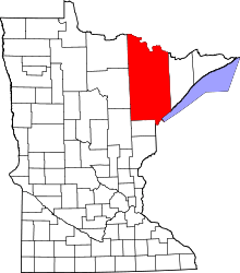
Dark River is an unorganized territory in Saint Louis County, Minnesota, United States; located north of Chisholm and Balkan Township. The population was 68 at the 2000 census.
Geography
According to the United States Census Bureau, the unorganized territory has a total area of 38.0 square miles (98.4 km²); 37.9 square miles (98.3 km²) of it is land and 0.04 square miles (0.1 km²) of it (0.11%) is water.
Demographics
As of the census[1] of 2000, there were 68 people, 22 households, and 21 families residing in the unorganized territory. The population density was 1.8 people per square mile (0.7/km²). There were 39 housing units at an average density of 1.0/sq mi (0.4/km²). The racial makeup of the unorganized territory was 92.65% White, 1.47% from other races, and 5.88% from two or more races. Hispanic or Latino of any race were 13.24% of the population.
There were 22 households out of which 31.8% had children under the age of 18 living with them, 86.4% were married couples living together, and 4.5% were non-families. 4.5% of all households were made up of individuals and none had someone living alone who was 65 years of age or older. The average household size was 3.09 and the average family size was 3.14.
In the unorganized territory the population was spread out with 29.4% under the age of 18, 5.9% from 18 to 24, 29.4% from 25 to 44, 25.0% from 45 to 64, and 10.3% who were 65 years of age or older. The median age was 38 years. For every 100 females there were 126.7 males. For every 100 females age 18 and over, there were 108.7 males.
The median income for a household in the unorganized territory was $29,107, and the median income for a family was $29,107. Males had a median income of $28,750 versus $0 for females. The per capita income for the unorganized territory was $10,984. None of the population or the families were below the poverty line.
References
- ↑ "American FactFinder". United States Census Bureau. Retrieved 2008-01-31.
Coordinates: 47°40′26″N 92°51′54″W / 47.67389°N 92.86500°W