Clinton Township, St. Louis County, Minnesota
| Clinton Township, Minnesota | |
|---|---|
| Township | |
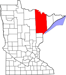
 Clinton Township, Minnesota Location within the state of Minnesota | |
| Coordinates: 47°24′21″N 92°36′54″W / 47.40583°N 92.61500°WCoordinates: 47°24′21″N 92°36′54″W / 47.40583°N 92.61500°W | |
| Country | United States |
| State | Minnesota |
| County | Saint Louis |
| Area | |
| • Total | 33.9 sq mi (87.7 km2) |
| • Land | 33.2 sq mi (86.0 km2) |
| • Water | 0.7 sq mi (1.7 km2) |
| Elevation | 1,375 ft (419 m) |
| Population (2010) | |
| • Total | 1,015 |
| • Density | 30/sq mi (12/km2) |
| Time zone | Central (CST) (UTC-6) |
| • Summer (DST) | CDT (UTC-5) |
| Area code(s) | 218 |
| FIPS code | 27-12016[1] |
| GNIS feature ID | 0663827[2] |
Clinton Township is a township in Saint Louis County, Minnesota, United States. Clinton Township was named for Clinton Markell, a prominent settler.[3] The population was 1,015 at the 2010 census.[4]
State Highway 37 (MN 37) and Saint Louis County Highway 7 are two of the main routes in the township. Other routes include Iron Junction Road.
The city of Iron Junction (Iron) is located within Clinton Township geographically but is a separate entity.
The unincorporated communities of Keenan, Ramshaw, and Wolf are located within the township.
The unincorporated community of Forbes also extends into the southern portion of Clinton Township.
The unincorporated community of Peary is located at the southeast corner of the township.
Geography
According to the United States Census Bureau, the township has a total area of 33.9 square miles (88 km2); 33.2 square miles (86 km2) is land and 0.6 square miles (1.6 km2), or 1.92%, is water.
The East Two River and Elbow Creek both flow through Clinton Township.
Long Lake Creek flows through the southeast corner of the township.
Adjacent townships, cities, and communities
The following are adjacent to Clinton Township :
- Fayal Township (east)
- The city of Eveleth (northeast)
- The city of Leonidas (northeast)
- The city of Mountain Iron (north)
- Great Scott Township (northwest)
- Cherry Township (west)
- Lavell Township (southwest)
- McDavitt Township (south)
- The unincorporated community of Zim (south)
- The unincorporated community of Central Lakes (southeast)
Unincorporated communities
Demographics
As of the census[1] of 2000, there were 1,036 people, 405 households, and 302 families residing in the township. The population density was 31.2 people per square mile (12.0/km²). There were 421 housing units at an average density of 12.7/sq mi (4.9/km²). The racial makeup of the township was 96.81% White, 0.29% Black or African American, 1.06% Native American, 0.29% Asian, 0.19% from other races, and 1.35% from two or more races. Hispanic or Latino of any race were 1.16% of the population.
There were 405 households out of which 31.4% had children under the age of 18 living with them, 62.2% were married couples living together, 5.9% had a female householder with no husband present, and 25.4% were non-families. 21.0% of all households were made up of individuals and 5.7% had someone living alone who was 65 years of age or older. The average household size was 2.56 and the average family size was 2.93.
In the township the population was spread out with 25.5% under the age of 18, 8.0% from 18 to 24, 26.9% from 25 to 44, 29.1% from 45 to 64, and 10.5% who were 65 years of age or older. The median age was 39 years. For every 100 females there were 115.8 males. For every 100 females age 18 and over, there were 113.3 males.
The median income for a household in the township was $44,773, and the median income for a family was $45,556. Males had a median income of $41,417 versus $23,068 for females. The per capita income for the township was $18,359. About 3.5% of families and 6.4% of the population were below the poverty line, including 8.3% of those under age 18 and 7.4% of those age 65 or over.
References
- 1 2 "American FactFinder". United States Census Bureau. Archived from the original on 2013-09-11. Retrieved 2008-01-31.
- ↑ "US Board on Geographic Names". United States Geological Survey. 2007-10-25. Retrieved 2008-01-31.
- ↑ Upham, Warren (1920). Minnesota Geographic Names: Their Origin and Historic Significance. Minnesota Historical Society. p. 479.
- ↑ "Race, Hispanic or Latino, Age, and Housing Occupancy: 2010 Census Redistricting Data (Public Law 94-171) Summary File (QT-PL), Clinton township, St. Louis County, Minnesota". U.S. Census Bureau, American FactFinder 2. Archived from the original on September 11, 2013. Retrieved August 24, 2011.