Culver, Minnesota
| Culver, Minnesota | |
|---|---|
| Unincorporated community | |
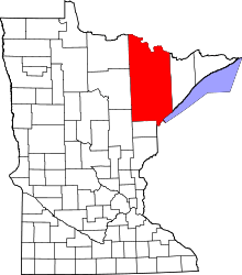
 Culver, Minnesota  Culver, Minnesota Location of the community of Culver | |
| Coordinates: 46°55′33″N 92°33′31″W / 46.92583°N 92.55861°WCoordinates: 46°55′33″N 92°33′31″W / 46.92583°N 92.55861°W | |
| Country | United States |
| State | Minnesota |
| County | Saint Louis |
| Elevation | 1,289 ft (393 m) |
| Population | |
| • Total | 30 |
| Time zone | Central (CST) (UTC-6) |
| • Summer (DST) | CDT (UTC-5) |
| ZIP code | 55779 |
| Area code(s) | 218 |
| GNIS feature ID | 661078[1] |
Culver is an unincorporated community in Saint Louis County, Minnesota, United States.
The community is located 27 miles northwest of the city of Duluth.
The center of Culver is generally considered at the junction of Saint Louis County Highway 7 (CR 7) and County Road 8 (CR 8), which is also the boundary line between Culver Township and Industrial Township. The unincorporated community of Culver also extends into the southern portion of New Independence Township.
The Artichoke River flows through the community.
South Ridge School is located in Culver.
A post office called Culver was established in 1894, and remained in operation until 1989.[2] The community was named for Joshua B. Culver, first mayor of Duluth, Minnesota.[3]
References
- ↑ "Culver, Minnesota". Geographic Names Information System. United States Geological Survey.
- ↑ "St. Louis County". Jim Forte Postal History. Archived from the original on 15 January 2016. Retrieved 7 August 2015.
- ↑ Upham, Warren (1920). Minnesota Geographic Names: Their Origin and Historic Significance. Minnesota Historical Society. p. 480.
- Rand McNally Road Atlas – 2007 edition – Minnesota entry
- Official State of Minnesota Highway Map – 2011/2012 edition