Waasa Township, St. Louis County, Minnesota
| Waasa Township, Minnesota | |
|---|---|
| Township | |
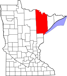
 Waasa Township, Minnesota Location within the state of Minnesota | |
| Coordinates: 47°39′58″N 92°6′56″W / 47.66611°N 92.11556°WCoordinates: 47°39′58″N 92°6′56″W / 47.66611°N 92.11556°W | |
| Country | United States |
| State | Minnesota |
| County | Saint Louis |
| Area | |
| • Total | 35.3 sq mi (91.6 km2) |
| • Land | 35.1 sq mi (90.9 km2) |
| • Water | 0.2 sq mi (0.6 km2) |
| Elevation | 1,457 ft (444 m) |
| Population (2010) | |
| • Total | 249 |
| • Density | 7.1/sq mi (2.7/km2) |
| Time zone | Central (CST) (UTC-6) |
| • Summer (DST) | CDT (UTC-5) |
| FIPS code | 27-67342[1] |
| GNIS feature ID | 0665881[2] |
Waasa Township is a township in Saint Louis County, Minnesota, United States. The population was 249 at the 2010 census.[3]
Saint Louis County Highway 21 (CR 21) serves as a main route in the township. CR 21 runs east–west through the township.
Other routes include Salo Road.
History
Waasa Township derives its name from Vaasa Province, in Finland.[4]
Geography
According to the United States Census Bureau, the township has a total area of 35.3 square miles (91 km2); 35.1 square miles (91 km2) is land and 0.2 square miles (0.52 km2), or 0.68%, is water.
The Embarrass River runs east–west through the middle of Waasa Township. Camp Eight Creek flows through the north–central part of the township. Spring Mine Creek flows through the southeast part of the township.
Adjacent townships, cities, and communities
The following are adjacent to Waasa Township :
- The city of Babbitt (east)
- The city of Hoyt Lakes (south)
- White Township (southwest)
- Embarrass Township (west)
- The unincorporated community of Embarrass (west)
- Kugler Township (northwest)
- Bear Island State Forest (north and northeast)
- Bear Island Lake (northeast)
Demographics
As of the census[1] of 2000, there were 304 people, 121 households, and 89 families residing in the township. The population density was 8.7 people per square mile (3.3/km²). There were 148 housing units at an average density of 4.2/sq mi (1.6/km²). The racial makeup of the township was 96.71% White and 3.29% Native American. 30.8% were of Finnish, 20.7% German, 16.0% Norwegian, 6.3% English and 5.5% Irish ancestry according to Census 2000.
There were 121 households out of which 27.3% had children under the age of 18 living with them, 63.6% were married couples living together, 5.0% had a female householder with no husband present, and 26.4% were non-families. 23.1% of all households were made up of individuals and 8.3% had someone living alone who was 65 years of age or older. The average household size was 2.51 and the average family size was 2.88.
In the township the population was spread out with 23.4% under the age of 18, 7.9% from 18 to 24, 25.7% from 25 to 44, 27.0% from 45 to 64, and 16.1% who were 65 years of age or older. The median age was 42 years. For every 100 females there were 121.9 males. For every 100 females age 18 and over, there were 121.9 males.
The median income for a household in the township was $37,778, and the median income for a family was $43,393. Males had a median income of $39,792 versus $21,750 for females. The per capita income for the township was $15,282. About 7.7% of families and 16.3% of the population were below the poverty line, including 31.7% of those under the age of eighteen and 5.0% of those sixty five or over.
References
- 1 2 "American FactFinder". United States Census Bureau. Retrieved 2008-01-31.
- ↑ "US Board on Geographic Names". United States Geological Survey. 2007-10-25. Retrieved 2008-01-31.
- ↑ "Race, Hispanic or Latino, Age, and Housing Occupancy: 2010 Census Redistricting Data (Public Law 94-171) Summary File (QT-PL), Waasa township, St. Louis County, Minnesota". U.S. Census Bureau, American FactFinder 2. Retrieved October 26, 2011.
- ↑ Upham, Warren (1920). Minnesota Geographic Names: Their Origin and Historic Significance. Minnesota Historical Society. p. 491.