Gheen (community), Minnesota
| Gheen, Minnesota | |
|---|---|
| Unincorporated community | |
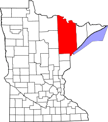
 Gheen, Minnesota  Gheen, Minnesota Location of the community of Gheen | |
| Coordinates: 47°58′05″N 92°48′30″W / 47.96806°N 92.80833°WCoordinates: 47°58′05″N 92°48′30″W / 47.96806°N 92.80833°W | |
| Country | United States |
| State | Minnesota |
| County | Saint Louis |
| Elevation | 1,362 ft (415 m) |
| Population | |
| • Total | 25 |
| Time zone | Central (CST) (UTC-6) |
| • Summer (DST) | CDT (UTC-5) |
| ZIP codes | 55771 |
| Area code(s) | 218 |
| GNIS feature ID | 661354[1] |
Gheen is an unincorporated community in Gheen Territory, Saint Louis County, Minnesota, United States; located one mile east of Gheen Corner on Willow River Road.
The community of Gheen is located 7 miles south of Orr, and 12 miles north of Cook.
U.S. Highway 53 is nearby. Gheen is located within the Kabetogama State Forest.
History
A post office called Gheen was established in 1906, and remained in operation until 1993.[2] The community was named for Edward Hickman Gheen, a Navy officer.[3]
References
- ↑ "Gheen, Minnesota". Geographic Names Information System. United States Geological Survey.
- ↑ "St. Louis County". Jim Forte Postal History. Retrieved 7 August 2015.
- ↑ Upham, Warren (1920). Minnesota Geographic Names: Their Origin and Historic Significance. Minnesota Historical Society. p. 483.
- Rand McNally Road Atlas – 2007 edition – Minnesota entry
- Official State of Minnesota Highway Map – 2011/2012 edition
This article is issued from Wikipedia - version of the 10/24/2016. The text is available under the Creative Commons Attribution/Share Alike but additional terms may apply for the media files.