Fayal Township, St. Louis County, Minnesota
| Fayal Township, Minnesota | |
|---|---|
| Township | |
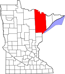
 Fayal Township, Minnesota Location within the state of Minnesota | |
| Coordinates: 47°25′16″N 92°30′42″W / 47.42111°N 92.51167°WCoordinates: 47°25′16″N 92°30′42″W / 47.42111°N 92.51167°W | |
| Country | United States |
| State | Minnesota |
| County | Saint Louis |
| Area | |
| • Total | 34.4 sq mi (89.2 km2) |
| • Land | 31.4 sq mi (81.4 km2) |
| • Water | 3.0 sq mi (7.8 km2) |
| Elevation | 1,368 ft (417 m) |
| Population (2010) | |
| • Total | 1,809 |
| • Density | 53/sq mi (20/km2) |
| Time zone | Central (CST) (UTC-6) |
| • Summer (DST) | CDT (UTC-5) |
| FIPS code | 27-20762[1] |
| GNIS feature ID | 0664152[2] |
| Website | www.fayaltwp.org |
Fayal Township is a township in Saint Louis County, Minnesota, United States. The population was 1,809 at the 2010 census.[3]
U.S. Highway 53 and State Highway 37 (MN 37) are two of the main routes in the township. Other routes include Bodas Road.
History
The township was named after Fayal Island in the Atlantic Ocean.[4]
Geography
According to the United States Census Bureau, the township has a total area of 34.5 square miles (89 km2); 31.4 square miles (81 km2) is land and 3.0 square miles (7.8 km2), or 8.77%, is water.
Eveleth–Virginia Municipal Airport is located within Fayal Township.
The Saint Louis River flows through the southeast corner of the township.
Adjacent townships, cities, and communities
The following are adjacent to Fayal Township :
- The city of Eveleth (north)
- The city of Gilbert (north)
- Clinton Township (west)
- Iron Junction (west)
- The unincorporated community of Forbes (west–southwest)
- McDavitt Township (southwest)
- Heikkala Lake Unorganized Territory (south)
- The unincorporated community of Central Lakes (south)
- Mud Hen Lake Unorganized Territory (southeast)
- The unincorporated community of Makinen (southeast)
- Tikander Lake Unorganized Territory (east)
- The unincorporated community of Palo (east)
- Biwabik Township (northeast)
Demographics
As of the census[1] of 2000, there were 1,906 people, 769 households, and 586 families residing in the township. The population density was 60.7 people per square mile (23.4/km²). There were 948 housing units at an average density of 30.2/sq mi (11.6/km²). The racial makeup of the township was 97.74% White, 0.05% African American, 0.42% Native American, 0.52% Asian, 0.10% Pacific Islander, 0.21% from other races, and 0.94% from two or more races. Hispanic or Latino of any race were 0.42% of the population.
There were 769 households out of which 30.3% had children under the age of 18 living with them, 69.4% were married couples living together, 3.9% had a female householder with no husband present, and 23.7% were non-families. 20.2% of all households were made up of individuals and 9.6% had someone living alone who was 65 years of age or older. The average household size was 2.47 and the average family size was 2.86.
In the township the population was spread out with 23.2% under the age of 18, 4.6% from 18 to 24, 22.8% from 25 to 44, 32.9% from 45 to 64, and 16.5% who were 65 years of age or older. The median age was 45 years. For every 100 females there were 104.7 males. For every 100 females age 18 and over, there were 100.5 males.
The median income for a household in the township was $50,665, and the median income for a family was $56,985. Males had a median income of $43,611 versus $28,295 for females. The per capita income for the township was $22,938. About 0.7% of families and 2.3% of the population were below the poverty line, including 0.6% of those under age 18 and 9.7% of those age 65 or over.
References
- 1 2 "American FactFinder". United States Census Bureau. Retrieved 2008-01-31.
- ↑ "US Board on Geographic Names". United States Geological Survey. 2007-10-25. Retrieved 2008-01-31.
- ↑ "Race, Hispanic or Latino, Age, and Housing Occupancy: 2010 Census Redistricting Data (Public Law 94-171) Summary File (QT-PL), Fayal township, St. Louis County, Minnesota". U.S. Census Bureau, American FactFinder 2. Retrieved October 26, 2011.
- ↑ Upham, Warren (1920). Minnesota Geographic Names: Their Origin and Historic Significance. Minnesota Historical Society. p. 482.