Kabetogama, Minnesota
| Kabetogama, Minnesota | |
|---|---|
| Unincorporated community | |
 Kabetogama, Minnesota  Kabetogama, Minnesota Location of the community of Kabetogama | |
| Coordinates: 48°26′16″N 93°01′39″W / 48.43778°N 93.02750°WCoordinates: 48°26′16″N 93°01′39″W / 48.43778°N 93.02750°W | |
| Country | United States |
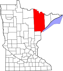
| State | Minnesota |
| County | Saint Louis |
| Township | Kabetogama Township |
| Elevation | 1,191 ft (363 m) |
| Population | |
| • Total | 70 |
| Time zone | Central (CST) (UTC-6) |
| • Summer (DST) | CDT (UTC-5) |
| ZIP code | 56669 |
| Area code(s) | 218 |
| GNIS feature ID | 661605[1] |
Kabetogama is an unincorporated community in Kabetogama Township, Saint Louis County, Minnesota, United States, located within the Kabetogama State Forest.
The community is located 27 miles southeast of International Falls on Saint Louis County Roads 122 and 123. Kabetogama is located 49 miles north of Cook.
U.S. Highway 53 is nearby. Voyageurs National Park is in the vicinity. The boundary line between Saint Louis and Koochiching counties is also nearby.
Notes
Adjacent Kabetogama Lake is one of four major lakes that make up the Voyageurs National Park. Kabetogama is the gateway into the park.
Kabetogama Lake has 25,000 acres (100 km2) of waters and has 200 islands. Kabetogama Lake was carved from an ancient glacier flow. Kabetogama Lake runs into Namakan lake to the east.
Kabetogama is noted for walleye fishing. There are also northern pike, crappie, perch, and bass. At the entrance to the lake, there is a large statue of a walleye with a saddle that people can climb onto and have their picture taken. It's an icon that's associated with the lake and the fishing.
The islands of Kabetogama Lake and surrounding area have miles of trails and various campsites for park visitors to use.
Many families homesteaded houses or cabins on Kabetogama Lake before it was a part of Voyageurs National Park.
The logging industry logged for White Pine trees in and around Kabetogama.
There are many outfitters in Kabetogama who rent out kayaks and canoes for people to explore the lake.
In the winter, visitors can ice fish, snowmobile, cross country ski and ice skate among other things.
The Kabetogama area is also known for hunting of whitetail deer, black bear, and small game birds.
Kabetogama Lake has many resorts that line the shores and is a vacation place for many returning and new people each year. Most visitors come in the summer when the weather is more agreeable.
Woodenfrog State Campground is located within the Kabetogama Lake shore lines. The campground was named after a Chippewa chief name Chief Woodenfrog.
The lake is roughly parallel to Rainy Lake. The Ojibwe name Gaa-biitoogamaag-zaaga'igan translates to “the lake that lies parallel or double with another lake.” French fur trappers similarly referred to Kabetogama as Travere or Travers, meaning “alongside.” A thin peninsula is all that separates lakes.
The 26,000-acre lake has myriad bays and more than 200 islands. It reaches a maximum depth of 80 feet and has an average water clarity of 9 feet. The largely undeveloped landscape is a transition zone between boreal and hardwood forests.
Kabetogama Lake has long been a popular destination for walleye anglers, and it was host to the 2010 Minnesota Governor’s Fishing Opener on May 15, 2010. Walleye, sauger, northern pike, smallmouth bass, crappie, and perch grow faster there than they do in nearby lakes that are colder, deeper, and less fertile.[2]
References
- ↑ "Kabetogama, Minnesota". Geographic Names Information System. United States Geological Survey.
- ↑ "lakekabetogama.org". Retrieved July 26, 2013.
Sources
- Rand McNally Road Atlas – 2007 edition – Minnesota entry
- Official State of Minnesota Highway Map – 2011/2012 edition