Poneto, Indiana
| Poneto, Indiana | |
|---|---|
| Town | |
|
Methodist church on Walnut St. | |
 Location of Poneto in the state of Indiana | |
| Coordinates: 40°39′22″N 85°13′20″W / 40.65611°N 85.22222°WCoordinates: 40°39′22″N 85°13′20″W / 40.65611°N 85.22222°W | |
| Country | United States |
| State | Indiana |
| County | Wells |
| Township | Chester, Harrison, Liberty |
| Area[1] | |
| • Total | 0.12 sq mi (0.31 km2) |
| • Land | 0.12 sq mi (0.31 km2) |
| • Water | 0 sq mi (0 km2) |
| Elevation[2] | 850 ft (259 m) |
| Population (2010)[3] | |
| • Total | 166 |
| • Estimate (2012[4]) | 166 |
| • Density | 1,383.3/sq mi (534.1/km2) |
| Time zone | Eastern (EST) (UTC-5) |
| • Summer (DST) | EDT (UTC-4) |
| ZIP code | 46781 |
| Area code(s) | 260 |
| FIPS code | 18-61020[5] |
| GNIS feature ID | 441431 |

Poneto is a town in Chester, Harrison and Liberty townships, Wells County, in the U.S. state of Indiana.[6] The population was 166 at the 2010 census.
History
The Poneto post office has been in operation since 1881.[7]
Geography
Poneto is located at 40°39′22″N 85°13′20″W / 40.65611°N 85.22222°W (40.656173, -85.222193).[8]
According to the 2010 census, the town has a total area of 0.12 square miles (0.31 km2), all land.[1]
Demographics
| Historical population | |||
|---|---|---|---|
| Census | Pop. | %± | |
| 1900 | 332 | — | |
| 1910 | 308 | −7.2% | |
| 1920 | 270 | −12.3% | |
| 1930 | 237 | −12.2% | |
| 1940 | 270 | 13.9% | |
| 1950 | 244 | −9.6% | |
| 1960 | 289 | 18.4% | |
| 1970 | 286 | −1.0% | |
| 1980 | 250 | −12.6% | |
| 1990 | 236 | −5.6% | |
| 2000 | 240 | 1.7% | |
| 2010 | 166 | −30.8% | |
| Est. 2015 | 167 | [9] | 0.6% |
2010 census
As of the census[3] of 2010, there were 166 people, 69 households, and 39 families residing in the town. The population density was 1,383.3 inhabitants per square mile (534.1/km2). There were 77 housing units at an average density of 641.7 per square mile (247.8/km2). The racial makeup of the town was 99.4% White and 0.6% Native American. Hispanic or Latino of any race were 1.8% of the population.
There were 69 households of which 29.0% had children under the age of 18 living with them, 49.3% were married couples living together, 4.3% had a female householder with no husband present, 2.9% had a male householder with no wife present, and 43.5% were non-families. 33.3% of all households were made up of individuals and 10.1% had someone living alone who was 65 years of age or older. The average household size was 2.41 and the average family size was 3.08.
The median age in the town was 41.6 years. 20.5% of residents were under the age of 18; 9.5% were between the ages of 18 and 24; 25.2% were from 25 to 44; 30.7% were from 45 to 64; and 13.9% were 65 years of age or older. The gender makeup of the town was 48.2% male and 51.8% female.
2000 census
As of the census[5] of 2000, there were 240 people, 78 households, and 64 families residing in the town. The population density was 2,078.5 people per square mile (772.2/km²). There were 82 housing units at an average density of 710.1 per square mile (263.8/km²). The racial makeup of the town was 100.00% White.
There were 78 households out of which 39.7% had children under the age of 18 living with them, 74.4% were married couples living together, 2.6% had a female householder with no husband present, and 16.7% were non-families. 15.4% of all households were made up of individuals and 10.3% had someone living alone who was 65 years of age or older. The average household size was 3.08 and the average family size was 3.45.
In the town the population was spread out with 33.3% under the age of 18, 10.4% from 18 to 24, 29.6% from 25 to 44, 19.2% from 45 to 64, and 7.5% who were 65 years of age or older. The median age was 30 years. For every 100 females there were 112.4 males. For every 100 females age 18 and over, there were 97.5 males.
The median income for a household in the town was $43,125, and the median income for a family was $46,750. Males had a median income of $32,125 versus $19,286 for females. The per capita income for the town was $15,820. About 3.3% of families and 5.2% of the population were below the poverty line, including 6.3% of those under the age of eighteen and 20.0% of those sixty five or over.
References
- 1 2 "Places: Indiana". 2010 Census Gazetteer Files. United States Census Bureau. Retrieved 2012-04-21. External link in
|work=(help) - ↑ "US Board on Geographic Names". United States Geological Survey. October 25, 2007. Retrieved 2016-07-06.
- 1 2 "American FactFinder". United States Census Bureau. Retrieved 2012-12-11.
- ↑ "Population Estimates". United States Census Bureau. Retrieved 2013-06-25.
- 1 2 "American FactFinder". United States Census Bureau. Retrieved 2008-01-31.
- ↑ "Poneto, Indiana". Geographic Names Information System. United States Geological Survey. Retrieved 2016-07-06.
- ↑ "Wells County". Jim Forte Postal History. Retrieved July 6, 2016.
- ↑ "US Gazetteer files: 2010, 2000, and 1990". United States Census Bureau. 2011-02-12. Retrieved 2011-04-23.
- ↑ "Annual Estimates of the Resident Population for Incorporated Places: April 1, 2010 to July 1, 2015". Retrieved July 2, 2016.
- ↑ "Census of Population and Housing". Census.gov. Retrieved June 4, 2015.
Municipalities and communities of Wells County, Indiana, United States | ||
|---|---|---|
| City | ||
| Towns | ||
| Townships | ||
| Unincorporated communities | ||
| Footnotes | ‡This populated place also has portions in an adjacent county or counties | |
| Counties | 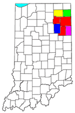 | |
|---|---|---|
| Municipalities with population over 10,000 in 2010 | ||
| Municipalities with population 1,000-10,000 in 2010 | ||
| Municipalities with population under 1,000 in 2010 | ||
| CDPs | ||