Huntington County, Indiana
| Huntington County, Indiana | |
|---|---|
 Huntington County Courthouse in Huntington | |
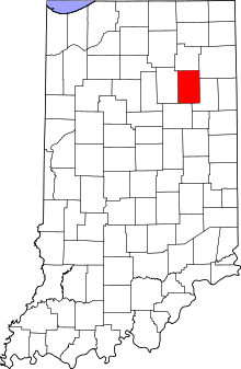 Location in the U.S. state of Indiana | |
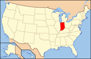 Indiana's location in the U.S. | |
| Founded | 1832 |
| Named for | Samuel H. Huntington |
| Seat | Huntington |
| Largest city | Huntington |
| Area | |
| • Total | 387.72 sq mi (1,004 km2) |
| • Land | 382.65 sq mi (991 km2) |
| • Water | 5.07 sq mi (13 km2), 1.31% |
| Population | |
| • (2010) | 37,124 |
| • Density | 97/sq mi (37.46/km²) |
| Congressional district | 3rd |
| Time zone | Eastern: UTC-5/-4 |
| Website |
www |
| Footnotes: Indiana county number 35 | |
Huntington County is a county located in the U.S. state of Indiana. According to Census 2010, the population was 37,124.[1] The county seat and lone city is Huntington.[2]
Huntington County comprises the Huntington, IN Micropolitan Statistical Area and is included in the Fort Wayne–Huntington–Auburn Combined Statistical Area
Geography
According to the 2010 census, the county has a total area of 387.72 square miles (1,004.2 km2), of which 382.65 square miles (991.1 km2) (or 98.69%) is land and 5.07 square miles (13.1 km2) (or 1.31%) is water.[3]

Adjacent counties
- Whitley County (north)
- Allen County (northeast)
- Wells County (east)
- Grant County (south)
- Wabash County (west)
History
Huntington County was formed in 1832. It was named for Samuel Huntington, who signed the Declaration of Independence and the Articles of Confederation.[4] He was also President of the Continental Congress under the Articles of Confederation.
Notable natives and former residents
Public Servants
- Sam Cook (1860–1946), Served as a US Congressman
- J. Danforth Quayle, Vice-President of the United States, U.S. Senator, U.S. Representative
- J. Edward Roush (1920–2004), U.S. Representative, Father of "911 Emergency System"
- John R. Kissinger (1877–1946), Congressional Medal of Honor and was featured in the movie, Yellow Jack.
Celebrities
- Chris Schenkel, (1923-2005) Emmy Award winning sportscaster
- Denny Jiosa, Grammy nominated jazz guitarist and composer
- Archbishop John F. Noll (1875–1956), founded Our Sunday Visitor, the world's largest Catholic weekly newspaper. Founded Victory Noll and St. Felix Monastery.
- Sandy Thomson, Chief Weather Specialist, WANE-TV Fort Wayne
Artists
- Mick Mars, Played guitar with the four man heavy metal rock group Mötley Crüe.
- Eiffel G. Plasterer, in the mid-1900s, toured America with his "Bubbles Concerto" program. He was a pioneer in soap bubble art and invented unique bubble-making techniques and equipment.
Athletes
- Gary Dilley, Bronze Medal in swimming at the Olympics held in Tokyo, Japan.
- George Haines, Coached the women's national swim team in the Olympics.
- Glen S. Hummer, legendary YMCA swim coach, coached Olympic team in Tokyo, Japan.
- W.L. Seibold, national horseshoe champion.
- Mark Seibold, 4-time World Horseshoe Pitching Champion 1966, 1969, 1979, 1986
- Ned Steele, national Ping Pong champion in 1938.[5]
- Steve Platt, basketball player and coach at Huntington University. Indiana’s all-time collegiate scoring leader (3,700 points), placing him seventh on the list of all-time collegiate scorers at any level. Platt twice led the nation in scoring in 1973 and 1974.
- Lisa Winter, basketball player at Ball State University and Valparaiso University. Indiana's Miss Basketball 1996.
- Matt Pike, football player at Purdue University and in the Arena Football League, 1999–Present. Won AF2 Title with Peoria in 2002.
- Chris Kramer, professional basketball player with EWE Baskets Oldenburg of the German Basketball Bundesliga, formerly with the Fort Wayne Mad Ants of the NBA Developmental League, the Mets de Guaynabo of the Baloncesto Superior Nacional, and the s.Oliver Baskets, Würzburg of the German Basketball Bundesliga. Kramer played college basketball at Purdue University where he was two-time Big Ten Defensive Player of the Year.
Points of interest
- Huntington County Historical Museum
- Huntington University Arboretum and Botanical Garden
- Huntington University
- J. Edward Roush Lake
- Joseph Decuis Restaurant
- Merillat Centre for the Arts
- Our Sunday Visitor Corporate Headquarters
- Sheets Wildlife Museum and Learning Center
- Sunken Gardens
- The Forks Of The Wabash
- The Indiana Room Genealogy Center
- Tel-Hy Nature Preserve
- Two-EE's Winery
- United States Vice Presidential Museum
- Victory Noll Center
Cities and towns
- Andrews
- Banquo
- Bippus
- Goblesville
- Huntington
- Lancaster
- Majenica
- Markle
- Monument City
- Mount Etna
- Plum Tree
- Roanoke
- Warren
Townships
- Clear Creek
- Dallas
- Huntington
- Jackson
- Jefferson
- Lancaster
- Polk
- Rock Creek
- Salamonie
- Union
- Warren
- Wayne
Unincorporated communities
- Banquo
- Bippus
- Bowerstown
- Bracken
- Buckeye
- Goblesville
- Harlansburg
- Lancaster
- Mahon
- Majenica
- Makin
- Mardenis
- Milo
- Pleasant Plain
- Plum Tree
- Roanoke Station
- Rock Creek Center
- Simpson
Education
School district
Private schools
Higher education
News and Media
Newspapers
- The Herald-Press daily newspaper
- The Huntington County TAB
- Warren Weekly
- HuntingtonFreePress
- Huntingtonian
Radio
- WBZQ 1300 AM
- Huntington North High School WVSH Viking Radio
- Huntington University Radio WQHC 105.5-FM The Fuse!
Transportation
Major highways
-
 Interstate 69
 -
 U.S. Route 24
 -
 U.S. Route 224
 -
 State Road 3
 -
 State Road 5
 -
 State Road 9
 -
 State Road 16
 -
 State Road 105
 -
 State Road 114
 -
 State Road 116
 -
 State Road 124
 -
 State Road 218
Climate and weather
| Huntington, Indiana | ||||||||||||||||||||||||||||||||||||||||||||||||||||||||||||
|---|---|---|---|---|---|---|---|---|---|---|---|---|---|---|---|---|---|---|---|---|---|---|---|---|---|---|---|---|---|---|---|---|---|---|---|---|---|---|---|---|---|---|---|---|---|---|---|---|---|---|---|---|---|---|---|---|---|---|---|---|
| Climate chart (explanation) | ||||||||||||||||||||||||||||||||||||||||||||||||||||||||||||
| ||||||||||||||||||||||||||||||||||||||||||||||||||||||||||||
| ||||||||||||||||||||||||||||||||||||||||||||||||||||||||||||
In recent years, average temperatures in Huntington have ranged from a low of 16 °F (−9 °C) in January to a high of 87 °F (31 °C) in July, although a record low of −28 °F (−33 °C) was recorded in January 1982 and a record high of 105 °F (41 °C) was recorded in June 1988. Average monthly precipitation ranged from 1.82 inches (46 mm) in February to 4.37 inches (111 mm) in June.[6]
Government
The county government is a constitutional body, and is granted specific powers by the Constitution of Indiana, and by the Indiana Code.
County Council: The county council is the fiscal branch of the county government and controls all the spending and revenue collection in the county. Representatives are elected from county districts. The council members serve four-year terms. They are responsible for setting salaries, the annual budget, and special spending. The council also has limited authority to impose local taxes, in the form of an income and property tax that is subject to state level approval, excise taxes, and service taxes.[7][8]
Board of Commissioners: The executive and legislative body of the county is made of a board of commissioners. The commissioners are elected county-wide, in staggered terms, and each serves a four-year term. One of the commissioners, typically the most senior, serves as president. The commissioners are charged with collecting revenue, and managing the day-to-day functions of the county government.[7][8]
Court: The county maintains a small claims court that can handle some civil cases. The judge on the court is elected to a term of four years and must be a member of the Indiana Bar Association. The judge is assisted by a constable who is also elected to a four-year term. In some cases, court decisions can be appealed to the state level circuit court.[8]
County Officials: The county has several other elected offices, including sheriff, coroner, auditor, treasurer, recorder, surveyor, and circuit court clerk Each of these elected officers serves a term of four years and oversees a different part of county government. Members elected to county government positions are required to declare party affiliations and to be residents of the county.[8]
Huntington County is part of Indiana's 5th congressional district; Indiana Senate district 17;[9] and Indiana House of Representatives district 50.[10]
Demographics
| Historical population | |||
|---|---|---|---|
| Census | Pop. | %± | |
| 1840 | 1,579 | — | |
| 1850 | 7,850 | 397.2% | |
| 1860 | 14,867 | 89.4% | |
| 1870 | 19,036 | 28.0% | |
| 1880 | 21,805 | 14.5% | |
| 1890 | 27,644 | 26.8% | |
| 1900 | 28,901 | 4.5% | |
| 1910 | 28,982 | 0.3% | |
| 1920 | 31,671 | 9.3% | |
| 1930 | 29,073 | −8.2% | |
| 1940 | 29,931 | 3.0% | |
| 1950 | 31,400 | 4.9% | |
| 1960 | 33,814 | 7.7% | |
| 1970 | 34,970 | 3.4% | |
| 1980 | 35,596 | 1.8% | |
| 1990 | 35,427 | −0.5% | |
| 2000 | 38,075 | 7.5% | |
| 2010 | 37,124 | −2.5% | |
| Est. 2015 | 36,630 | [11] | −1.3% |
| U.S. Decennial Census[12] 1790-1960[13] 1900-1990[14] 1990-2000[15] 2010-2013[1] | |||
As of the 2010 United States Census, there were 37,124 people, 14,218 households, and 10,074 families residing in the county.[16] The population density was 97.0 inhabitants per square mile (37.5/km2). There were 15,805 housing units at an average density of 41.3 per square mile (15.9/km2).[3] The racial makeup of the county was 97.1% white, 0.4% Asian, 0.4% American Indian, 0.4% black or African American, 0.5% from other races, and 1.1% from two or more races. Those of Hispanic or Latino origin made up 1.7% of the population.[16] In terms of ancestry, 37.9% were German, 14.9% were Irish, 12.9% were American, and 12.1% were English.[17]
Of the 14,218 households, 32.3% had children under the age of 18 living with them, 56.5% were married couples living together, 9.9% had a female householder with no husband present, 29.1% were non-families, and 24.4% of all households were made up of individuals. The average household size was 2.52 and the average family size was 2.97. The median age was 39.0 years.[16]
The median income for a household in the county was $47,697 and the median income for a family was $55,630. Males had a median income of $41,648 versus $30,218 for females. The per capita income for the county was $21,575. About 7.7% of families and 11.4% of the population were below the poverty line, including 15.6% of those under age 18 and 9.8% of those age 65 or over.[18]
See also
Further reading
- History of Huntington County, Indiana. Walsworth Publishing Co. (1887).
References
- 1 2 "Huntington County QuickFacts". United States Census Bureau. Retrieved 2011-09-20.
- ↑ "Find a County". National Association of Counties. Archived from the original on May 31, 2011. Retrieved 2011-06-07.
- 1 2 "Population, Housing Units, Area, and Density: 2010 - County". United States Census Bureau. Retrieved 2015-07-10.
- ↑ Gannett, Henry (1905). The Origin of Certain Place Names in the United States. Govt. Print. Off. p. 163.
- ↑ https://books.google.com/books?id=9qlWAXyn7HEC&sitesec=buy&source=gbs_navlinks_s
- 1 2 "Monthly Averages for Huntington, Indiana". The Weather Channel. Retrieved 2011-01-27.
- 1 2 Indiana Code. "Title 36, Article 2, Section 3". IN.gov. Retrieved 2008-09-16.
- 1 2 3 4 Indiana Code. "Title 2, Article 10, Section 2" (PDF). IN.gov. Retrieved 2008-09-16.
- ↑ "Indiana Senate Districts". State of Indiana. Retrieved 2011-07-14.
- ↑ "Indiana House Districts". State of Indiana. Retrieved 2011-07-14.
- ↑ "County Totals Dataset: Population, Population Change and Estimated Components of Population Change: April 1, 2010 to July 1, 2015". Retrieved July 2, 2016.
- ↑ "U.S. Decennial Census". United States Census Bureau. Archived from the original on May 11, 2015. Retrieved July 10, 2014.
- ↑ "Historical Census Browser". University of Virginia Library. Retrieved July 10, 2014.
- ↑ "Population of Counties by Decennial Census: 1900 to 1990". United States Census Bureau. Retrieved July 10, 2014.
- ↑ "Census 2000 PHC-T-4. Ranking Tables for Counties: 1990 and 2000" (PDF). United States Census Bureau. Retrieved July 10, 2014.
- 1 2 3 "DP-1 Profile of General Population and Housing Characteristics: 2010 Demographic Profile Data". United States Census Bureau. Retrieved 2015-07-10.
- ↑ "DP02 SELECTED SOCIAL CHARACTERISTICS IN THE UNITED STATES – 2006-2010 American Community Survey 5-Year Estimates". United States Census Bureau. Retrieved 2015-07-10.
- ↑ "DP03 SELECTED ECONOMIC CHARACTERISTICS – 2006-2010 American Community Survey 5-Year Estimates". United States Census Bureau. Retrieved 2015-07-10.
External links
- Huntington County Chamber of Commerce
- Official Web site of Huntington, Indiana
- Huntington County Community Network
- Huntington Herald Press daily newspaper
- Huntington County United Economic Development
 |
Whitley County | Allen County | | |
| Wabash County | |
Wells County | ||
| ||||
| | ||||
| Grant County |
Municipalities and communities of Huntington County, Indiana, United States | ||
|---|---|---|
| City | ||
| Towns | ||
| Townships | ||
| Unincorporated communities | ||
| Footnotes | ‡This populated place also has portions in an adjacent county or counties | |
| Counties | 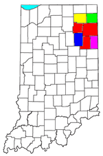 | |
|---|---|---|
| Municipalities with population over 10,000 in 2010 | ||
| Municipalities with population 1,000-10,000 in 2010 | ||
| Municipalities with population under 1,000 in 2010 | ||
| CDPs | ||
Coordinates: 40°50′N 85°29′W / 40.83°N 85.49°W