Steuben County, Indiana
| Steuben County, Indiana | |
|---|---|
|
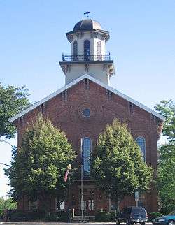
Steuben County Courthouse, in Angola, Indiana. The courthouse is on the National Register of Historic Places. For a list of all such sites in Steuben County, see National Register of Historic Places listings in Steuben County, Indiana. | |
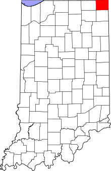 Location in the U.S. state of Indiana | |
 Indiana's location in the U.S. | |
| Founded | 1837 |
| Named for | Baron Frederick von Steuben |
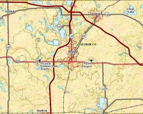
| Seat | Angola |
| Largest city | Angola |
| Area | |
| • Total | 322.47 sq mi (835 km2) |
| • Land | 308.94 sq mi (800 km2) |
| • Water | 13.53 sq mi (35 km2), 4.20% |
| Population | |
| • (2010) | 34,185 |
| • Density | 111/sq mi (42.75/km²) |
| Congressional district | 3rd |
| Time zone | Eastern: UTC-5/-4 |
| Website | Official Site of Steuben County, Indiana |
| Footnotes: Indiana county number 76 | |
Steuben County is a county located in the northeast corner of the U.S. state of Indiana. The county was named after Baron von Steuben, a Prussian military officer who helped train the Continental Army during the American Revolutionary War.
Today, the county contains a state park and 105 lakes of various sizes. Some of the larger lakes are Lake James, Lake George, Clear Lake, Jimmerson Lake, Lake Gage, and Crooked Lake. As of 2010, the county population was 34,185.[1] The county seat is Angola.[2]
History
Steuben County was officially created in 1837 from LaGrange County, and named for Baron Frederick von Steuben, an officer of the American Revolutionary War.[3]
Geography
According to the 2010 census, the county has a total area of 322.47 square miles (835.2 km2), of which 308.94 square miles (800.2 km2) (or 95.80%) is land and 13.53 square miles (35.0 km2) (or 4.20%) is water.[4]
Cities and towns
Unincorporated towns
Townships
Adjacent counties

- Branch County, Michigan (north)
- Hillsdale County, Michigan (northeast)
- Williams County, Ohio (east)
- DeKalb County (south)
- Noble County (southwest)
- LaGrange County (west)
Major highways
-


 Indiana Toll Road (Interstate 80 and Interstate 90)
 -
 Interstate 69
 -
 U.S. Route 20
 -
 State Road 1
 -
 State Road 120
 -
 State Road 127
 -
 State Road 327
 -
 State Road 427
 -
 State Road 827
Attractions
- Pokagon State Park, a popular state park with year-round activities is located entirely in the county.
Climate and weather
| Angola, Indiana | ||||||||||||||||||||||||||||||||||||||||||||||||||||||||||||
|---|---|---|---|---|---|---|---|---|---|---|---|---|---|---|---|---|---|---|---|---|---|---|---|---|---|---|---|---|---|---|---|---|---|---|---|---|---|---|---|---|---|---|---|---|---|---|---|---|---|---|---|---|---|---|---|---|---|---|---|---|
| Climate chart (explanation) | ||||||||||||||||||||||||||||||||||||||||||||||||||||||||||||
| ||||||||||||||||||||||||||||||||||||||||||||||||||||||||||||
| ||||||||||||||||||||||||||||||||||||||||||||||||||||||||||||
In recent years, average temperatures in Angola have ranged from a low of 14 °F (−10 °C) in January to a high of 82 °F (28 °C) in July, although a record low of −27 °F (−33 °C) was recorded in January 1981 and a record high of 106 °F (41 °C) was recorded in July 1936. Average monthly precipitation ranged from 1.83 inches (46 mm) in February to 4.08 inches (104 mm) in August.[5]
Government
The county government is a constitutional body, and is granted specific powers by the Constitution of Indiana, and by the Indiana Code.
County Council: The county council is the legislative branch of the county government and controls all the spending and revenue collection in the county. Representatives are elected from county districts. The council members serve four-year terms. They are responsible for setting salaries, the annual budget, and special spending. The council also has limited authority to impose local taxes, in the form of an income and property tax that is subject to state level approval, excise taxes, and service taxes.[6][7]
Board of Commissioners: The executive body of the county is made of a board of commissioners. The commissioners are elected county-wide, in staggered terms, and each serves a four-year term. One of the commissioners, typically the most senior, serves as president. The commissioners are charged with executing the acts legislated by the council, collecting revenue, and managing the day-to-day functions of the county government.[6][7]
Court: The county maintains a small claims court that can handle some civil cases. The judge on the court is elected to a term of four years and must be a member of the Indiana Bar Association. The judge is assisted by a constable who is also elected to a four-year term. In some cases, court decisions can be appealed to the state level circuit court.[7]
County Officials: The county has several other elected offices, including sheriff, coroner, auditor, treasurer, recorder, surveyor, and circuit court clerk. Each of these elected officers serves a term of four years and oversees a different part of county government. Members elected to county government positions are required to declare party affiliations and to be residents of the county.[7]
Steuben County is part of Indiana's 3rd congressional district and in 2008 was represented by Mark Souder in the United States Congress.[8]
Demographics
| Historical population | |||
|---|---|---|---|
| Census | Pop. | %± | |
| 1840 | 2,578 | — | |
| 1850 | 6,104 | 136.8% | |
| 1860 | 10,374 | 70.0% | |
| 1870 | 12,854 | 23.9% | |
| 1880 | 14,645 | 13.9% | |
| 1890 | 14,478 | −1.1% | |
| 1900 | 15,219 | 5.1% | |
| 1910 | 14,274 | −6.2% | |
| 1920 | 13,360 | −6.4% | |
| 1930 | 13,386 | 0.2% | |
| 1940 | 13,740 | 2.6% | |
| 1950 | 17,087 | 24.4% | |
| 1960 | 17,184 | 0.6% | |
| 1970 | 20,159 | 17.3% | |
| 1980 | 24,694 | 22.5% | |
| 1990 | 27,446 | 11.1% | |
| 2000 | 33,214 | 21.0% | |
| 2010 | 34,185 | 2.9% | |
| Est. 2015 | 34,372 | [9] | 0.5% |
| U.S. Decennial Census[10] 1790-1960[11] 1900-1990[12] 1990-2000[13] 2010-2013[1] | |||
As of the 2010 United States Census, there were 34,185 people, 13,310 households, and 9,153 families residing in the county.[14] The population density was 110.7 inhabitants per square mile (42.7/km2). There were 19,377 housing units at an average density of 62.7 per square mile (24.2/km2).[4] The racial makeup of the county was 96.8% white, 0.5% black or African American, 0.5% Asian, 0.3% American Indian, 0.9% from other races, and 0.9% from two or more races. Those of Hispanic or Latino origin made up 2.9% of the population.[14] In terms of ancestry, 37.8% were German, 12.6% were English, 10.5% were Irish, and 8.2% were American.[15]
Of the 13,310 households, 30.4% had children under the age of 18 living with them, 54.3% were married couples living together, 9.3% had a female householder with no husband present, 31.2% were non-families, and 25.3% of all households were made up of individuals. The average household size was 2.47 and the average family size was 2.94. The median age was 40.2 years.[14]
The median income for a household in the county was $47,697 and the median income for a family was $57,154. Males had a median income of $40,833 versus $29,614 for females. The per capita income for the county was $22,950. About 7.7% of families and 10.9% of the population were below the poverty line, including 16.4% of those under age 18 and 6.3% of those age 65 or over.[16]
Education
Colleges and universities

School districts
- Fremont Community Schools
- Hamilton Community Schools
- M S D of Steuben County
- Prairie Heights Community School Corporation
Notable people
- Edgar "Pop" Buell (1913–1980), humanitarian aid worker in Laos in the 1960s and 1970s, was born in Richland Township and farmed there until he joined International Voluntary Services in 1960.[17]
- Sile Doty, infamous robber, burglar, horse thief, highwayman, counterfeiter, and criminal gang leader.
See also
- The Herald Republican, daily newspaper covering Steuben County
- National Register of Historic Places listings in Steuben County, Indiana
References
- 1 2 "Steuben County QuickFacts". United States Census Bureau. Retrieved 2011-09-25.
- ↑ "Find a County". National Association of Counties. Retrieved 2011-06-07.
- ↑ De Witt Clinton Goodrich & Charles Richard Tuttle (1875). An Illustrated History of the State of Indiana. Indiana: R. S. Peale & co. p. 573.
- 1 2 "Population, Housing Units, Area, and Density: 2010 - County". United States Census Bureau. Retrieved 2015-07-10.
- 1 2 "Monthly Averages for Angola, Indiana". The Weather Channel. Retrieved 2011-01-27.
- 1 2 Indiana Code. "Title 36, Article 2, Section 3". IN.gov. Retrieved 2008-09-16.
- 1 2 3 4 Indiana Code. "Title 2, Article 10, Section 2" (PDF). IN.gov. Retrieved 2008-09-16.
- ↑ "US Congressman Mark Souder". US Congress. Retrieved 2008-10-08.
- ↑ "County Totals Dataset: Population, Population Change and Estimated Components of Population Change: April 1, 2010 to July 1, 2015". Retrieved July 2, 2016.
- ↑ "U.S. Decennial Census". United States Census Bureau. Retrieved July 10, 2014.
- ↑ "Historical Census Browser". University of Virginia Library. Retrieved July 10, 2014.
- ↑ "Population of Counties by Decennial Census: 1900 to 1990". United States Census Bureau. Retrieved July 10, 2014.
- ↑ "Census 2000 PHC-T-4. Ranking Tables for Counties: 1990 and 2000" (PDF). United States Census Bureau. Retrieved July 10, 2014.
- 1 2 3 "DP-1 Profile of General Population and Housing Characteristics: 2010 Demographic Profile Data". United States Census Bureau. Retrieved 2015-07-10.
- ↑ "DP02 SELECTED SOCIAL CHARACTERISTICS IN THE UNITED STATES – 2006-2010 American Community Survey 5-Year Estimates". United States Census Bureau. Retrieved 2015-07-10.
- ↑ "DP03 SELECTED ECONOMIC CHARACTERISTICS – 2006-2010 American Community Survey 5-Year Estimates". United States Census Bureau. Retrieved 2015-07-10.
- ↑ See 1920 Federal Census, Richland Township, Steuben County, Indiana, page 5B, Enumeration District 161; and; Theory and Practice of Communism in 1972 (Southeast Asia), Part I. Hearings of the House Committee on Internal Security, May 25, 1972, on northeastern Laos. pp. 1-4, 7761-7817. Testimony of Edgar M. Buell.
External links
- Official Site of Steuben County, Indiana
- Steuben County Tourism Bureau
- Steuben County Community Foundation
- Carnegie Public Library of Steuben County
- Steuben County Genealogical Society
 |
Branch County, Michigan | Hillsdale County, Michigan | | |
| LaGrange County | |
Williams County, Ohio | ||
| ||||
| | ||||
| Noble County | DeKalb County |
Municipalities and communities of Steuben County, Indiana, United States | ||
|---|---|---|
| City | ||
| Towns | ||
| Townships | ||
| Unincorporated communities |
| |
| Footnotes | ‡This populated place also has portions in an adjacent county or counties | |

Coordinates: 41°38′N 85°00′W / 41.64°N 85.00°W