Mount Etna, Indiana
| Mount Etna, Indiana | |
|---|---|
| Town | |
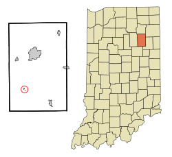 Location of Mount Etna in the state of Indiana | |
| Coordinates: 40°44′30″N 85°33′41″W / 40.74167°N 85.56139°WCoordinates: 40°44′30″N 85°33′41″W / 40.74167°N 85.56139°W[1] | |
| Country | United States |
| State | Indiana |
| County | Huntington |
| Townships | Jefferson, Lancaster, Polk, Wayne |
| Area[2] | |
| • Total | 0.08 sq mi (0.21 km2) |
| • Land | 0.08 sq mi (0.21 km2) |
| • Water | 0 sq mi (0 km2) |
| Elevation | 810 ft (247 m) |
| Population (2010)[3] | |
| • Total | 94 |
| • Estimate (2012[4]) | 105 |
| • Density | 1,175.0/sq mi (453.7/km2) |
| Time zone | Eastern (EST) (UTC-5) |
| • Summer (DST) | EDT (UTC-4) |
| ZIP code | 46750 |
| Area code(s) | 260 |
| FIPS code | 18-51408[5] |
| GNIS feature ID | 0439560[6] |
Mount Etna is a town in Huntington County, Indiana, United States. The population was 94 at the 2010 census. It lies at the intersection of four townships: Jefferson, Lancaster, Polk and Wayne.
History
Mount Etna was platted in 1839.[7] It was an important trading point in the 19th century until the building of the railroad through neighboring rival towns diverted much of its business.[8]
Geography
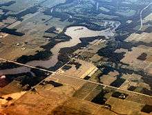
Mount Etna is located on State Route 124 about 20 miles (32 km) west of Bluffton. According to the 2010 census, Mount Etna has a total area of 0.08 square miles (0.21 km2), all land.[2]
Demographics
| Historical population | |||
|---|---|---|---|
| Census | Pop. | %± | |
| 1860 | 155 | — | |
| 1870 | 221 | 42.6% | |
| 1880 | 182 | −17.6% | |
| 1900 | 175 | — | |
| 1910 | 148 | −15.4% | |
| 1920 | 137 | −7.4% | |
| 1930 | 135 | −1.5% | |
| 1940 | 139 | 3.0% | |
| 1950 | 171 | 23.0% | |
| 1960 | 192 | 12.3% | |
| 1970 | 164 | −14.6% | |
| 1980 | 122 | −25.6% | |
| 1990 | 111 | −9.0% | |
| 2000 | 110 | −0.9% | |
| 2010 | 94 | −14.5% | |
| Est. 2015 | 103 | [9] | 9.6% |
2010 census
As of the census[3] of 2010, there were 94 people, 42 households, and 27 families residing in the town. The population density was 1,175.0 inhabitants per square mile (453.7/km2). There were 51 housing units at an average density of 637.5 per square mile (246.1/km2). The racial makeup of the town was 96.8% White, 2.1% Pacific Islander, and 1.1% from other races. Hispanic or Latino of any race were 2.1% of the population.
There were 42 households of which 26.2% had children under the age of 18 living with them, 54.8% were married couples living together, 2.4% had a female householder with no husband present, 7.1% had a male householder with no wife present, and 35.7% were non-families. 28.6% of all households were made up of individuals and 7.1% had someone living alone who was 65 years of age or older. The average household size was 2.24 and the average family size was 2.70.
The median age in the town was 45.2 years. 17% of residents were under the age of 18; 4.3% were between the ages of 18 and 24; 27.6% were from 25 to 44; 35.1% were from 45 to 64; and 16% were 65 years of age or older. The gender makeup of the town was 53.2% male and 46.8% female.
2000 census
As of the census[5] of 2000, there were 110 people, 42 households, and 34 families residing in the town. The population density was 1,343.1 people per square mile (530.9/km²). There were 46 housing units at an average density of 561.6 per square mile (222.0/km²). The racial makeup of the town was 100.00% White.
There were 42 households out of which 33.3% had children under the age of 18 living with them, 66.7% were married couples living together, 11.9% had a female householder with no husband present, and 19.0% were non-families. 19.0% of all households were made up of individuals and 11.9% had someone living alone who was 65 years of age or older. The average household size was 2.62 and the average family size was 3.00.
In the town the population was spread out with 24.5% under the age of 18, 6.4% from 18 to 24, 26.4% from 25 to 44, 28.2% from 45 to 64, and 14.5% who were 65 years of age or older. The median age was 38 years. For every 100 females there were 83.3 males. For every 100 females age 18 and over, there were 84.4 males.
The median income for a household in the town was $37,500, and the median income for a family was $42,500. Males had a median income of $29,167 versus $22,500 for females. The per capita income for the town was $13,421. There were 6.3% of families and 10.7% of the population living below the poverty line, including 25.0% of under eighteens and none of those over 64.
References
- ↑ "US Gazetteer files: 2010, 2000, and 1990". United States Census Bureau. 2011-02-12. Retrieved 2011-04-23.
- 1 2 "G001 - Geographic Identifiers - 2010 Census Summary File 1". United States Census Bureau. Retrieved 2015-07-17.
- 1 2 "American FactFinder". United States Census Bureau. Retrieved 2012-12-11.
- ↑ "Population Estimates". United States Census Bureau. Retrieved 2013-06-25.
- 1 2 "American FactFinder". United States Census Bureau. Retrieved 2008-01-31.
- ↑ "US Board on Geographic Names". United States Geological Survey. 2007-10-25. Retrieved 2008-01-31.
- ↑ History of Huntington County, Indiana: From the Earliest Time to the Present. Brant & Fuller. 1887. p. 694.
- ↑ Bash, Frank Sumner (1914). History of Huntington County, Indiana: A Narrative Account of Its Historical Progress, Its People, and Its Principal Interests. The Lewis Publishing Company. p. 162.
- ↑ "Annual Estimates of the Resident Population for Incorporated Places: April 1, 2010 to July 1, 2015". Retrieved July 2, 2016.
- ↑ "Census of Population and Housing". Census.gov. Retrieved June 4, 2015.
Municipalities and communities of Huntington County, Indiana, United States | ||
|---|---|---|
| City | ||
| Towns | ||
| Townships | ||
| Unincorporated communities | ||
| Footnotes | ‡This populated place also has portions in an adjacent county or counties | |
| Counties |  | |
|---|---|---|
| Municipalities with population over 10,000 in 2010 | ||
| Municipalities with population 1,000-10,000 in 2010 | ||
| Municipalities with population under 1,000 in 2010 | ||
| CDPs | ||