National Register of Historic Places listings in Butler County, Kentucky

Location of Butler County in Kentucky
This is a list of the National Register of Historic Places listings in Butler County, Kentucky.
This is intended to be a complete list of the properties and districts on the National Register of Historic Places in Butler County, Kentucky, United States. The locations of National Register properties and districts for which the latitude and longitude coordinates are included below, may be seen in a map.[1]
There are 16 properties and districts listed on the National Register in the county, of which 6 are part of a National Historic Landmark spread across multiple counties. Another property was once listed but has been removed.
- This National Park Service list is complete through NPS recent listings posted December 16, 2016.[2]
- Adair
- Allen
- Anderson
- Ballard
- Barren
- Bath
- Bell
- Boone
- Bourbon
- Boyd
- Boyle
- Bracken
- Breckinridge
- Breathitt
- Bullitt
- Butler
- Caldwell
- Calloway
- Campbell
- Carlisle
- Carroll
- Carter
- Casey
- Christian
- Clark
- Clay
- Clinton
- Crittenden
- Cumberland
- Daviess
- Edmonson
- Elliott
- Estill
- Fayette
- Fleming
- Floyd
- Franklin
- Fulton
- Gallatin
- Garrard
- Grant
- Graves
- Grayson
- Green
- Greenup
- Hancock
- Hardin
- Harlan
- Harrison
- Hart
- Henderson
- Henry
- Hickman
- Hopkins
- Jackson
- Jefferson
- Jessamine
- Johnson
- Kenton
- Knott
- Knox
- LaRue
- Laurel
- Lawrence
- Lee
- Leslie
- Letcher
- Lewis
- Lincoln
- Livingston
- Logan
- Lyon
- Madison
- Magoffin
- Marion
- Marshall
- Martin
- Mason
- McCracken
- McCreary
- McLean
- Meade
- Menifee
- Mercer
- Metcalfe
- Monroe
- Montgomery
- Morgan
- Muhlenberg
- Nelson
- Nicholas
- Ohio
- Oldham
- Owen
- Owsley
- Pendleton
- Perry
- Pike
- Powell
- Pulaski
- Robertson
- Rockcastle
- Rowan
- Russell
- Scott
- Shelby
- Simpson
- Spencer
- Taylor
- Todd
- Trigg
- Trimble
- Union
- Warren
- Washington
- Wayne
- Webster
- Whitley
- Wolfe
- Woodford
Current listings
| [3] | Name on the Register | Image | Date listed[4] | Location | City or town | Description |
|---|---|---|---|---|---|---|
| 1 | Annis Mound and Village Site (15BT2; 15BT20; 15BT21) | 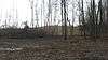 |
(#85003182) |
Western bank of the Green River in Horseshoe Bend, northeast of Logansport[5] 37°17′25″N 86°45′30″W / 37.290278°N 86.758333°W |
Logansport | |
| 2 | Baby Track Rock Petroglyphs (15BT40) | Upload image | (#89001175) |
Address Restricted |
Morgantown | |
| 3 | Carlston Annis Shell Mound (15BT5) | Upload image | (#86000632) |
Eastern side of the Green River off Kentucky Route 403[6] 37°17′28″N 86°48′19″W / 37.291111°N 86.805278°W |
Schulztown | Part of the Green River Shell Middens Archeological District National Historic Landmark[7]:8 |
| 4 | John Carson House | 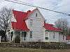 |
(#91000922) |
205 S. Main St. 37°13′28″N 86°41′06″W / 37.224444°N 86.685000°W |
Morgantown | |
| 5 | Carson-Annis Ferry Farm | 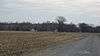 |
(#98000935) |
1086 Annis Ferry Rd. 37°17′39″N 86°45′10″W / 37.294167°N 86.752778°W |
Morgantown | Originally listed as "Carson's Landing", but boundaries increased and name changed on April 10, 2007 |
| 6 | Confederate-Union Veterans' Monument in Morgantown | 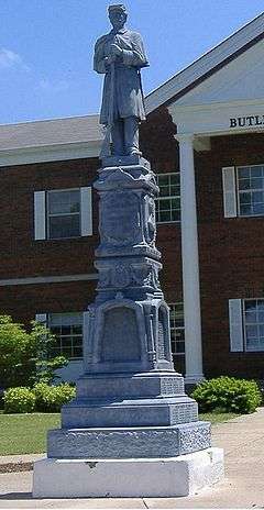 |
(#97000713) |
1 block north of the junction of U.S. Route 231 and KY 403 37°13′32″N 86°41′00″W / 37.225500°N 86.683222°W |
Morgantown | |
| 7 | DeWeese Shell Mound (15BT6) | Upload image | (#86000635) |
Eastern bank of the Green River in Horseshoe Bend, west of Taylor Lake[5] 37°18′26″N 86°49′04″W / 37.307222°N 86.817778°W |
Highview | Part of the Green River Shell Middens Archeological District National Historic Landmark[7]:9 |
| 8 | Finney Hotel |  |
(#95001349) |
Junction of Kentucky Route 403 and Hime St. 37°11′04″N 86°38′01″W / 37.184306°N 86.633611°W |
Woodbury | |
| 9 | Ice House on Little Muddy Creek | Upload image | (#87000171) |
U.S. Route 231 37°09′14″N 86°40′33″W / 37.153889°N 86.675833°W |
Morgantown | |
| 10 | Rayburn Johnson Shell Mound (15BT41) |  |
(#86000633) |
Eastern bank of the Green River in Horseshoe Bend, northwest of Taylor Lake[8] 37°19′28″N 86°49′04″W / 37.324444°N 86.817778°W |
Prentiss | Part of the Green River Shell Middens Archeological District National Historic Landmark[7]:12 |
| 11 | Read Shell Mound (15BT10) | Upload image | (#86000647) |
Northern side of the Green River, west of Morgantown[9]:120 37°14′33″N 86°47′27″W / 37.242500°N 86.790833°W |
Monticello | Part of the Green River Shell Middens Archeological District National Historic Landmark[7]:10 |
| 12 | Reedyville Petroglyphs (15BT65) | Upload image | (#89001176) |
Lock 5 Rd., just north of the Green River[10] 37°10′02″N 86°24′52″W / 37.167222°N 86.414306°W |
Reedyville | |
| 13 | Russell Shell Mound (15BT11) | Upload image | (#86000637) |
Eastern bank of the Green River in Horseshoe Bend[5] 37°16′16″N 86°48′01″W / 37.271111°N 86.800278°W |
Logansport | Part of the Green River Shell Middens Archeological District National Historic Landmark[7]:11 |
| 14 | Turkey Rock Petroglyphs (15BT64) | Upload image | (#89001177) |
Address Restricted |
Morgantown | |
| 15 | U.S. Army Corps of Engineers Superintendent's House and Workmen's Office |  |
(#80001489) |
Woodbury Park 37°11′05″N 86°37′56″W / 37.184861°N 86.632222°W |
Woodbury | |
| 16 | Woodbury Shell Midden (15BT67) |  |
(#86000639) |
Left bank of the Green River immediately above Woodbury[8] 37°10′51″N 86°37′39″W / 37.180833°N 86.627500°W |
Woodbury | Part of the Green River Shell Middens Archeological District National Historic Landmark[7]:13 |
Former listing
| [3] | Name on the Register | Image | Date listed | Date removed | Location | City or town | Summary |
|---|---|---|---|---|---|---|---|
| 1 | Butler County Jail | Upload image | (#84000219) | S. Warren and E. Logan Sts. |
Morgantown |
See also
| Wikimedia Commons has media related to National Register of Historic Places in Butler County, Kentucky. |
References
- ↑ The latitude and longitude information provided in this table was derived originally from the National Register Information System, which has been found to be fairly accurate for about 99% of listings. For about 1% of NRIS original coordinates, experience has shown that one or both coordinates are typos or otherwise extremely far off; some corrections may have been made. A more subtle problem causes many locations to be off by up to 150 yards, depending on location in the country: most NRIS coordinates were derived from tracing out latitude and longitudes off of USGS topographical quadrant maps created under the North American Datum of 1927, which differs from the current, highly accurate WGS84 GPS system used by most on-line maps. Chicago is about right, but NRIS longitudes in Washington are higher by about 4.5 seconds, and are lower by about 2.0 seconds in Maine. Latitudes differ by about 1.0 second in Florida. Some locations in this table may have been corrected to current GPS standards.
- ↑ "National Register of Historic Places: Weekly List Actions". National Park Service, United States Department of the Interior. Retrieved on December 16, 2016.
- 1 2 Numbers represent an ordering by significant words. Various colorings, defined here, differentiate National Historic Landmarks and historic districts from other NRHP buildings, structures, sites or objects.
- ↑ The eight-digit number below each date is the number assigned to each location in the National Register Information System database, which can be viewed by clicking the number.
- 1 2 3 Funkhouser, W.D., and W.S. Webb. "Archaeological Survey of Kentucky: Butler County". University of Kentucky Reports in Anthropology 7.5 (1950): 358.
- ↑ Funkhouser, W.D., and W.S. Webb. "Archaeological Survey of Kentucky: Butler County". University of Kentucky Reports in Anthropology 2 (1932): 56.
- 1 2 3 4 5 6 National Historic Landmark Nomination: Green River Shell Middens. National Park Service: 1994-05-05.
- 1 2 Claassen, Cheryl. Feasting with Shellfish in the Southern Ohio Valley: Archaic Sacred Sites and Rituals. Knoxville: U of Tennessee P, 2010, 41.
- ↑ Milner, George R., and Richard W. Jefferies. "The Read Archaic Shell Midden in Kentucky". Southeastern Archaeology 17.2 (1998): 119-132.
- ↑ Coy, Fred E., Jr., and Thomas C. Fuller. "Reedyville Petroglyphs: Butler County, Kentucky". Central States Archaeological Journal 17.3 (1970): 99-111: 103.
| Topics | |
|---|---|
| Lists by states |
|
| Lists by insular areas | |
| Lists by associated states | |
| Other areas | |
| |
Municipalities and communities of Butler County, Kentucky, United States | ||
|---|---|---|
| Cities | | |
| Unincorporated communities | ||
This article is issued from Wikipedia - version of the 4/2/2016. The text is available under the Creative Commons Attribution/Share Alike but additional terms may apply for the media files.