Green River Shell Middens Archeological District
|
Green River Shell Middens Archeological District | |
| Location | Along the Green River |
|---|---|
| NRHP Reference # | 85003182 |
| Significant dates | |
| Added to NRHP | May 5, 1994[1] |
| Designated NHLD | May 5, 1994[1] |
The Green River Shell Middens Archeological District is a historic district composed of archaeological sites in the U.S. state of Kentucky. All of the district's sites are shell middens along the banks of the Green River that date from the later portion of the Archaic period.[2]
The district was established and named a National Historic Landmark on May 5, 1994.[2] Each of the district's twenty-three contributing properties had previously been listed on the National Register of Historic Places by itself. The sites are distributed among five counties: Butler County (BT), Henderson County (HE), McLean County (McL), Muhlenberg County (MU), and Ohio County (OH).[3]
Contributing properties
The district comprises the following sites, listed by their Smithsonian trinomials; names are provided for named sites.
| Number[4] | Name[4] | Location | City | Photo | Comments |
|---|---|---|---|---|---|
| 15BT5 | Carlston Annis | Eastern side of the Green River off Kentucky Route 403 37°16′28″N 86°48′19″W / 37.27444°N 86.80528°W[5]:56 |
Schulztown | ||
| 15BT6 | DeWeese | Eastern bank of the Green River in Horseshoe Bend, west of Taylor Lake 37°18′26″N 86°49′4″W / 37.30722°N 86.81778°W[5]:358 |
Highview | ||
| 15BT10 | Read | Northern side of the Green River, west of Morgantown 37°14′33″N 86°47′27″W / 37.24250°N 86.79083°W[6]:120 |
Monticello | ||
| 15BT11 | Russell | Eastern bank of the Green River in Horseshoe Bend 37°16′16″N 86°48′1″W / 37.27111°N 86.80028°W[5]:358 |
Logansport | ||
| 15BT41 | Rayburn Johnson | Eastern bank of the Green River in Horseshoe Bend, northwest of Taylor Lake 37°19′28″N 86°49′4″W / 37.32444°N 86.81778°W[7]:41 |
Prentiss | 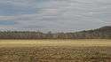 |
|
| 15BT67 | Woodbury | Left bank of the Green River immediately above Woodbury 37°10′51″N 86°37′39″W / 37.18083°N 86.62750°W[7]:41 |
Woodbury |  |
|
| 15HE160 | Bluff City | 0.5 miles (0.80 km) above Bluff City on a Green River bluff 37°47′58″N 87°22′20″W / 37.79944°N 87.37222°W[8]:440 |
Hebbardsville |  |
|
| 15HE580 | None | Right bank of the Green River, 1 mile (1.6 km) above Bluff City 37°48′25″N 87°21′56″W / 37.80694°N 87.36556°W[7]:40 |
Hebbardsville | 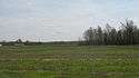 |
|
| 15HE589 | James Giles | Left bank of the Green River, east of Bluff City 37°48′20″N 87°19′31″W / 37.80556°N 87.32528°W[7]:40 |
Rumsey | 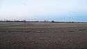 |
|
| 15HE635 | None | In the lawn of a house on Reed Bluff City Rd., northeast of Bluff City 37°48′54″N 87°22′12″W / 37.81500°N 87.37000°W[7]:40 |
Hebbardsville |  |
|
| 15McL2 | R.D. Ford | Along the Green River off Kentucky Route 256, west of Calhoun 37°33′36″N 87°22′0″W / 37.56000°N 87.36667°W[9]:4 |
Ashbyburg | ||
| 15McL7 | Butterfield | Southern bank of the Green River across from the mouth of the Rough River 37°28′57″N 87°8′3″W / 37.48250°N 87.13417°W[9]:31 |
Livermore |  |
|
| 15McL15 | Austin | Left bank of the Green River, 4 miles (6.4 km) below Calhoun 37°32′36″N 87°18′21″W / 37.54333°N 87.30583°W[9]:4 |
Rumsey |  |
|
| 15McL16 | None | Left bank of the Green River immediately above Rumsey 37°31′48″N 87°15′5″W / 37.53000°N 87.25139°W[9]:4 |
Rumsey |  |
|
| 15McL17 | None | Above the right bank of the Rough River, 1.5 miles (2.4 km) east of Livermore 37°29′3″N 87°6′21″W / 37.48417°N 87.10583°W[9]:4 |
Livermore | ||
| 15McL109 | Crowe | Left bank of the Green River, 1 mile (1.6 km) above Livermore 37°28′26″N 87°7′27″W / 37.47389°N 87.12417°W[7]:41 |
Kirtley |  |
|
| 15MU12 | Baker | Left bank of the Green River, 3 miles (4.8 km) above the Paradise Fossil Plant 37°14′18″N 86°56′47″W / 37.23833°N 86.94639°W[10] |
Skilesville | ||
| 15OH1 | Chiggerville | Right bank of the Green River, 3 miles (4.8 km) above the Paradise Fossil Plant 37°14′24″N 86°56′29″W / 37.24000°N 86.94139°W[10] |
Knightsburg | ||
| 15OH10 | Smallhous | Right bank of the Green River at Smallhous 37°22′49″N 87°5′33″W / 37.38028°N 87.09250°W[8]:443 |
Smallhous | ||
| 15OH13 | Bowles | Northern side of the Green River opposite Rochester 37°12′51″N 86°53′52″W / 37.21417°N 86.89778°W[11] |
Rochester | ||
| 15OH19 | Jimtown | Jimtown Hill, 2 miles (3.2 km) above Livermore 37°28′0″N 87°6′32″W / 37.46667°N 87.10889°W[7]:41 |
Kirtley | ||
| 15OH95 | J.T. Barnard | Across the Green River from South Carrollton 37°20′12″N 87°7′48″W / 37.33667°N 87.13000°W[7]:41 |
Central City | ||
| 15OH97 | None | Foot of Kirtley-River Rd. at the Green River above Livermore 37°26′12″N 87°6′8″W / 37.43667°N 87.10222°W[7]:41 |
Kirtley |
See also
- Indian Knoll, another shell midden in the region not included in the district
References
- 1 2 National Park Service (2010-07-09). "National Register Information System". National Register of Historic Places. National Park Service.
- 1 2 "National Historic Landmarks Program (NHL)". National Park Service. Retrieved 2008-07-15.
- ↑ National Park Service (2008-04-15). "National Register Information System". National Register of Historic Places. National Park Service.
- 1 2 National Historic Landmark Nomination: Green River Shell Middens. National Park Service: 1994-05-05.
- 1 2 3 Funkhouser, W.D., and W.S. Webb. "Archaeological Survey of Kentucky: Butler County". University of Kentucky Reports in Anthropology 7.5 (1950).
- ↑ Milner, George R., and Richard W. Jefferies. "The Read Archaic Shell Midden in Kentucky". Southeastern Archaeology 17.2 (1998): 119-132.
- 1 2 3 4 5 6 7 8 9 Claassen, Cheryl. Feasting with Shellfish in the Southern Ohio Valley: Archaic Sacred Sites and Rituals. Knoxville: U of Tennessee P, 2010.
- 1 2 Moore, Clarence B. "Some Aboriginal Sites on Green River, Kentucky". Journal of the Philadelphia Academy of Natural Sciences 16 (1916): 431-487.
- 1 2 3 4 5 Webb, William S., and William G. Haag. "Archaic Sites in McLean County, Kentucky". University of Kentucky Reports in Anthropology 7.1 (1947): 1-46.
- 1 2 Moore, Christopher R. Production, Exchange, and Social Interaction in the Green River Region of Western Kentucky: A Multiscalar Approach to the Analysis of Two Shell Midden Sites. Diss. University of Kentucky, 2011, 163.
- ↑ Emerson, Thomas E. Archaic Societies: Diversity and Complexity Across the Midcontinent. Albany: SUNY Press, 2009, 655.
External links
| Topics | |
|---|---|
| Lists by states |
|
| Lists by insular areas | |
| Lists by associated states | |
| Other areas | |
| |