National Register of Historic Places listings in McLean County, Kentucky

Location of McLean County in Kentucky
This is a list of the National Register of Historic Places listings in McLean County, Kentucky.
It is intended to be a complete list of the properties on the National Register of Historic Places in McLean County, Kentucky, United States. The locations of National Register properties for which the latitude and longitude coordinates are included below, may be seen in a map.[1]
There are 9 properties listed on the National Register in the county, of which 6 are part of a National Historic Landmark spread across multiple counties.
- This National Park Service list is complete through NPS recent listings posted December 16, 2016.[2]
- Adair
- Allen
- Anderson
- Ballard
- Barren
- Bath
- Bell
- Boone
- Bourbon
- Boyd
- Boyle
- Bracken
- Breckinridge
- Breathitt
- Bullitt
- Butler
- Caldwell
- Calloway
- Campbell
- Carlisle
- Carroll
- Carter
- Casey
- Christian
- Clark
- Clay
- Clinton
- Crittenden
- Cumberland
- Daviess
- Edmonson
- Elliott
- Estill
- Fayette
- Fleming
- Floyd
- Franklin
- Fulton
- Gallatin
- Garrard
- Grant
- Graves
- Grayson
- Green
- Greenup
- Hancock
- Hardin
- Harlan
- Harrison
- Hart
- Henderson
- Henry
- Hickman
- Hopkins
- Jackson
- Jefferson
- Jessamine
- Johnson
- Kenton
- Knott
- Knox
- LaRue
- Laurel
- Lawrence
- Lee
- Leslie
- Letcher
- Lewis
- Lincoln
- Livingston
- Logan
- Lyon
- Madison
- Magoffin
- Marion
- Marshall
- Martin
- Mason
- McCracken
- McCreary
- McLean
- Meade
- Menifee
- Mercer
- Metcalfe
- Monroe
- Montgomery
- Morgan
- Muhlenberg
- Nelson
- Nicholas
- Ohio
- Oldham
- Owen
- Owsley
- Pendleton
- Perry
- Pike
- Powell
- Pulaski
- Robertson
- Rockcastle
- Rowan
- Russell
- Scott
- Shelby
- Simpson
- Spencer
- Taylor
- Todd
- Trigg
- Trimble
- Union
- Warren
- Washington
- Wayne
- Webster
- Whitley
- Wolfe
- Woodford
Current listings
| [3] | Name on the Register | Image | Date listed[4] | Location | City or town | Description |
|---|---|---|---|---|---|---|
| 1 | Archaeological Site 15 McL 18 |  |
(#82002738) |
Left bank of the Green River, 1.5 miles (2.4 km) below the mouth of the Rough River[5]:4 37°29′08″N 87°09′52″W / 37.485556°N 87.164444°W |
Livermore | |
| 2 | Archeological Site No. 15McL16 | 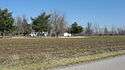 |
(#86000648) |
Left bank of the Green River immediately above Rumsey[5]:4 37°31′48″N 87°15′05″W / 37.530000°N 87.251389°W |
Rumsey | Part of the Green River Shell Middens Archeological District National Historic Landmark[6]:21 |
| 3 | Archeological Site No. 15McL17 | Upload image | (#86000649) |
Above the right bank of the Rough River, 1.5 miles (2.4 km) east of Livermore[5]:4 37°29′03″N 87°06′21″W / 37.484167°N 87.105833°W |
Livermore | Part of the Green River Shell Middens Archeological District National Historic Landmark[6]:22 |
| 4 | Austin Site (15McL15) | 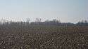 |
(#86000650) |
Left bank of the Green River, 4 miles (6.4 km) below Calhoun[5]:4 37°32′36″N 87°18′21″W / 37.543333°N 87.305833°W |
Calhoun | Part of the Green River Shell Middens Archeological District National Historic Landmark[6]:20 |
| 5 | Battle of Sacramento Battlefield | 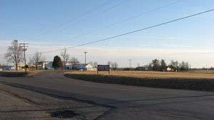 |
(#97000875) |
Junction of Kentucky Routes 81 and 85 37°25′10″N 87°15′42″W / 37.419444°N 87.261667°W |
Sacramento | |
| 6 | Butterfield Site (15McL7) | 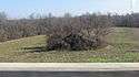 |
(#86000651) |
Southern bank of the Green River across from the mouth of the Rough River[5]:31 37°28′57″N 87°08′03″W / 37.482500°N 87.134167°W |
Livermore | Part of the Green River Shell Middens Archeological District National Historic Landmark[6]:19 |
| 7 | Crowe Shell Midden (15McL109) | 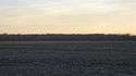 |
(#86000652) |
Left bank of the Green River, 1 mile (1.6 km) above Livermore[7] 37°28′26″N 87°07′27″W / 37.473889°N 87.124167°W |
Kirtley | Part of the Green River Shell Middens Archeological District National Historic Landmark[6]:23 |
| 8 | R.D. Ford Shell Midden (15McL2) | Upload image | (#86000653) |
Along the Green River off Kentucky Route 256, west of Calhoun[5]:4 37°33′36″N 87°22′00″W / 37.560000°N 87.366667°W |
Ashbyburg | Part of the Green River Shell Middens Archeological District National Historic Landmark.[6]:18 |
| 9 | Griffith-Franklin House | 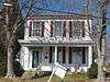 |
(#75002061) |
207 W. 2nd St. 37°32′13″N 87°15′38″W / 37.536944°N 87.260556°W |
Calhoun |
See also
| Wikimedia Commons has media related to National Register of Historic Places in McLean County, Kentucky. |
- List of National Historic Landmarks in Kentucky
- National Register of Historic Places listings in Kentucky
References
- ↑ The latitude and longitude information provided in this table was derived originally from the National Register Information System, which has been found to be fairly accurate for about 99% of listings. For about 1% of NRIS original coordinates, experience has shown that one or both coordinates are typos or otherwise extremely far off; some corrections may have been made. A more subtle problem causes many locations to be off by up to 150 yards, depending on location in the country: most NRIS coordinates were derived from tracing out latitude and longitudes off of USGS topographical quadrant maps created under the North American Datum of 1927, which differs from the current, highly accurate WGS84 GPS system used by most on-line maps. Chicago is about right, but NRIS longitudes in Washington are higher by about 4.5 seconds, and are lower by about 2.0 seconds in Maine. Latitudes differ by about 1.0 second in Florida. Some locations in this table may have been corrected to current GPS standards.
- ↑ "National Register of Historic Places: Weekly List Actions". National Park Service, United States Department of the Interior. Retrieved on December 16, 2016.
- ↑ Numbers represent an ordering by significant words. Various colorings, defined here, differentiate National Historic Landmarks and historic districts from other NRHP buildings, structures, sites or objects.
- ↑ The eight-digit number below each date is the number assigned to each location in the National Register Information System database, which can be viewed by clicking the number.
- 1 2 3 4 5 6 Webb, William S., and William G. Haag. "Archaic Sites in McLean County, Kentucky". University of Kentucky Reports in Anthropology 7.1 (1947): 1-46.
- 1 2 3 4 5 6 National Historic Landmark Nomination: Green River Shell Middens. National Park Service: 1994-05-05.
- ↑ Claassen, Cheryl. Feasting with Shellfish in the Southern Ohio Valley: Archaic Sacred Sites and Rituals. Knoxville: U of Tennessee P, 2010, 41.
| Topics | |
|---|---|
| Lists by states |
|
| Lists by insular areas | |
| Lists by associated states | |
| Other areas | |
| |
Municipalities and communities of McLean County, Kentucky, United States | ||
|---|---|---|
| Cities | | |
| CDP |
| |
| Unincorporated communities | ||
This article is issued from Wikipedia - version of the 4/2/2016. The text is available under the Creative Commons Attribution/Share Alike but additional terms may apply for the media files.