La Crosse, Virginia
| La Crosse, Virginia | |
|---|---|
| Town | |
 La Crosse, Virginia Location within the state of Virginia | |
| Coordinates: 36°41′50″N 78°5′32″W / 36.69722°N 78.09222°WCoordinates: 36°41′50″N 78°5′32″W / 36.69722°N 78.09222°W | |
| Country | United States |
| State | Virginia |
| County | Mecklenburg |
| Area | |
| • Total | 1.2 sq mi (3.0 km2) |
| • Land | 1.2 sq mi (3.0 km2) |
| • Water | 0.0 sq mi (0.0 km2) |
| Elevation | 476 ft (145 m) |
| Population (2000) | |
| • Total | 618 |
| • Density | 532.4/sq mi (205.6/km2) |
| Time zone | Eastern (EST) (UTC-5) |
| • Summer (DST) | EDT (UTC-4) |
| ZIP code | 23950 |
| Area code(s) | 434 |
| FIPS code | 51-43176[1] |
| GNIS feature ID | 1495802[2] |
La Crosse is a town in Mecklenburg County, Virginia, United States. Its name is derived from the fact that it was a place where railroads once crossed, and there is still a caboose in the center of the town. La Crosse is adjacent to the neighboring town South Hill.
The town's population was 618 at the 2000 census.
History
The La Crosse Hotel and O.H.P. Tanner House are listed on the National Register of Historic Places.[3][4]
Geography
La Crosse is located at 36°41′50″N 78°5′32″W / 36.69722°N 78.09222°W (36.697177, -78.092322).[5]
According to the United States Census Bureau, the town has a total area of 1.2 square miles (3.0 km²), all land.
Demographics
| Historical population | |||
|---|---|---|---|
| Census | Pop. | %± | |
| 1910 | 281 | — | |
| 1920 | 320 | 13.9% | |
| 1930 | 427 | 33.4% | |
| 1940 | 524 | 22.7% | |
| 1950 | 675 | 28.8% | |
| 1960 | 726 | 7.6% | |
| 1970 | 674 | −7.2% | |
| 1980 | 734 | 8.9% | |
| 1990 | 549 | −25.2% | |
| 2000 | 618 | 12.6% | |
| 2010 | 604 | −2.3% | |
| Est. 2015 | 589 | [6] | −2.5% |
As of the census[1] of 2000, there were 618 people, 263 households, and 160 families residing in the town. The population density was 532.4 people per square mile (205.7/km²). There were 314 housing units at an average density of 270.5 per square mile (104.5/km²). The racial makeup of the town was 54.85% White, 43.20% African American, 0.32% Native American, 0.16% Asian, 0.49% from other races, and 0.97% from two or more races. Hispanic or Latino of any race were 2.91% of the population.
There were 263 households out of which 27.4% had children under the age of 18 living with them, 35.7% were married couples living together, 21.7% had a female householder with no husband present, and 38.8% were non-families. 34.2% of all households were made up of individuals and 18.3% had someone living alone who was 65 years of age or older. The average household size was 2.29 and the average family size was 2.90.
In the town the population was spread out with 22.3% under the age of 18, 9.2% from 18 to 24, 27.0% from 25 to 44, 23.5% from 45 to 64, and 18.0% who were 65 years of age or older. The median age was 40 years. For every 100 females there were 79.7 males. For every 100 females age 18 and over, there were 80.5 males.
The median income for a household in the town was $24,643, and the median income for a family was $31,771. Males had a median income of $23,611 versus $17,813 for females. The per capita income for the town was $13,532. About 9.8% of families and 16.0% of the population were below the poverty line, including 24.1% of those under age 18 and 19.1% of those age 65 or over.
References
- 1 2 "American FactFinder". United States Census Bureau. Retrieved 2008-01-31.
- ↑ "US Board on Geographic Names". United States Geological Survey. 2007-10-25. Retrieved 2008-01-31.
- ↑ National Park Service (2010-07-09). "National Register Information System". National Register of Historic Places. National Park Service.
- ↑ "National Register of Historic Places Listings". Weekly List of Actions Taken on Properties: 8/22/11 through 8/26/11. National Park Service. 2011-09-02.
- ↑ "US Gazetteer files: 2010, 2000, and 1990". United States Census Bureau. 2011-02-12. Retrieved 2011-04-23.
- ↑ "Annual Estimates of the Resident Population for Incorporated Places: April 1, 2010 to July 1, 2015". Retrieved July 2, 2016.
- ↑ "Census of Population and Housing". Census.gov. Retrieved June 4, 2015.
Municipalities and communities of Mecklenburg County, Virginia, United States | ||
|---|---|---|
| Towns | 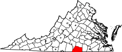 | |
| CDPs | ||
| Unincorporated communities | ||
| Footnotes | ‡This populated place also has portions in an adjacent county or counties | |