Tazewell, Virginia
| Tazewell | ||
|---|---|---|
| Town | ||
| Town of Tazewell, Virginia | ||
|
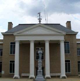
Downtown Tazewell (photographed by Doug Kerr) | ||
| ||
 Tazewell Location in the Commonwealth of Virginia | ||
| Coordinates: 37°7′37″N 81°31′10″W / 37.12694°N 81.51944°WCoordinates: 37°7′37″N 81°31′10″W / 37.12694°N 81.51944°W | ||
| Country | United States | |
| State | Virginia | |
| County | Tazewell | |
| Incorporated | 1800 | |
| Government | ||
| • Mayor | A. Donald Buchanan, Jr. | |
| Area | ||
| • Total | 4.0 sq mi (10.5 km2) | |
| • Land | 4.0 sq mi (10.5 km2) | |
| • Water | 0.0 sq mi (0.0 km2) | |
| Elevation | 2,503 ft (763 m) | |
| Population (2010) | ||
| • Total | 4,627 | |
| U.S. Census Bureau, 2010 Population Estimates | ||
| Time zone | EST (UTC-5) | |
| • Summer (DST) | EDT (UTC-4) | |
| ZIP codes | 24608, 24651 | |
| Area code(s) | 276 | |
| FIPS code | 51-77792[1] | |
| GNIS feature ID | 1498543[2] | |
| Website |
www | |


Tazewell is a town in Tazewell County, Virginia, United States. The population was 4,627 at the 2010 census. It is part of the Bluefield, WV-VA micropolitan area, which has a population of 107,578. It is the county seat of Tazewell County.[3]
History
Originally named Jeffersonville, Tazewell is situated near the headwaters of the Clinch River. It is one of the smallest towns in the United States to once own a street car.
The Big Crab Orchard Site, Bull Thistle Cave Archeological Site, Burke's Garden Rural Historic District, Chimney Rock Farm, Tazewell Historic District, George Oscar Thompson House, James Wynn House, and the Tazewell Train Station at North Tazewell, are listed on the National Register of Historic Places.[4]
Geography
Tazewell is located at 37°07′37″N 81°31′10″W / 37.126938°N 81.519455°W (37.126938, -81.519455).[5]
According to the United States Census Bureau, the town has a total area of 4.0 square miles (10.5 km2), all land.
Climate
The climate in this area has mild differences between highs and lows, and there is adequate rainfall year round. According to the Köppen Climate Classification system, Tazewell has a marine west coast climate, abbreviated "Cfb" on climate maps.[6]
Demographics
| Historical population | |||
|---|---|---|---|
| Census | Pop. | %± | |
| 1880 | 508 | — | |
| 1890 | 604 | 18.9% | |
| 1900 | 1,096 | 81.5% | |
| 1910 | 1,230 | 12.2% | |
| 1920 | 1,261 | 2.5% | |
| 1930 | 1,211 | −4.0% | |
| 1940 | 1,374 | 13.5% | |
| 1950 | 1,347 | −2.0% | |
| 1960 | 3,000 | 122.7% | |
| 1970 | 4,168 | 38.9% | |
| 1980 | 4,468 | 7.2% | |
| 1990 | 4,176 | −6.5% | |
| 2000 | 4,206 | 0.7% | |
| 2010 | 4,627 | 10.0% | |
| Est. 2015 | 4,421 | [7] | −4.5% |
As of the census[1] of 2000, there were 4,206 people, 1,650 households, and 1,098 families residing in the town. The population density was 1,040.1 people per square mile (402.0/km2). There were 1,804 housing units at an average density of 446.1 per square mile (172.4/km2). The racial makeup of the town was 88.78% White, 9.32% African American, 0.17% Native American, 0.52% Asian, 0.36% from other races, and 0.86% from two or more races. Hispanic or Latino of any race were 0.62% of the population.
There were 1,650 households out of which 26.1% had children under the age of 18 living with them, 51.7% were married couples living together, 11.8% had a female householder with no husband present, and 33.4% were non-families. 31.2% of all households were made up of individuals and 15.6% had someone living alone who was 65 years of age or older. The average household size was 2.25 and the average family size was 2.81.
In the town the population was spread out with 18.6% under the age of 18, 8.1% from 18 to 24, 26.3% from 25 to 44, 25.3% from 45 to 64, and 21.7% who were 65 years of age or older. The median age was 43 years. For every 100 females there were 92.1 males. For every 100 females age 18 and over, there were 87.3 males.
The median income for a household in the town was $28,510, and the median income for a family was $37,792. Males had a median income of $35,912 versus $22,664 for females. The per capita income for the town was $15,468. About 11.6% of families and 20.6% of the population were below the poverty line, including 20.7% of those under age 18 and 27.8% of those age 65 or over.
Notable people
- Fred M. Wilcox - director of the film Forbidden Planet
- Kathryn Harrold - television and movie actress
- Billy Wagner - baseball player
- Ann Oppenhimer - founder, Folk Art Society of America
See also
References
- 1 2 "American FactFinder". United States Census Bureau. Retrieved 2008-01-31.
- ↑ "US Board on Geographic Names". United States Geological Survey. 2007-10-25. Retrieved 2008-01-31.
- ↑ "Find a County". National Association of Counties. Retrieved 2011-06-07.
- ↑ National Park Service (2010-07-09). "National Register Information System". National Register of Historic Places. National Park Service.
- ↑ "US Gazetteer files: 2010, 2000, and 1990". United States Census Bureau. 2011-02-12. Retrieved 2011-04-23.
- ↑ Climate Summary for Tazewell, Virginia
- ↑ "Annual Estimates of the Resident Population for Incorporated Places: April 1, 2010 to July 1, 2015". Retrieved July 2, 2016.
- ↑ "Census of Population and Housing". Census.gov. Retrieved June 4, 2015.
External links
Municipalities and communities of Tazewell County, Virginia, United States | ||
|---|---|---|
| Towns |  | |
| CDPs | ||
| Unincorporated communities | ||
| Footnotes | ‡This populated place also has portions in an adjacent county or counties | |