Appomattox, Virginia
| Appomattox, Virginia | |
|---|---|
| Town | |
| Town of Appomattox | |
|
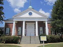
The Appomattox Theater in July 2011. | |
 Appomattox, Virginia Location within the state of Virginia | |
| Coordinates: 37°21′32″N 78°49′35″W / 37.35889°N 78.82639°WCoordinates: 37°21′32″N 78°49′35″W / 37.35889°N 78.82639°W | |
| Country |
|
| State |
|
| County |
|
| Area | |
| • Total | 2.2 sq mi (5.7 km2) |
| • Land | 2.2 sq mi (5.6 km2) |
| • Water | 0.0 sq mi (0.0 km2) |
| Elevation | 850 ft (259 m) |
| Population (2010) | |
| • Total | 2,043 |
| • Density | 808.7/sq mi (311.9/km2) |
| Time zone | Eastern (EST) (UTC-5) |
| • Summer (DST) | EDT (UTC-4) |
| ZIP code | 24522 |
| Area code(s) | 434 |
| FIPS code | 51-02072[1] |
| GNIS feature ID | 1498448[2] |
Appomattox is a town in Appomattox County, Virginia, United States. The population was 2,043 at the 2010 census. It is the county seat of Appomattox County.[3]
Appomattox is part of the Lynchburg Metropolitan Statistical Area.
History

The town was named for the Appomattox River. The river was named after the Appamatuck Virginian Indian tribe, one of the Algonquian-speaking Powhatan Confederacy, historically based in the coastal area and encountered by the English before the tribes of the Piedmont. The Appamatuck historically lived somewhat to the east of the present town, around the area of present-day Petersburg. At the time of European encounter, the area of Appomattox County above the fall line was part of the territory of the Manahoac tribe, who spoke Siouan. The town is located three miles west of the restored historic village of Appomattox Court House (a.k.a. Clover Hill), the site of Confederate General Robert E. Lee's surrender to Union General Ulysses S. Grant on April 9, 1865, essentially ending the American Civil War. The area is preserved as Appomattox Court House National Historical Park and is administered by the National Park Service.
At the time of the Civil War, the present community of Appomattox was the site of a railroad depot on the line between Petersburg and Lynchburg. The town was first named "Nebraska" in 1855. In 1895 it was renamed "West Appomattox". The first postmaster of "Nebraska, Virginia", was Samuel D. McDearmon.[4]
Near the end of the Civil War, Robert E. Lee made a last attempt to reach the depot, hoping to transport the Army of Northern Virginia south by railroad to meet Joseph E. Johnston's larger Army of Tennessee, then located in Greensboro, North Carolina. The arrival of Federal troops and their blocking Lee's army from the depot led to Lee's surrender on April 9. Johnston later surrendered 98,270 Confederate troops (the largest surrender of the war), marking the end of the conflict on April 26, 1865. Small bands of soldiers continued fighting until June 1865.
The inconvenience of the railroad's location to the original Appomattox Court House in the village of Clover Hill led to the decline of the courthouse community. After fire destroyed the courthouse building in 1892, the county relocated the court to the depot area, which formally became the county seat in 1894.
In 1990, there were 11,971 residents reported for Appomattox County; the Town of Appomattox had 1703 residents.
In addition to Appomattox Court House National Historical Park, the Appomattox River Bridge, Appomattox Historic District, Holiday Lake 4-H Educational Center, and Holliday Lake State Park are listed on the National Register of Historic Places.[5]
The 2010 Appomattox shootings occurred from January 17 to 20 and left eight people dead.
Geography
Appomattox is located at 37°21′32″N 78°49′35″W / 37.35889°N 78.82639°W (37.358973, -78.826438).[6]
According to the United States Census Bureau, the town has a total area of 2.2 square miles (5.6 km²).
Demographics
| Historical population | |||
|---|---|---|---|
| Census | Pop. | %± | |
| 1930 | 704 | — | |
| 1940 | 992 | 40.9% | |
| 1950 | 1,094 | 10.3% | |
| 1960 | 1,184 | 8.2% | |
| 1970 | 1,400 | 18.2% | |
| 1980 | 1,345 | −3.9% | |
| 1990 | 1,707 | 26.9% | |
| 2000 | 1,761 | 3.2% | |
| 2010 | 1,733 | −1.6% | |
| Est. 2015 | 1,759 | [7] | 1.5% |
As of the census[1] of 2010, there were 2043 people and 597 families residing in the town. The population density was 808.7 people per square mile (311.9/km²). There were 767 housing units at an average density of 352.2 per square mile (135.8/km²). The racial makeup of the town was 63.87% White, 37.14% African American, 0.08% Native American, 0.11% from other races, and 0.17% from two or more races. Hispanic or Latino of any race were 0.23% of the population.
There were 716 households out of which 29.3% had children under the age of 18 living with them, 42.7% were married couples living together, 20.0% had a female householder with no husband present, and 34.4% were non-families. 30.4% of all households were made up of individuals and 17.2% had someone living alone who was 65 years of age or older. The average household size was 2.35 and the average family size was 2.92.
In the town the population was spread out with 23.9% under the age of 18, 8.6% from 18 to 24, 27.4% from 25 to 44, 20.8% from 45 to 64, and 19.2% who were 65 years of age or older. The median age was 39 years. For every 100 females there were 82.3 males. For every 100 females age 18 and over, there were 75.2 males.
Federally, Appomattox is part of Virginia's 5th congressional district, represented by Republican Robert Hurt, elected in 2010.
Notable people
- Watkins Abbitt, Jr., member of the Virginia House of Delegates[9]
- Larry Robinson, former NFL player[10]
Climate
The climate in this area is characterized by hot, humid summers and generally mild to cool winters. According to the Köppen Climate Classification system, Appomattox has a humid subtropical climate, abbreviated "Cfa" on climate maps.[11]
References
- 1 2 "American FactFinder". United States Census Bureau. Archived from the original on September 11, 2013. Retrieved January 31, 2008.
- ↑ "US Board on Geographic Names". United States Geological Survey. October 25, 2007. Retrieved January 31, 2008.
- ↑ "Find a County". National Association of Counties. Archived from the original on May 31, 2011. Retrieved June 7, 2011.
- ↑ "Appomattox town history". Retrieved January 11, 2009.
- ↑ National Park Service (2010-07-09). "National Register Information System". National Register of Historic Places. National Park Service.
- ↑ "US Gazetteer files: 2010, 2000, and 1990". United States Census Bureau. February 12, 2011. Retrieved April 23, 2011.
- ↑ "Annual Estimates of the Resident Population for Incorporated Places: April 1, 2010 to July 1, 2015". Retrieved July 2, 2016.
- ↑ "Census of Population and Housing". Census.gov. Archived from the original on May 11, 2015. Retrieved June 4, 2015.
- ↑ "Abbitt, Watkins Moorman (1908-1998)". Project Vote Smart. Retrieved November 4, 2012.
- ↑ "Larry Robinson". pro-football-reference.com. Retrieved October 10, 2015.
- ↑ Climate Summary for Appomattox, Virginia
External links
Municipalities and communities of Appomattox County, Virginia, United States | ||
|---|---|---|
| Towns | 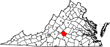 | |
| CDP | ||
| Other unincorporated communities | ||
| Footnotes | ‡This populated place also has portions in an adjacent county or counties | |