Fincastle, Virginia
| Fincastle, Virginia | |
|---|---|
| Town | |
|
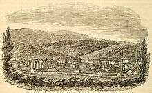
A view of East Main Street in Fincastle, Virginia | |
 Location of Fincastle, Virginia | |
| Coordinates: 37°29′58″N 79°52′36″W / 37.49944°N 79.87667°WCoordinates: 37°29′58″N 79°52′36″W / 37.49944°N 79.87667°W | |
| Country | United States |
| State | Virginia |
| County | Botetourt |
| Area | |
| • Total | 0.2 sq mi (0.6 km2) |
| • Land | 0.2 sq mi (0.6 km2) |
| • Water | 0.0 sq mi (0.0 km2) |
| Elevation | 1,240 ft (378 m) |
| Population (2000) | |
| • Total | 359 |
| • Density | 1,480.8/sq mi (571.8/km2) |
| Time zone | Eastern (EST) (UTC-5) |
| • Summer (DST) | EDT (UTC-4) |
| ZIP code | 24090 |
| Area code(s) | 540 |
| FIPS code | 51-27824[1] |
| GNIS feature ID | 1498478[2] |

Fincastle is a town in Botetourt County, Virginia, USA. The population was 353 at the 2010 census. It is the county seat of Botetourt County.[3]
Fincastle is part of the Roanoke Metropolitan Statistical Area.
History
Fincastle was founded in 1772 and named after Lord Fincastle, son of Lord Dunmore, Virginia's last royal governor.[4] As the seat of Botetourt County, Fincastle was something of the last outpost before the Western frontier serving as a supply station for settlers heading West. From its inception until the Revolutionary war, Fincastle oversaw a massive governmental district that stretched to the Mississippi River and included parts of modern-day Wisconsin. Town lore says that folks who lived more than 500 miles away were excused from jury duty. Fincastle's courthouse was designed by Thomas Jefferson and today still houses county government functions for a much smaller county and contains a vast archive of public records relevant to the late colonial Virginia and the Western expansion periods. George Washington, Patrick Henry, Thomas Jefferson and other prominent Virginians either appeared in Fincastle or sent their agents to lay claim to tracts of wilderness lands. Meriwether Lewis and William Clark departed from Fincastle when they were commissioned by President Thomas Jefferson to explore the Louisiana Purchase. A little over a year after his arrival back in Virginia, Clark married Julia Hancock of Fincastle, a cousin, on January 5, 1808.
The Judith River in Montana was named in honor of Julia Hancock by Clark during the Expedition; he mistakenly thought that was her given name, because he knew her as a child as "Judy". Upon his return from the West, he quickly took up courting his cousin in Fincastle. She moved with him to St. Louis, where besides their children, they raised and educated Jean Baptiste Charbonneau, the son of Sacagawea.
The Bowyer-Holladay House, Breckinridge Mill, Fincastle Historic District, Greenfield, Hawthorne Hall, Prospect Hill, Santillane, Wheatland Manor, and Wiloma are listed on the National Register of Historic Places.[5]
Geography
Fincastle is located at 37°29′58″N 79°52′36″W / 37.499421°N 79.876674°W (37.499421, -79.876674).[6]
According to the United States Census Bureau, the town has a total area of 0.2 square mile (0.6 km2), all land.
Demographics
| Historical population | |||
|---|---|---|---|
| Census | Pop. | %± | |
| 1860 | 896 | — | |
| 1880 | 675 | — | |
| 1900 | 652 | — | |
| 1910 | 479 | −26.5% | |
| 1920 | 457 | −4.6% | |
| 1930 | 517 | 13.1% | |
| 1940 | 442 | −14.5% | |
| 1950 | 405 | −8.4% | |
| 1960 | 403 | −0.5% | |
| 1970 | 397 | −1.5% | |
| 1980 | 282 | −29.0% | |
| 1990 | 236 | −16.3% | |
| 2000 | 359 | 52.1% | |
| 2010 | 353 | −1.7% | |
| Est. 2015 | 341 | [7] | −3.4% |
As of the census[1] of 2000, there were 359 people, 129 households, and 83 families residing in the town. The population density was 1,480.8 people per square mile (577.5/km2). There were 142 housing units at an average density of 585.7 per square mile (228.4/km2). The racial makeup of the town was 89.69% White, 7.52% African American, 0.28% Native American, 0.28% Asian, 1.67% from other races, and 0.56% from two or more races. Hispanic or Latino of any race were 1.95% of the population.
There were 129 households out of which 27.1% had children under the age of 18 living with them, 51.9% were married couples living together, 10.1% had a female householder with no husband present, and 34.9% were non-families. 32.6% of all households were made up of individuals and 13.2% had someone living alone who was 65 years of age or older. The average household size was 2.39 and the average family size was 3.04.
In the town the population was spread out with 19.8% under the age of 18, 11.1% from 18 to 24, 32.3% from 25 to 44, 24.2% from 45 to 64, and 12.5% who were 65 years of age or older. The median age was 39 years. For every 100 females there were 117.6 males. For every 100 females age 18 and over, there were 126.8 males.
The median income for a household in the town was $33,438, and the median income for a family was $54,688. Males had a median income of $32,500 versus $21,563 for females. The per capita income for the town was $19,954. None of the families and 2.3% of the population were living below the poverty line, including no under eighteens and 10.2% of those over 64.
Notable people
- Jacob Ammen, (1807–1894), born in Fincastle, Union Army general[9]
- Joseph R. Anderson, (1813–1892), born in Fincastle, Confederate Army general and iron manufacturer[9]
- John Strother Griffin (1816–1898), physician and land developer, Los Angeles, California
- William Radford (1808–1890), Union Navy officer and later Admiral
References
- 1 2 "American FactFinder". United States Census Bureau. Retrieved 2008-01-31.
- ↑ "US Board on Geographic Names". United States Geological Survey. 2007-10-25. Retrieved 2008-01-31.
- ↑ "Find a County". National Association of Counties. Retrieved 2011-06-07.
- ↑ Gannett, Henry (1905). The Origin of Certain Place Names in the United States. Govt. Print. Off. p. 126.
- ↑ National Park Service (2010-07-09). "National Register Information System". National Register of Historic Places. National Park Service.
- ↑ "US Gazetteer files: 2010, 2000, and 1990". United States Census Bureau. 2011-02-12. Retrieved 2011-04-23.
- ↑ "Annual Estimates of the Resident Population for Incorporated Places: April 1, 2010 to July 1, 2015". Retrieved July 2, 2016.
- ↑ "Census of Population and Housing". Census.gov. Retrieved June 4, 2015.
- 1 2 Who Was Who in America, Historical Volume, 1607-1896. Marquis Who's Who. 1967.
External links
Municipalities and communities of Botetourt County, Virginia, United States | ||
|---|---|---|
| Towns |  | |
| CDPs | ||
| Unincorporated communities |
| |
| Footnotes | ‡This populated place also has portions in an adjacent county or counties | |