Jonesville, Virginia
| Town of Jonesville, Virginia | |
|---|---|
| Town | |
|
Jonesville welcome sign | |
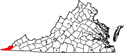
 Location in the Commonwealth of Virginia | |
| Coordinates: 36°41′17″N 83°6′59″W / 36.68806°N 83.11639°WCoordinates: 36°41′17″N 83°6′59″W / 36.68806°N 83.11639°W | |
| Country | United States |
| State | Virginia |
| County | Lee |
| Government | |
| • Mayor | Greg Smith |
| Area | |
| • Total | 1.1 sq mi (2.9 km2) |
| • Land | 1.1 sq mi (2.9 km2) |
| • Water | 0.0 sq mi (0.0 km2) |
| Elevation | 1,503 ft (458 m) |
| Population (2000) | |
| • Total | 995 |
| • Density | 901/sq mi (347.9/km2) |
| U.S. Census Bureau, 2000 Population Estimates | |
| Time zone | EST (UTC-5) |
| • Summer (DST) | EDT (UTC-4) |
| ZIP code | 24263 |
| Area code(s) | 276 |
| FIPS code | 51-41272[1] |
| GNIS feature ID | 1498497[2] |
| Website | http://www.townofjonesville.org/ |
.jpg)
Jonesville is a town in and the county seat of Lee County, Virginia, United States.[3] The population was 995 at the 2000 census.
History
Jonesville was established in 1794 as the county seat of Lee County. The town was known as Glade Spring in its infancy. It was incorporated in 1884, and re-incorporated in 1901. It is named for Frederick Jones, a landowner.[4]
Jonesville was a small but thriving center of local commerce in the late nineteenth and early twentieth centuries, but like most towns in the central Appalachian region, it fell into gradual economic decline as the coal boom ebbed in the latter half of the twentieth century. By the end of the century much of the commercial real estate in its downtown area was either unoccupied or underutilized. Most of Jonesville's remaining commercial activity is concentrated in the west end. Jonesville Drug, one of the oldest surviving downtown businesses, relocated to the old Chappell's Dairy site on the west end in 2004.
The Dickinson-Milbourn House and Jonesville Methodist Campground are listed on the National Register of Historic Places.[5]
Notable residents
- Glen Morgan Williams, United States Federal Judge, was born in Jonesville.[6]
- Andrew Taylor Still, M. D., D.O., father of osteopathic medicine and founder of its first school and infirmary, was born in Jonesville in 1828.
Geography
Jonesville is located at 36°41′17″N 83°6′59″W / 36.68806°N 83.11639°W (36.688012, -83.116305).[7]
According to the United States Census Bureau, the town has a total area of 1.1 square miles (2.8 km²), all land.
Demographics
| Historical population | |||
|---|---|---|---|
| Census | Pop. | %± | |
| 1870 | 274 | — | |
| 1910 | 383 | — | |
| 1920 | 328 | −14.4% | |
| 1930 | 384 | 17.1% | |
| 1940 | 588 | 53.1% | |
| 1950 | 597 | 1.5% | |
| 1960 | 711 | 19.1% | |
| 1970 | 700 | −1.5% | |
| 1980 | 874 | 24.9% | |
| 1990 | 927 | 6.1% | |
| 2000 | 995 | 7.3% | |
| 2010 | 1,034 | 3.9% | |
| Est. 2015 | 974 | [8] | −5.8% |
As of the census[1] of 2000, there were 995 people, 497 households, and 261 families residing in the town. The population density was 901.1 people per square mile (349.2/km²). There were 565 housing units at an average density of 511.7 per square mile (198.3/km²). The racial makeup of the town was 99.30% White, 0.10% African American, and 0.60% from two or more races. Hispanic or Latino of any race were 0.40% of the population.
There were 497 households out of which 22.5% had children under the age of 18 living with them, 38.8% were married couples living together, 12.3% had a female householder with no husband present, and 47.3% were non-families. 45.1% of all households were made up of individuals and 20.5% had someone living alone who was 65 years of age or older. The average household size was 1.91 and the average family size was 2.66.
In the town the population was spread out with 18.1% under the age of 18, 8.4% from 18 to 24, 24.7% from 25 to 44, 25.4% from 45 to 64, and 23.3% who were 65 years of age or older. The median age was 44 years. For every 100 females there were 87.4 males. For every 100 females age 18 and over, there were 85.6 males.
The median income for a household in the town was $16,548, and the median income for a family was $27,368. Males had a median income of $26,950 versus $19,297 for females. The per capita income for the town was $18,347. About 25.4% of families and 32.3% of the population were below the poverty line, including 55.6% of those under age 18 and 24.4% of those age 65 or over.
Government and infrastructure
The Federal Bureau of Prisons United States Penitentiary, Lee is located 8 miles (13 km) east of Jonesville.[10]
References
- 1 2 "American FactFinder". United States Census Bureau. Retrieved 2008-01-31.
- ↑ "US Board on Geographic Names". United States Geological Survey. 2007-10-25. Retrieved 2008-01-31.
- ↑ "Find a County". National Association of Counties. Retrieved 2011-06-07.
- ↑ "Profile for Jonesville, Virginia". ePodunk. Retrieved 2010-05-03.
- ↑ National Park Service (2010-07-09). "National Register Information System". National Register of Historic Places. National Park Service.
- ↑ http://www2.timesdispatch.com/news/state-news/2012/nov/06/tdmet04-retired-federal-judge-glen-m-williams-dies-ar-2339668/
- ↑ "US Gazetteer files: 2010, 2000, and 1990". United States Census Bureau. 2011-02-12. Retrieved 2011-04-23.
- ↑ "Annual Estimates of the Resident Population for Incorporated Places: April 1, 2010 to July 1, 2015". Retrieved July 2, 2016.
- ↑ "Census of Population and Housing". Census.gov. Retrieved June 4, 2015.
- ↑ "USP Lee." Federal Bureau of Prisons. Retrieved on January 3, 2012. "USP Lee is located in southwest Virginia in Lee County, 8 miles east of Jonesville, off U.S. 58 at the intersection of State Route 638."