Dillwyn, Virginia
| Dillwyn, Virginia | |
|---|---|
| Town | |
 Location of Dillwyn, Virginia | |
| Coordinates: 37°32′30″N 78°27′32″W / 37.54167°N 78.45889°WCoordinates: 37°32′30″N 78°27′32″W / 37.54167°N 78.45889°W | |
| Country | United States |
| State | Virginia |
| County | Buckingham |
| Area | |
| • Total | 0.7 sq mi (1.7 km2) |
| • Land | 0.7 sq mi (1.7 km2) |
| • Water | 0.0 sq mi (0.0 km2) |
| Elevation | 643 ft (196 m) |
| Population (2010) | |
| • Total | 447 |
| • Density | 694/sq mi (267.8/km2) |
| Time zone | Eastern (EST) (UTC-5) |
| • Summer (DST) | EDT (UTC-4) |
| ZIP code | 23936 |
| Area code(s) | 434 |
| FIPS code | 51-22560[1] |
| GNIS feature ID | 1492868[2] |
| Website |
www |
Dillwyn is an incorporated town in Buckingham County, Virginia, in the United States. The population was 447 at the 2010 census.[3]
History
The Peter Francisco House was listed on the National Register of Historic Places in 1972.[4]
Geography
Dillwyn is located in east-central Buckingham County at 37°32′30″N 78°27′32″W / 37.54167°N 78.45889°W (37.541658, −78.458869).[5] U.S. Route 15 passes through the town, leading south 2 miles (3 km) to U.S. Route 60 and 23 miles (37 km) to Farmville, and north 37 miles (60 km) to Interstate 64 east of Charlottesville.
According to the United States Census Bureau, Dillwyn has a total area of 0.66 square miles (1.7 km2), all of it land.[3]
Demographics
| Historical population | |||
|---|---|---|---|
| Census | Pop. | %± | |
| 1920 | 405 | — | |
| 1930 | 442 | 9.1% | |
| 1940 | 436 | −1.4% | |
| 1950 | 556 | 27.5% | |
| 1960 | 515 | −7.4% | |
| 1970 | 497 | −3.5% | |
| 1980 | 596 | 19.9% | |
| 1990 | 458 | −23.2% | |
| 2000 | 447 | −2.4% | |
| 2010 | 447 | 0.0% | |
| Est. 2015 | 444 | [6] | −0.7% |
As of the census[1] of 2000, there were 447 people, 176 households, and 114 families residing in the town. The population density was 646.4 people per square mile (250.1/km²). There were 200 housing units at an average density of 289.2 per square mile (111.9/km²). The racial makeup of the town was 57.27% White, 39.60% African American, 0.67% from other races, and 2.46% from two or more races. Hispanic or Latino of any race were 0.67% of the population.

There were 176 households out of which 30.7% had children under the age of 18 living with them, 38.6% were married couples living together, 22.2% had a female householder with no husband present, and 34.7% were non-families. 32.4% of all households were made up of individuals and 19.9% had someone living alone who was 65 years of age or older. The average household size was 2.16 and the average family size was 2.63.
In the town the population was spread out with 20.6% under the age of 18, 4.3% from 18 to 24, 21.5% from 25 to 44, 24.2% from 45 to 64, and 29.5% who were 65 years of age or older. The median age was 48 years. For every 100 females there were 70.6 males. For every 100 females age 18 and over, there were 68.2 males.
The median income for a household in the town was $19,167, and the median income for a family was $24,688. Males had a median income of $19,167 versus $17,868 for females. The per capita income for the town was $11,091. About 29.7% of families and 34.9% of the population were below the poverty line, including 59.2% of those under age 18 and 29.7% of those age 65 or over.
In popular culture
In AMC's drama series Breaking Bad, Dillwyn is named as the false hideout location of Jesse Pinkman, who is running for his life.[8]
References
- 1 2 "American FactFinder". United States Census Bureau. Retrieved 2008-01-31.
- ↑ "US Board on Geographic Names". United States Geological Survey. 2007-10-25. Retrieved 2008-01-31.
- 1 2 "Geographic Identifiers: 2010 Demographic Profile Data (G001): Dillwyn town, Virginia". U.S. Census Bureau, American Factfinder. Retrieved May 2, 2014.
- ↑ National Park Service (2010-07-09). "National Register Information System". National Register of Historic Places. National Park Service.
- ↑ "US Gazetteer files: 2010, 2000, and 1990". United States Census Bureau. 2011-02-12. Retrieved 2011-04-23.
- ↑ "Annual Estimates of the Resident Population for Incorporated Places: April 1, 2010 to July 1, 2015". Retrieved July 2, 2016.
- ↑ "Census of Population and Housing". Census.gov. Retrieved June 4, 2015.
- ↑ (Season 3, episode 13.)
External links
Municipalities and communities of Buckingham County, Virginia, United States | ||
|---|---|---|
| Town | 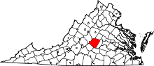 | |
| CDPs | ||
| Unincorporated communities |
| |
| Footnotes | ‡This populated place also has portions in an adjacent county or counties | |