Ridgeway, Virginia
| Ridgeway, Virginia | |
|---|---|
| Town | |
 Location of Ridgeway, Virginia | |
| Coordinates: 36°34′45″N 79°51′36″W / 36.57917°N 79.86000°WCoordinates: 36°34′45″N 79°51′36″W / 36.57917°N 79.86000°W | |
| Country | United States |
| State | Virginia |
| County | Henry |
| Area | |
| • Total | 0.9 sq mi (2.4 km2) |
| • Land | 0.9 sq mi (2.4 km2) |
| • Water | 0.0 sq mi (0.0 km2) |
| Elevation | 948 ft (289 m) |
| Population (2000) | |
| • Total | 775 |
| • Density | 825.3/sq mi (318.6/km2) |
| Time zone | Eastern (EST) (UTC-5) |
| • Summer (DST) | EDT (UTC-4) |
| ZIP code | 24148 |
| Area code(s) | 276 |
| FIPS code | 51-67208[1] |
| GNIS feature ID | 1473206[2] |
Ridgeway is a town in Henry County, Virginia, United States. The population was 775 at the 2000 census. It is part of the Martinsville Micropolitan Statistical Area. It is best known for being the location of Martinsville Speedway.
History

Approximately three miles south of Ridgeway in Henry County on U.S. Route 220 is a Virginia State historic marker noting the passing of the surveying party of William Byrd II, who moved through the area in 1728 on his expedition to survey the dividing line between Virginia and North Carolina.
Belleview and Ingleside are listed on the National Register of Historic Places.[3]
Geography
Ridgeway is located at 36°34′45″N 79°51′36″W / 36.57917°N 79.86000°W (36.579148, -79.860078).[4]
According to the United States Census Bureau, the town has a total area of 0.9 square miles (2.4 km²), all of it land.
Demographics
| Historical population | |||
|---|---|---|---|
| Census | Pop. | %± | |
| 1890 | 236 | — | |
| 1900 | 332 | 40.7% | |
| 1910 | 393 | 18.4% | |
| 1920 | 320 | −18.6% | |
| 1930 | 359 | 12.2% | |
| 1940 | 422 | 17.5% | |
| 1950 | 440 | 4.3% | |
| 1960 | 524 | 19.1% | |
| 1970 | 624 | 19.1% | |
| 1980 | 858 | 37.5% | |
| 1990 | 752 | −12.4% | |
| 2000 | 775 | 3.1% | |
| 2010 | 742 | −4.3% | |
| Est. 2015 | 708 | [5] | −4.6% |
As of the census[1] of 2000, there were 775 people, 310 households, and 221 families residing in the town. The population density was 825.3 people per square mile (318.3/km²). There were 327 housing units at an average density of 348.2 per square mile (134.3/km²). The racial makeup of the town was 79.87% White, 16.00% African American, 2.45% Asian, 1.03% from other races, and 0.65% from two or more races. Hispanic or Latino of any race were 2.32% of the population.
There were 310 households out of which 31.3% had children under the age of 18 living with them, 54.2% were married couples living together, 13.2% had a female householder with no husband present, and 28.4% were non-families. 26.1% of all households were made up of individuals and 10.6% had someone living alone who was 65 years of age or older. The average household size was 2.50 and the average family size was 3.01.
In the town the population was spread out with 25.4% under the age of 18, 6.1% from 18 to 24, 27.7% from 25 to 44, 28.4% from 45 to 64, and 12.4% who were 65 years of age or older. The median age was 39 years. For every 100 females there were 86.3 males. For every 100 females age 18 and over, there were 80.6 males.
The median income for a household in the town was $34,196, and the median income for a family was $39,500. Males had a median income of $27,109 versus $21,146 for females. The per capita income for the town was $16,054. About 12.1% of families and 12.0% of the population were below the poverty line, including 12.0% of those under age 18 and 15.3% of those age 65 or over.
Notable people
- Jimmy Hensley, NASCAR driver
- Roscoe Reynolds, State Senator
- Charles Mann, Professional Football Player
References
- 1 2 "American FactFinder". United States Census Bureau. Archived from the original on September 11, 2013. Retrieved 2008-01-31.
- ↑ "US Board on Geographic Names". United States Geological Survey. 2007-10-25. Retrieved 2008-01-31.
- ↑ National Park Service (2010-07-09). "National Register Information System". National Register of Historic Places. National Park Service.
- ↑ "US Gazetteer files: 2010, 2000, and 1990". United States Census Bureau. 2011-02-12. Retrieved 2011-04-23.
- ↑ "Annual Estimates of the Resident Population for Incorporated Places: April 1, 2010 to July 1, 2015". Retrieved July 2, 2016.
- ↑ "Census of Population and Housing". Census.gov. Archived from the original on May 11, 2015. Retrieved June 4, 2015.
Municipalities and communities of Henry County, Virginia, United States | ||
|---|---|---|
| Town | 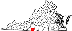 | |
| CDPs | ||
| Unincorporated communities | ||