Washington County, Arkansas
| Washington County, Arkansas | ||
|---|---|---|
| County | ||
| County of Washington | ||
 | ||
| ||
 Location in the U.S. state of Arkansas | ||
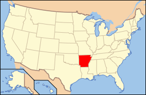 Arkansas's location in the U.S. | ||
| Founded | October 17, 1828 | |
| Named for | George Washington | |
| Seat | Fayetteville | |
| Largest city | Fayetteville | |
| Area | ||
| • Total | 952 sq mi (2,466 km2) | |
| • Land | 942 sq mi (2,440 km2) | |
| • Water | 10 sq mi (26 km2), 1.1% | |
| Population (est.) | ||
| • (2015) | 225,477 | |
| • Density | 215/sq mi (83/km²) | |
| ZIP code(s) | 72701, 72703, 72704, 72717, 72727, 72729, 72730, 72738, 72744, 72749, 72753, 72761, 72762, 72764, 72769, 72773, 72774, 72959 | |
| Area code(s) | 479 | |
| Congressional district | 3rd | |
| Time zone | Central: UTC-6/-5 | |
| Website |
www | |

Washington County is a county located in the northwest part of the U.S. state of Arkansas. As of the 2010 census, the population was 203,065,[1] making it the third-most populous county in Arkansas. The county seat is Fayetteville.[2] It is Arkansas's 17th county, formed on October 17, 1828, and named for George Washington, the first President of the United States. Washington County is part of the Fayetteville-Springdale-Rogers, AR-MO Metropolitan Statistical Area.
History

Washington County began as part of the Cherokee Territory, following an 1817 treaty. The area was next known as Lovely County, and one year later Washington County was created after another Cherokee treaty. The court house was centrally located in the city of Washington, modern-day Fayetteville (renamed to avoid confusion with Washington, Arkansas in South Arkansas). The Lee Creek Valley in southern Washington County contained many of the county's early settlements, including Cane Hill and Evansville.[3]
Arkansas College and Cane Hill College were both founded in Washington County within a day of each other in 1834, with the University of Arkansas being founded in Fayetteville in 1871. The county witnessed major battles during the American Civil War, including the Battle of Fayetteville, the Battle of Prairie Grove, and the Battle of Cane Hill. The county then was sparsely settled and many residents were pro-Union, since slaves were few, plantations almost nonexistent, and news came via White River travelers, not from the southern part of the state.[4] A Butterfield Overland Mail route was established through the county in 1858, causing more families to settle there.[4]
The economy of Washington County was based on apples in the late 19th century. A mixture of wet weather, altitude, and loamy soils provided a good environment for apple orchards.[5] First planted in areas around Lincoln, Evansville, and Cane Hill in the 1830s, apple orchards began all across the county. The United States Census reported a crop of 614,924 bushels of apples produced by the county in 1900, the highest in the state. Several varieties of apple were discovered in the area including Shannon Pippin, Wilson June, and most notably the Arkansas Black.[6] The Ben Davis became the apple of choice in the area for sale and shipment across the region. Corn became the dominant crop, outselling apples by almost $500,000 in 1900.[7]
Arkansas Industrial University was founded in the growing community of Fayetteville in 1871 after William McIlroy a donated farmland for the site. The university changed its name in 1899 to the University of Arkansas.[8] Railroads came to Washington County after the St. Louis – San Francisco Railway (Frisco) decided to build a line to Texas through Fort Smith. Two possible routes were proposed, one passing through Prairie Grove, the other through Fayetteville. Many Fayetteville residents and farmers sold or donated land for the right of way to influence the choice. They were successful and in 1881 the first passenger train arrived at Fayetteville.[9] The county continued to grow with more churches and schools after the railroad's completion.[10] Rural parts of the county began losing population in the 1920s during the Great Depression, when high taxes forcing residents to move to Fayetteville or west to Oklahoma. The rural areas later became the Ozark National Forest and Devil's Den State Park.[10]
Geography

According to the U.S. Census Bureau, the county has a total area of 952 square miles (2,470 km2), of which 942 square miles (2,440 km2) is land and 10 square miles (26 km2) (1.1%) is water.[11] It is the fourth-largest county by area in Arkansas. The county is in the Boston Mountains, a subdivision of the Ozark Mountains. Devil's Den State Park in southern Washington County is known for its picturesque views and mountain vistas.[12] Washington County also contains Lake Wedington, located in scenic country west of Fayetteville on Wedington Drive.
Geology
Washington County sits on a basement of Precambrian granite and rhyolite, as most of the continental interior of the United States does.[13] Much of the county's geologic history must be inferred from nearby Oklahoma and Missouri research, due to the steepness of the more recently formed mountains that did not form in the neighboring states. This igneous material was eroded until the Paleozoic, when oceans covered the now-low-lying area.[14] These oceans came and retreated for 300 million years, depositing various different sedements during that time. This created fossiliferous limestone and ripple marked-sandstone, both present throughout the north part of the county as evidence of ancient oceans.[14]
Sediments were deposited from the Devonian, Mississippian, and Pennsylvanian periods. During this deposition period, the county had a climate similar to that of the present-day Bahamas, as the equator was north of Washington County.[15] The Devonian brought mostly shales, the Mississippian brought the limestones and chert visible in the bluffs. This chert is present throughout most of the county. The county is also home to the Boone Formation (red soils), white limestones, the Wedington Sandstone, the Bastesville Sandstone, the Pitkin formation (ocean-fossil limestone), and the Fayetteville Shale.
Settlers were attracted to the area by its numerous streams, used to power gristmills, sandstones and clays for use in construction, lime-sweetened soil, and chert for road construction.[16]
Today, Washington County consists of two main formations, the Boston Mountains and the Springfield Plateau. During the late Pennsylvanian, sediments were deposited on top of the Springfield Plateau. The area was uplifted during the Ouachita orogeny and subsequent erosion formed the rugged Boston Mountains. Erosion of these sediments causes the Boston Mountains to be carved steeply in the south, while in the north of the county, the Boston Mountain sediments are almost entirely eroded, exposing the older rocks of the Springfield Plateau.
Major highways
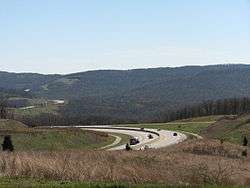
Washington County has contained the Ozark Trail, Trail of Tears, and the Butterfield Overland Mail route. Today, Interstate 49 serves as the county's main thoroughfare, and connects the University of Arkansas with Fort Smith and Interstate 40 to the south and other NWA cities to the north. Future plans call for Interstate 49 to be extended to ultimately connect New Orleans, Louisiana with Kansas City, Missouri through Washington County.
Adjacent counties
- Benton County (north)
- Madison County (east)
- Crawford County (south)
- Adair County, Oklahoma (west)
National protected area
- Ozark National Forest (part)
Demographics
| Historical population | |||
|---|---|---|---|
| Census | Pop. | %± | |
| 1830 | 2,182 | — | |
| 1840 | 7,148 | 227.6% | |
| 1850 | 9,970 | 39.5% | |
| 1860 | 14,673 | 47.2% | |
| 1870 | 17,266 | 17.7% | |
| 1880 | 23,844 | 38.1% | |
| 1890 | 32,024 | 34.3% | |
| 1900 | 34,256 | 7.0% | |
| 1910 | 33,889 | −1.1% | |
| 1920 | 35,468 | 4.7% | |
| 1930 | 39,255 | 10.7% | |
| 1940 | 41,114 | 4.7% | |
| 1950 | 49,979 | 21.6% | |
| 1960 | 55,797 | 11.6% | |
| 1970 | 77,370 | 38.7% | |
| 1980 | 100,494 | 29.9% | |
| 1990 | 113,409 | 12.9% | |
| 2000 | 157,715 | 39.1% | |
| 2010 | 203,065 | 28.8% | |
| Est. 2015 | 225,477 | [17] | 11.0% |
| U.S. Decennial Census[18] 1790–1960[19] 1900–1990[20] 1990–2000[21] 2010–2015[1] | |||

As of the 2000 United States Census,[23] there were 157,715 people, 60,151 households, and 39,459 families residing in the county. The population density was 166 people per square mile (64/km²). There were 64,330 housing units at an average density of 68 per square mile (26/km²). The racial makeup of the county was 88.00% White, 2.24% Black or African American, 1.25% Native American, 1.54% Asian, 0.53% Pacific Islander, 4.26% from other races, and 2.17% from two or more races. 8.20% of the population were Hispanic or Latino of any race.
There were 60,151 households out of which 32.50% had children under the age of 18 living with them, 52.30% were married couples living together, 9.40% had a female householder with no husband present, and 34.40% were non-families. 25.80% of all households were made up of individuals and 7.10% had someone living alone who was 65 years of age or older. The average household size was 2.52 and the average family size was 3.07.
In the county the population was spread out with 25.00% under the age of 18, 15.30% from 18 to 24, 30.20% from 25 to 44, 19.50% from 45 to 64, and 9.90% who were 65 years of age or older. The median age was 31 years. For every 100 females there were 100.40 males. For every 100 females age 18 and over, there were 98.70 males.
The median income for a household in the county was $34,691, and the median income for a family was $42,795. Males had a median income of $29,428 versus $21,769 for females. The per capita income for the county was $17,347. About 9.40% of families and 14.60% of the population were below the poverty line, including 16.50% of those under age 18 and 10.20% of those age 65 or over.
As of the 2010 Census Washington County had a population of 203,065. The racial makeup of the county was 74.14% Non-Hispanic white, 2.96% black, 1.18% Native American, 2.17% Asian, 2.03% Pacific Islander, 0.11% non-Hispanics of some other race, 2.16% Non-Hispanics of two or more races and 15.49% Hispanic.
Education

Unified school districts
There are 9 school districts in the county.[24]
- Elkins School District[25]
- Farmington School District[26]
- Fayetteville School District[27]
- Greenland School District[28]
- Haas Hall Academy[29]
- Lincoln School District[30]
- Prairie Grove School District[31]
- Springdale School District[32]
- West Fork School District[33]
Colleges and universities
The University of Arkansas at Fayetteville was founded in 1871 on the site of a hilltop farm that overlooked the Ozark Mountains, giving it the nickname "The Hill".[34] The University of Arkansas is in Fayetteville, in Washington County. Historically, Cane Hill College in Canehill was the first college in Arkansas, prior to the University of Arkansas's founding in 1871. Canehill probably influenced the placing the University of Arkansas Washington County, since the history of education in the county was a major factor in the decision.
Communities
Cities
Towns
Unincorporated communities
Townships
Townships in Arkansas are the divisions of a county. Each township includes unincorporated areas and some may have incorporated towns or cities within part of their space. Townships have limited purposes in modern times. However, they are of value for historical purposes in terms of genealogical research. Each town or city is within one or more townships in an Arkansas county based on census maps. The townships of Washington County are listed below. In Washington County, each incorporated town/city is at least partially located within its namesake township.[35][36]
- Boston
- Brush Creek
- Cane Hill
- Center
- Cove Creek
- Crawford
- Durham
- Dutch Mills
- Elkins (Elkins)
- Elm Springs (Elm Springs)
- Farmington (Farmington)
- Fayetteville (Fayetteville)
- Goshen (Goshen)
- Greenland (Greenland)
- Harmon
- Illinois
- Johnson (Johnson)
- Lee's Creek
- Lincoln (Lincoln)
- Litteral
- Marrs Hill
- Morrow
- Prairie
- Prairie Grove (Prairie Grove)
- Reed
- Rhea's Mill
- Richland
- Springdale (most of Springdale)
- Starr Hill
- Tontitown (Tontitown)
- Valley
- Vineyard
- Wedington
- West Fork (West Fork)
- White River
- Winslow (Winslow)
- Wyman
See also
- List of counties in Arkansas
- List of lakes in Washington County, Arkansas
- List of places named for George Washington
- National Register of Historic Places listings in Washington County, Arkansas
References
- 1 2 "State & County QuickFacts". United States Census Bureau. Retrieved May 19, 2014.
- ↑ "Find a County". National Association of Counties. Retrieved 2011-06-07.
- ↑ Keck, Wallace (1994). History & Self-Guiding Tour of the Upper Lee Creek Valley & Devil's Den State Park. Little Rock, AR: Arkansas State Parks. p. 6.
- 1 2 Keck, Wallace (1994). History & Self-Guiding Tour of the Upper Lee Creek Valley & Devil's Den State Park. Little Rock, AR: Arkansas State Parks. p. 7.
- ↑ "Early Days in the Fruit Empire". Washington County History. Springdale, Arkansas: Shiloh Museum of Ozark History. 1989. p. 232.
- ↑ Washington County History. Springdale, Arkansas: Shiloh Museum of Ozark History. 1989. p. 233.
- ↑ "Apple Varieties". Washington County History. Springdale, Arkansas: Shiloh Museum of Ozark History. 1989. p. 235.
- ↑ Leflar, Robert (1972). First 100 Years: Centennial History of the University of Arkansas. Fayetteville, AR: University of Arkansas Foundation, Inc. p. 67.
- ↑ "The Railroad". Washington County History. Springdale, Arkansas: Shiloh Museum of Ozark History. 1989. p. 237.
- 1 2 Keck, Wallace (1994). History & Self-Guiding Tour of the Upper Lee Creek Valley & Devil's Den State Park. Little Rock, AR: Arkansas State Parks. p. 8.
- ↑ "2010 Census Gazetteer Files". United States Census Bureau. August 22, 2012. Retrieved August 27, 2015.
- ↑ "Devil's Den State Park - West Fork, Arkansas". Dale Cox. Retrieved 2010-01-28.
- ↑ Mathis (1989). Washington County History. Springdale, AR: Shiloh Museum. p. 9.
- 1 2 Mathis (1989). Washington County History. Springdale, AR: Shiloh Museum. p. 11.
- ↑ Mathis (1989). Washington County History. Springdale, AR: Shiloh Museum. p. 14.
- ↑ Mathis (1989). Washington County History. Springdale, AR: Shiloh Museum. p. 2.
- ↑ "County Totals Dataset: Population, Population Change and Estimated Components of Population Change: April 1, 2010 to July 1, 2015". Retrieved July 2, 2016.
- ↑ "U.S. Decennial Census". United States Census Bureau. Retrieved August 27, 2015.
- ↑ "Historical Census Browser". University of Virginia Library. Retrieved August 27, 2015.
- ↑ Forstall, Richard L., ed. (March 27, 1995). "Population of Counties by Decennial Census: 1900 to 1990". United States Census Bureau. Retrieved August 27, 2015.
- ↑ "Census 2000 PHC-T-4. Ranking Tables for Counties: 1990 and 2000" (PDF). United States Census Bureau. April 2, 2001. Retrieved August 27, 2015.
- ↑ Based on 2000 census data
- ↑ "American FactFinder". United States Census Bureau. Retrieved 2011-05-14.
- ↑ Education, Arkansas Department of. "County/District Elegibility" (PDF). Retrieved 2012-12-18.
- ↑ Schools, Elkins Public. "Elkins Public Schools". Retrieved 2009-05-26.
- ↑ Schools, Farmington Public (2009-05-20). "Farmington School District - Farmington Arkansas". Retrieved 2009-05-26.
- ↑ Schools, Fayetteville Public (2009). "Fayetteville Public Schools :: Schools & Staff - School Websites". Retrieved 2009-05-26.
- ↑ School District, Greenland (2005). "Greenand School District, AR 72737". Retrieved 2009-05-26.
- ↑ Academy, Haas Hall (2012). "Haas Hall Academy". Retrieved 2012-12-18.
- ↑ School District, Lincoln. "Lincoln Consolidated School District". Retrieved 2011-01-01.
- ↑ School District, Prairie Grove. "Prairie Grove School District - Schools". Retrieved 2009-05-26.
- ↑ Schools, Springdale. "Springdale Schools - Schools". Archived from the original on May 20, 2009. Retrieved 2009-05-26.
- ↑ Schools, West Fork Public. "West Fork, AR West Fork Public Schools". Retrieved 2009-05-26.
- ↑ "Overview and Points of Pride." Profile. Retrieved on May 10, 2009.
- ↑ 2011 Boundary and Annexation Survey (BAS): Washington County, AR (PDF) (Map). U. S. Census Bureau. Retrieved 2011-08-08.
- ↑ "Arkansas: 2010 Census Block Maps - County Subdivision". United States Census Bureau. Retrieved May 29, 2014.
External links
| Wikimedia Commons has media related to Washington County, Arkansas. |
 |
Benton County | | ||
| Adair County, Oklahoma | |
Madison County | ||
| ||||
| | ||||
| Crawford County |
Coordinates: 36°00′09″N 94°13′38″W / 36.00250°N 94.22722°W