Nevada County, Arkansas
| Nevada County, Arkansas | |
|---|---|
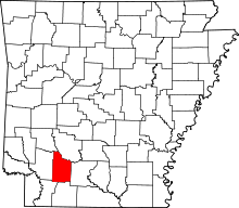 Location in the U.S. state of Arkansas | |
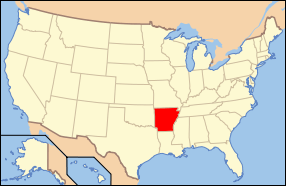 Arkansas's location in the U.S. | |
| Founded | March 20, 1871 |
| Named for | state of Nevada |
| Seat | Prescott |
| Largest city | Prescott |
| Area | |
| • Total | 621 sq mi (1,608 km2) |
| • Land | 618 sq mi (1,601 km2) |
| • Water | 2.8 sq mi (7 km2), 0.5% |
| Population (est.) | |
| • (2015) | 8,558 |
| • Density | 15/sq mi (6/km²) |
| Congressional district | 4th |
| Time zone | Central: UTC-6/-5 |
| Website |
nevadacounty |
Nevada County is a county located in the U.S. state of Arkansas. As of the 2010 census, the population was 8,997.[1] The county seat is Prescott.[2] Nevada County is Arkansas's 63rd county, formed on March 20, 1871, from portions of Hempstead, Ouachita and Columbia Counties. It was named after the state of Nevada because of the perceived similarity between their physical shapes; the Arkansas county's shape roughly follows the same outline as the state's boundary when inverted. In contrast with the name of the state, the local pronunciation for the southwestern Arkansas county is "nuh-VAY-duh". It is an alcohol prohibition or dry county.
Dorcheat Bayou, a 122-mile stream, begins in Nevada County. It flows south into Columbia County and then Webster Parish, Louisiana, and empties into Lake Bistineau. In the 19th century, the bayou was navigable for three to six months by steamboat from Bistineau to Minden. It is now popular for fishing and natural beauty.[3]
Geography
According to the U.S. Census Bureau, the county has a total area of 621 square miles (1,610 km2), of which 618 square miles (1,600 km2) is land and 2.8 square miles (7.3 km2) (0.5%) is water.[4] The county is bounded on the north by the Little Missouri River, a branch of the Ouachita River, and drained by several tributaries of that stream and of Red River.[5] Nevada County is alternately considered as part of the greater regions of South Arkansas or Southwest Arkansas.
Major highways
Adjacent counties
- Clark County (northeast)
- Ouachita County (east)
- Columbia County (south)
- Lafayette County (southwest)
- Hempstead County (west)
- Pike County (northwest)
Demographics
| Historical population | |||
|---|---|---|---|
| Census | Pop. | %± | |
| 1880 | 12,959 | — | |
| 1890 | 14,832 | 14.5% | |
| 1900 | 16,609 | 12.0% | |
| 1910 | 19,344 | 16.5% | |
| 1920 | 21,934 | 13.4% | |
| 1930 | 20,407 | −7.0% | |
| 1940 | 19,869 | −2.6% | |
| 1950 | 14,781 | −25.6% | |
| 1960 | 10,700 | −27.6% | |
| 1970 | 10,111 | −5.5% | |
| 1980 | 11,097 | 9.8% | |
| 1990 | 10,101 | −9.0% | |
| 2000 | 9,955 | −1.4% | |
| 2010 | 8,997 | −9.6% | |
| Est. 2015 | 8,558 | [6] | −4.9% |
| U.S. Decennial Census[7] 1790–1960[8] 1900–1990[9] 1990–2000[10] 2010–2015[1] | |||

As of the 2000 United States Census,[12] there were 9,955 people, 3,893 households, and 2,721 families residing in the county. The population density was 16 people per square mile (6/km²). There were 4,751 housing units at an average density of 8 per square mile (3/km²). The racial makeup of the county was 66.90% White, 31.18% Black or African American, 0.38% Native American, 0.06% Asian, 0.85% from other races, and 0.62% from two or more races. 1.52% of the population were Hispanic or Latino of any race.
There were 3,893 households out of which 31.40% had children under the age of 18 living with them, 51.90% were married couples living together, 14.00% had a female householder with no husband present, and 30.10% were non-families. 27.80% of all households were made up of individuals and 13.70% had someone living alone who was 65 years of age or older. The average household size was 2.48 and the average family size was 3.02.
In the county the population was spread out with 25.20% under the age of 18, 8.70% from 18 to 24, 26.10% from 25 to 44, 23.80% from 45 to 64, and 16.10% who were 65 years of age or older. The median age was 38 years. For every 100 females there were 94.40 males. For every 100 females age 18 and over, there were 89.90 males.
The median income for a household in the county was $26,962, and the median income for a family was $33,095. Males had a median income of $27,888 versus $17,920 for females. The per capita income for the county was $14,184. About 18.30% of families and 22.80% of the population were below the poverty line, including 28.00% of those under age 18 and 27.10% of those age 65 or over.
Communities
Cities
Towns
Census-designated place
Townships

Townships in Arkansas are the divisions of a county. Each township includes unincorporated areas; some may have incorporated cities or towns within part of their boundaries. Arkansas townships have limited purposes in modern times. However, the United States Census does list Arkansas population based on townships (sometimes referred to as "county subdivisions" or "minor civil divisions"). Townships are also of value for historical purposes in terms of genealogical research. Each town or city is within one or more townships in an Arkansas county based on census maps and publications. The townships of Nevada County are listed below; listed in parentheses are the cities, towns, and/or census-designated places that are fully or partially inside the township. [13][14]
- Alabama
- Albany
- Boughton
- Caney (Cale, Rosston)
- Emmet (Emmet)
- Georgia
- Jackson
- Leake
- Missouri (Prescott)
- Parker (Bodcaw)
- Redland
- Taylor (Willisville)
- Union (Bluff City, Reader)
See also
References
- 1 2 "State & County QuickFacts". United States Census Bureau. Retrieved May 23, 2014.
- ↑ "Find a County". National Association of Counties. Retrieved 2011-06-07.
- ↑ Marietta M. LeBreton, "Bayou Dorcheat" in The Rivers and Bayous of Louisiana by Edwin Adams Davis. ISBN 978-1-56554-437-6. Retrieved August 24, 2009.
- ↑ "2010 Census Gazetteer Files". United States Census Bureau. August 22, 2012. Retrieved August 27, 2015.
- ↑
 Ripley, George; Dana, Charles A., eds. (1879). "Nevada. I. A S. W. county of Arkansas". The American Cyclopædia.
- ↑ "County Totals Dataset: Population, Population Change and Estimated Components of Population Change: April 1, 2010 to July 1, 2015". Retrieved July 2, 2016.
- ↑ "U.S. Decennial Census". United States Census Bureau. Retrieved August 27, 2015.
- ↑ "Historical Census Browser". University of Virginia Library. Retrieved August 27, 2015.
- ↑ Forstall, Richard L., ed. (March 27, 1995). "Population of Counties by Decennial Census: 1900 to 1990". United States Census Bureau. Retrieved August 27, 2015.
- ↑ "Census 2000 PHC-T-4. Ranking Tables for Counties: 1990 and 2000" (PDF). United States Census Bureau. April 2, 2001. Retrieved August 27, 2015.
- ↑ Based on 2000 census data
- ↑ "American FactFinder". United States Census Bureau. Retrieved 2011-05-14.
- ↑ 2011 Boundary and Annexation Survey (BAS): Nevada County, AR (PDF) (Map). U. S. Census Bureau. Retrieved 2011-08-16.
- ↑ "Arkansas: 2010 Census Block Maps - County Subdivision". United States Census Bureau. Retrieved May 29, 2014.
 |
Pike County | Clark County | | |
| Hempstead County | |
Ouachita County | ||
| ||||
| | ||||
| Lafayette County | Columbia County |
Municipalities and communities of Nevada County, Arkansas, United States | ||
|---|---|---|
| Cities | | |
| Towns | ||
| CDP | ||
| Unincorporated communities | ||
| Footnotes | ‡This populated place also has portions in an adjacent county or counties | |

Coordinates: 33°39′40″N 93°18′03″W / 33.66111°N 93.30083°W