West Fork, Arkansas
| West Fork, Arkansas | |
|---|---|
| City | |
|
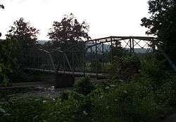
Historic Woolsey Bridge over the West Fork, White River | |
| Motto: "Where the best begins!"[1] | |
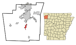 Location in Washington County and the state of Arkansas | |
| Coordinates: 35°55′57″N 94°10′57″W / 35.93250°N 94.18250°WCoordinates: 35°55′57″N 94°10′57″W / 35.93250°N 94.18250°W | |
| Country | United States |
| State | Arkansas |
| County | Washington |
| Founded | 1848 |
| Incorporated | May 18, 1885 |
| Area | |
| • Total | 3.3 sq mi (8.6 km2) |
| • Land | 3.3 sq mi (8.6 km2) |
| • Water | 0 sq mi (0 km2) |
| Elevation | 1,342 ft (409 m) |
| Population (2000) | |
| • Total | 2,042 |
| • Density | 618.8/sq mi (237.4/km2) |
| Time zone | Central (CST) (UTC-6) |
| • Summer (DST) | CDT (UTC-5) |
| ZIP code | 72774 |
| Area code(s) | 479 |
| FIPS code | 05-74360 |
| GNIS feature ID | 0081903 |
| Website |
www |
West Fork is a city in Washington County, Arkansas, United States. The population is 2,317 at the 2010 census. It is part of the Fayetteville–Springdale–Rogers, AR-MO Metropolitan Statistical Area.
History
West Fork was incorporated as a city on May 18, 1885.[2]
Geography
West Fork is located at 35°55′57″N 94°10′57″W / 35.93250°N 94.18250°W (35.932618, -94.182539).[3] According to the United States Census Bureau, the city has a total area of 3.3 square miles (8.5 km2), all of it land.
Demographics
| Historical population | |||
|---|---|---|---|
| Census | Pop. | %± | |
| 1930 | 343 | — | |
| 1940 | 392 | 14.3% | |
| 1950 | 359 | −8.4% | |
| 1960 | 350 | −2.5% | |
| 1970 | 919 | 162.6% | |
| 1980 | 1,526 | 66.1% | |
| 1990 | 1,607 | 5.3% | |
| 2000 | 2,042 | 27.1% | |
| 2010 | 2,317 | 13.5% | |
| Est. 2015 | 2,543 | [4] | 9.8% |
| Encyclopedia of Arkansas History and Culture[2] | |||
As of the census[5] of 2000, there were 2,042 people, 750 households, and 600 families residing in the city. The population density was 612.8 people per square mile (236.8/km²). There were 800 housing units at an average density of 240.1 per square mile (92.8/km²). The racial makeup of the city was 94.56% White or European American, 0.44% Black or African American, 0.93% Native American, 0.54% Asian, 1.71% from other races, and 1.81% from two or more races. 3.13% of the population were Hispanic or Latino of any race.
There were 750 households out of which 41.2% had children under the age of 18 living with them, 63.3% were married couples living together, 12.1% had a female householder with no husband present, and 19.9% were non-families. 16.4% of all households were made up of individuals and 7.6% had someone living alone who was 65 years of age or older. The average household size was 3.72 and the average family size was 4.04.
In the city the population was spread out with 30.0% under the age of 18, 8.1% from 18 to 24, 30.2% from 25 to 44, 21.8% from 45 to 64, and 9.8% who were 65 years of age or older. The median age was 33 years. For every 100 females there were 96.9 males. For every 100 females age 18 and over, there were 92.1 males.
Economically one of the poorer regions of the Northwest Arkansas region, the median income for a household in the city was $31,356, and the median income for a family was $34,818. Males had a median income of $28,037 versus $20,091 for females. The per capita income for the city was $14,976. About 34.6% of families and 25.8% of the population were below the poverty line, including 28.3% of those under age 18 and 19.7% of those age 65 or over.
Parks and recreation
The White River cuts the town of West Fork in half. The town sits on the west fork of the White River, hence the name. Alongside the river is Riverside Park, a common spot for recreational activities such as parties and reunions. The park features playground equipment, several pavilions, many benches, and a walking path. The town is flanked by mountains on both the east and west with Bloyd Mountain on the east being over 2,000 ft. in elevation.
Education
West Fork Public Schools[6] serves the city, and includes:
- West Fork Elementary
- West Fork Middle School
- West Fork High School
All of the West Fork schools are co-located on School Avenue, west of the White River. West Fork's official school mascot is a tiger.
Media
West Fork is the home of the Washington County Observer newspaper.[7]
Notable people
- Lance Eads, Republican member of the Arkansas House of Representatives for District 88 in Washington County; former resident of West Fork[8]
- Justin Harris, operator of Growing God's Kingdom Preschool in West Fork; Republican member of the Arkansas House of Representatives for District 81 (Washington and Crawford counties)[9]
- Will Phillips, advocate and public speaker
References
- ↑ "The City of West Fork, Arkansas". The City of West Fork, Arkansas. Retrieved August 15, 2013.
- 1 2 Campbell, Denele (December 28, 2011). "West Fork (Washington County)". Encyclopedia of Arkansas History and Culture. Butler Center for Arkansas Studies at the Central Arkansas Library System. Retrieved July 7, 2013.
- ↑ "US Gazetteer files: 2010, 2000, and 1990". United States Census Bureau. 2011-02-12. Retrieved 2011-04-23.
- ↑ "Annual Estimates of the Resident Population for Incorporated Places: April 1, 2010 to July 1, 2015". Retrieved July 2, 2016.
- ↑ "American FactFinder". United States Census Bureau. Retrieved 2008-01-31.
- ↑ http://www.edline.net/pages/West_Fork_Public_Schools
- ↑ "Washington County Observer". Washington County Observer. Retrieved September 11, 2012.
- ↑ "Lance Ronaco Eads". intelius.com. Retrieved April 11, 2015.
- ↑ "Justin Harris' Biography". votesmart.org. Retrieved January 6, 2014.
External links
| Wikimedia Commons has media related to West Fork, Arkansas. |
- The City of West Fork, Arkansas Portal style website, Government, Business, Library, Recreation and more
- Encyclopedia of Arkansas History & Culture entry: : West Fork (Washington County)
- Local.Arkansas.gov
- Washington County Observer
- City-Data.com Comprehensive Statistical Data and more about West Fork
