Stinnett, Texas
| Stinnett, Texas | |
|---|---|
| City | |
|
Hutchinson County Courthouse | |
 Location of Stinnett, Texas | |
 | |
| Coordinates: 35°49′34″N 101°26′37″W / 35.82611°N 101.44361°WCoordinates: 35°49′34″N 101°26′37″W / 35.82611°N 101.44361°W | |
| Country | United States |
| State | Texas |
| County | Hutchinson |
| Area | |
| • Total | 2.0 sq mi (5.2 km2) |
| • Land | 2.0 sq mi (5.2 km2) |
| • Water | 0.0 sq mi (0.0 km2) |
| Elevation | 3,186 ft (971 m) |
| Population (2000) | |
| • Total | 1,936 |
| • Density | 970/sq mi (370/km2) |
| Time zone | Central (CST) (UTC-6) |
| • Summer (DST) | CDT (UTC-5) |
| ZIP code | 79083 |
| Area code(s) | 806 |
| FIPS code | 48-70340 [1] |
| GNIS feature ID | 1369216 [2] |
| Website | cityofstinnett.com |

Stinnett (/stᵻˈnɛt/ sti-NET) is a city and county seat of Hutchinson County, Texas, United States.[3] The population was 1,936 at the 2000 census.
History
Stinnett was established in 1901 by A.P. (Ace) Borger, better known as the founder of Borger, a larger community in the county. In 1926, Stinnett replaced Plemons, which later became a ghost town, as the Hutchinson County seat. The courthouse, built in 1927 in the Spanish Renaissance style, was financed from petroleum money. The structure, designed by the architect W.F. Townes, consists of brown brick and cut white stone.[4]
Geography
Stinnett is located at 35°49′34″N 101°26′37″W / 35.82611°N 101.44361°W (35.826231, -101.443617).[5] According to the United States Census Bureau, the city has a total area of 2.0 square miles (5.2 km2), all of it land.
Climate
According to the Köppen Climate Classification system, Stinnett has a semi-arid climate, abbreviated "BSk" on climate maps.[6]
Demographics
| Historical population | |||
|---|---|---|---|
| Census | Pop. | %± | |
| 1930 | 377 | — | |
| 1940 | 635 | 68.4% | |
| 1950 | 1,170 | 84.3% | |
| 1960 | 2,695 | 130.3% | |
| 1970 | 2,014 | −25.3% | |
| 1980 | 2,222 | 10.3% | |
| 1990 | 2,166 | −2.5% | |
| 2000 | 1,936 | −10.6% | |
| 2010 | 1,881 | −2.8% | |
| Est. 2015 | 1,856 | [7] | −1.3% |
As of the census[1] of 2000, there were 1,936 people, 765 households, and 554 families residing in the city. The population density was 972.8 people per square mile (375.6/km²). There were 870 housing units at an average density of 437.2 per square mile (168.8/km²). The racial makeup of the city was 91.58% White, 0.26% African American, 1.29% Native American, 0.21% Asian, 3.98% from other races, and 2.69% from two or more races. Hispanic or Latino of any race were 7.54% of the population.
There were 765 households out of which 36.1% had children under the age of 18 living with them, 56.6% were married couples living together, 11.0% had a female householder with no husband present, and 27.5% were non-families. 26.1% of all households were made up of individuals and 13.2% had someone living alone who was 65 years of age or older. The average household size was 2.49 and the average family size was 2.98.
In the city the population was spread out with 27.9% under the age of 18, 7.7% from 18 to 24, 27.1% from 25 to 44, 22.5% from 45 to 64, and 14.7% who were 65 years of age or older. The median age was 37 years. For every 100 females there were 101.5 males. For every 100 females age 18 and over, there were 96.8 males.
The median income for a household in the city was $33,387, and the median income for a family was $42,969. Males had a median income of $35,395 versus $18,750 for females. The per capita income for the city was $16,242. About 7.9% of families and 10.6% of the population were below the poverty line, including 15.4% of those under age 18 and 7.5% of those age 65 or over.
Education
The City of Stinnett is served by the Plemons-Stinnett-Phillips Consolidated Independent School District.
Notable people
- Donny Anderson, former NFL player. Though born in Borger, Anderson graduated in 1961 from Stinnett High School. He was named All-American while playing college football at Texas Tech in Lubbock. He went on to play for the NFL's Green Bay Packers.[9]
References
- 1 2 "American FactFinder". United States Census Bureau. Archived from the original on September 11, 2013. Retrieved 2008-01-31.
- ↑ "US Board on Geographic Names". United States Geological Survey. 2007-10-25. Retrieved 2008-01-31.
- ↑ "Find a County". National Association of Counties. Archived from the original on May 31, 2011. Retrieved 2011-06-07.
- ↑ Texas Historical Commission marker at Hutchinson County Courthouse, Stinnett, Texas
- ↑ "US Gazetteer files: 2010, 2000, and 1990". United States Census Bureau. 2011-02-12. Retrieved 2011-04-23.
- ↑ Climate Summary for Stinnett, Texas
- ↑ "Annual Estimates of the Resident Population for Incorporated Places: April 1, 2010 to July 1, 2015". Retrieved July 2, 2016.
- ↑ "Census of Population and Housing". Census.gov. Archived from the original on May 11, 2015. Retrieved June 4, 2015.
- ↑ Hutchinson County Highlights
External links
Municipalities and communities of Hutchinson County, Texas, United States | ||
|---|---|---|
| Cities | 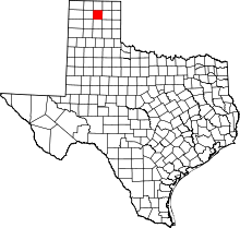 | |
| Town | ||
| CDP |
| |
| Unincorporated community | ||
| Ghost towns | ||
| Footnotes | ‡This populated place also has portions in an adjacent county or counties | |
