Levelland, Texas
| Levelland, Texas | |
|---|---|
| City | |
|
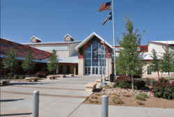
Mallet Event Center and Rodeo Arena | |
 Levelland | |
| Coordinates: 33°35′14″N 102°22′41″W / 33.58722°N 102.37806°WCoordinates: 33°35′14″N 102°22′41″W / 33.58722°N 102.37806°W[1] | |
| Country |
|
| State |
|
| County | Hockley |
| Region | Llano Estacado |
| Established | 1921 |
| Elevation[1] | 3,520 ft (1,070 m) |
| Population (2010) | |
| • Total | 13,542 |
| Time zone | CST (UTC-6) |
| ZIP code | 79336, 79338 |
| Area code | 806 |
| Website | Levelland,Texas Official Website |
Levelland is a city in Hockley County, Texas, in the United States. As of the 2010 census, the city population was 13,542. It is the county seat of Hockley County.[2] It is located on the Llano Estacado, 30 miles (48 km) west of Lubbock. Major industries include cotton farming and petroleum production. It is the home of South Plains College.
Levelland is the principal city of the Levelland Micropolitan Statistical Area, which includes all of Hockley County and part of the larger Lubbock-Levelland Combined Statistical Area.
Geography
According to the United States Census Bureau, the city has a total area of 9.9 square miles (26 km2), of which, 9.9 square miles (26 km2) of it is land and 0.04 square miles (0.10 km2) of it (0.20%) is covered by water.[3]
Demographics
| Historical population | |||
|---|---|---|---|
| Census | Pop. | %± | |
| 1930 | 1,661 | — | |
| 1940 | 3,091 | 86.1% | |
| 1950 | 8,264 | 167.4% | |
| 1960 | 10,153 | 22.9% | |
| 1970 | 11,445 | 12.7% | |
| 1980 | 13,809 | 20.7% | |
| 1990 | 13,986 | 1.3% | |
| 2000 | 12,866 | −8.0% | |
| 2010 | 13,542 | 5.3% | |
| Est. 2015 | 13,914 | [4] | 2.7% |
As of the census[6] of 2000, 12,866 people, 4,574 households, and 3,361 families resided in the city. The population density was 1,296.5 people per square mile (500.8/km²). The 5,186 housing units averaged 522.6 per square mile (201.8/km²). The racial makeup of the city was 70.34% White, 5.36% African American, 0.95% Native American, 0.18% Asian, 0.05% Pacific Islander, 20.92% from other races, and 2.21% from two or more races. Hispanics or Latinos of any race were 39.21% of the population.
Of the 4,574 households, 36.2% had children under the age of 18 living with them, 55.9% were married couples living together, 13.2% had a female householder with no husband present, and 26.5% were not families; 23.2% of all households were made up of individuals and 11.6% had someone living alone who was 65 years of age or older. The average household size was 2.68 and the average family size was 3.17.
In the city, the population was distributed as 27.6% under the age of 18, 14.0% from 18 to 24, 24.6% from 25 to 44, 19.8% from 45 to 64, and 13.9% who were 65 years of age or older. The median age was 33 years. For every 100 females, there were 93.0 males. For every 100 females age 18 and over, there were 88.0 males.
The median income for a household in the city was $28,820, and for a family was $32,408. Males had a median income of $29,800 versus $20,042 for females. The per capita income for the city was $14,296. About 15.7% of families and 20.2% of the population were below the poverty line, including 25.8% of those under age 18 and 13.2% of those age 65 or over.
Climate
| Climate data for Levelland, Texas. (1926-2013) | |||||||||||||
|---|---|---|---|---|---|---|---|---|---|---|---|---|---|
| Month | Jan | Feb | Mar | Apr | May | Jun | Jul | Aug | Sep | Oct | Nov | Dec | Year |
| Record high °F (°C) | 82 (28) |
87 (31) |
95 (35) |
101 (38) |
111 (44) |
115 (46) |
111 (44) |
106 (41) |
105 (41) |
103 (39) |
94 (34) |
81 (27) |
115 (46) |
| Average high °F (°C) | 54.1 (12.3) |
58.6 (14.8) |
66.4 (19.1) |
75.7 (24.3) |
84.0 (28.9) |
91.5 (33.1) |
92.4 (33.6) |
90.8 (32.7) |
84.2 (29) |
75.8 (24.3) |
64.0 (17.8) |
55.5 (13.1) |
74.4 (23.6) |
| Average low °F (°C) | 24.2 (−4.3) |
27.4 (−2.6) |
33.5 (0.8) |
42.8 (6) |
52.8 (11.6) |
61.8 (16.6) |
64.6 (18.1) |
63.3 (17.4) |
56.1 (13.4) |
45.1 (7.3) |
33.1 (0.6) |
26.3 (−3.2) |
44.2 (6.8) |
| Record low °F (°C) | −16 (−27) |
−8 (−22) |
3 (−16) |
20 (−7) |
26 (−3) |
43 (6) |
48 (9) |
49 (9) |
33 (1) |
18 (−8) |
0 (−18) |
−3 (−19) |
−16 (−27) |
| Average precipitation inches (mm) | 0.61 (15.5) |
0.58 (14.7) |
0.84 (21.3) |
1.09 (27.7) |
2.55 (64.8) |
2.57 (65.3) |
2.46 (62.5) |
2.45 (62.2) |
2.75 (69.9) |
1.78 (45.2) |
0.68 (17.3) |
0.63 (16) |
18.99 (482.3) |
| Average snowfall inches (cm) | 2.2 (5.6) |
2.3 (5.8) |
0.7 (1.8) |
0.2 (0.5) |
0.0 (0) |
0.0 (0) |
0.0 (0) |
0.0 (0) |
0.0 (0) |
0.2 (0.5) |
0.7 (1.8) |
2.0 (5.1) |
8.3 (21.1) |
| Source: The Western Regional Climate Center[7] | |||||||||||||
Education
- The City of Levelland is served by the Levelland Independent School District.
- The Levelland High School mascot is the Lobo.
- Levelland is also home to South Plains College.
Levelland in popular culture
The James McMurtry song "Levelland", recorded in 1995, is a song about life in the city, told from a slightly acerbic point of view. The song has also been recorded by Robert Earl Keen.
Held in the third week of July, Camp Bluegrass is a large social event, with public concerts, held on the South Plains College campus.
Levelland is also home to the 12-year-old state champions in baseball, the Levelland Kekambas. This was the first team to ever win state from Levelland. The team ended up placing fifth at the regional tournament in Fort Smith, Arkansas.
UFO Allegations
Levelland is famous as the site of a well-publicized series of UFO sightings in November 1957. Several motorists driving on various highways around Levelland claimed to see a large, egg-shaped object which emitted a blue glow and caused their automobiles to shut off.[8] In most cases, the object was sitting either on the highway or close to it. When the object took off, witnesses claimed their vehicles would restart and work normally. Among witnesses were Weir Clem, Levelland's sheriff, and Ray Jones, the town's fire chief. The United States Air Force concluded a severe electrical storm (most probably ball lightning), was the major cause for the sightings and reported auto failures.[8] However, several prominent UFO researchers, among them Dr. James E. McDonald, a physicist at the University of Arizona, and Dr. J. Allen Hynek, an astronomer at Northwestern University, disputed this explanation. Both men argued that no electrical storm was in the area when the sightings occurred.[8]
Levelland Municipal Airport (LLN)
- Airport elevation - 3514 ft above mean sea level
- Two active runways
- 17/35 - 6,110 ft
- 08/26 - 2,072 ft
Notable people
- Beau Boulter, attorney, lobbyist, and former U.S. representative from Texas' 13th congressional district, graduated from Levelland High School in 1960.
- Frank Jackson, wide receiver with the Dallas Texans, the Kansas City Chiefs, and the Miami Dolphins 1961-67, AFL All-Star 1965, born in Levelland April 14, 1939.
- Gene Mayfield (January 31, 1928 – October 2, 2009), a successful high school and college football coach, concluded his career at Levelland High School.
- The Sparkles, a garage band active 1957-72, most well known for the late 1960s singles "No Friend of Mine" and "Hipsville 29 B.C. (I Need Help)"
See also
- Llano Estacado
- South Plains
- Yellow House Canyon
- XIT Ranch
- Blackwater Draw
- List of ghost towns in Texas
References
- 1 2 "Levelland". Geographic Names Information System. United States Geological Survey.
- ↑ "Find a County". National Association of Counties. Retrieved 2011-06-07.
- ↑ "US Gazetteer files: 2010, 2000, and 1990". United States Census Bureau. 2011-02-12. Retrieved 2011-04-23.
- ↑ "Annual Estimates of the Resident Population for Incorporated Places: April 1, 2010 to July 1, 2015". Retrieved July 2, 2016.
- ↑ "Census of Population and Housing". Census.gov. Retrieved June 4, 2015.
- ↑ "American FactFinder". United States Census Bureau. Retrieved 2008-01-31.
- ↑ "Seasonal Temperature and Precipitation Information". Western Regional Climate Center. Retrieved December 12, 2014.
- 1 2 3 Clark, Jerome (1998). The UFO Book: Encyclopedia of the Extraterrestrial. Detroit: Visible Ink Press. pp. 339–340. ISBN 9781578590292.
External links
- City of Levelland
- Levelland Chamber of Commerce
- Cotton Ridge Church
- Levelland,TX from the Handbook of Texas Online
- U.S. Geological Survey Geographic Names Information System: Levelland
- Photos of the Llano Estacado
Municipalities and communities of Hockley County, Texas, United States | ||
|---|---|---|
| Cities |  | |
| Towns | ||
| Unincorporated communities | ||
