Anderson, Texas
| Anderson, Texas | |
|---|---|
| City | |
|
Grimes County Courthouse | |
 Location of Anderson, Texas | |
 | |
| Coordinates: 30°29′13″N 95°59′16″W / 30.48694°N 95.98778°WCoordinates: 30°29′13″N 95°59′16″W / 30.48694°N 95.98778°W | |
| Country | United States |
| State | Texas |
| County | Grimes |
| Area | |
| • Total | 0.5 sq mi (1.3 km2) |
| • Land | 0.5 sq mi (1.3 km2) |
| • Water | 0.0 sq mi (0.0 km2) |
| Elevation | 344 ft (105 m) |
| Population (2009) | |
| • Total | 280 |
| • Density | 558.0/sq mi (214.6/km2) |
| Time zone | Central (CST) (UTC-6) |
| • Summer (DST) | CDT (UTC-5) |
| ZIP codes | 77830, 77875 |
| Area code(s) | 936 |
| FIPS code | 48-03192[1] |
| GNIS feature ID | 1351091[2] |

Anderson is a city in Grimes County, Texas, United States. The population was 280 in 2009. It is the county seat.[3] The city and its surroundings are listed on the National Register of Historic Places as the Anderson Historic District.[4]
The town is named for Kenneth Lewis Anderson, a vice-president of the Republic of Texas who died here at the Fanthorp Inn, in 1845.
Geography
Anderson is located at 30°29′13″N 95°59′16″W / 30.48694°N 95.98778°W (30.487081, -95.987818).[5]
According to the United States Census Bureau, the city has a total area of 0.5 square miles (1.3 km2), all of it land.
Politics
John S. Freeman served as Mayor of Anderson from 1999 to 2004. Mrs. Gayle Sowell has served as Mayor of Anderson from 2004 until present.
Demographics
| Historical population | |||
|---|---|---|---|
| Census | Pop. | %± | |
| 2000 | 257 | — | |
| 2010 | 222 | −13.6% | |
| Est. 2015 | 229 | [6] | 3.2% |
As of the census[1] of 2000, there were 257 people, 92 households, and 59 families residing in the city. The population density was 498.6 people per square mile (190.8/km²). There were 119 housing units at an average density of 230.8 per square mile (88.4/km²). The racial makeup of the city was 54.86% White, 40.47% African American, 0.78% Native American, 2.72% from other races, and 1.17% from two or more races. Hispanic or Latino of any race were 4.67% of the population.
There were 92 households out of which 21.7% had children under the age of 18 living with them, 46.7% were married couples living together, 14.1% had a female householder with no husband present, and 34.8% were non-families. 32.6% of all households were made up of individuals and 17.4% had someone living alone who was 65 years of age or older. The average household size was 2.35 and the average family size was 2.95.
In the city the population was spread out with 17.9% under the age of 18, 7.8% from 18 to 24, 30.7% from 25 to 44, 29.6% from 45 to 64, and 14.0% who were 65 years of age or older. The median age was 42 years. For every 100 females there were 112.4 males. For every 100 females age 18 and over, there were 129.3 males.
The median income for a household in the city was $33,409, and the median income for a family was $34,375. Males had a median income of $24,135 versus $22,188 for females. The per capita income for the city was $14,718. About 8.3% of families and 11.0% of the population were below the poverty line, including 9.1% of those under the age of eighteen and 21.1% of those sixty five or over.
Education
Public education in the city of Anderson is provided by the Anderson-Shiro Consolidated Independent School District.
Notable residents
Chuck Norris owns a ranch between Anderson and Navasota. William Abke. Top oilfield hand of the land.
Climate
The climate in this area is characterized by hot, humid summers and generally mild to cool winters. According to the Köppen Climate Classification system, Anderson has a humid subtropical climate, abbreviated "Cfa" on climate maps.[8]
References
- 1 2 "American FactFinder". United States Census Bureau. Archived from the original on 2013-09-11. Retrieved 2008-01-31.
- ↑ "US Board on Geographic Names". United States Geological Survey. 2007-10-25. Retrieved 2008-01-31.
- ↑ "Find a County". National Association of Counties. Archived from the original on 2011-05-31. Retrieved 2011-06-07.
- ↑ http://www.nationalregisterofhistoricplaces.com/tx/Grimes/districts.html National Register of Historic Places. Retrieved 2009-10-09.
- ↑ "US Gazetteer files: 2010, 2000, and 1990". United States Census Bureau. 2011-02-12. Retrieved 2011-04-23.
- ↑ "Annual Estimates of the Resident Population for Incorporated Places: April 1, 2010 to July 1, 2015". Retrieved July 2, 2016.
- ↑ "Census of Population and Housing". Census.gov. Archived from the original on May 11, 2015. Retrieved June 4, 2015.
- ↑ Climate Summary for Anderson, Texas
External links
Municipalities and communities of Grimes County, Texas, United States | ||
|---|---|---|
| Cities | 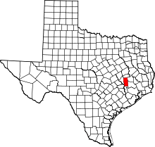 | |
| Unincorporated communities | ||
