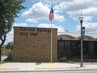
Carrizo Springs, Texas
| Carrizo Springs, Texas | |
|---|---|
| City | |
|
Carrizo Springs water tower | |
 Location in the state of Texas | |
 | |
| Coordinates: 28°31′36″N 99°51′45″W / 28.52667°N 99.86250°WCoordinates: 28°31′36″N 99°51′45″W / 28.52667°N 99.86250°W | |
| Country | United States |
| State | Texas |
| County | Dimmit |
| Government | |
| • Mayor | Adrian DeLeon |
| Area | |
| • Total | 3.1 sq mi (8.1 km2) |
| • Land | 3.1 sq mi (8.1 km2) |
| • Water | 0.0 sq mi (0.0 km2) |
| Elevation | 604 ft (184 m) |
| Population (2010) | |
| • Total | 5,368 |
| Time zone | CST (UTC-6) |
| • Summer (DST) | CDT (UTC-5) |
| ZIP code | 78834 |
| Area code(s) | 830 |
| FIPS code | 48-12988[1] |
| GNIS feature ID | 1372953[2] |
| Website |
cityofcarrizo |

Carrizo Springs is a city in and the county seat of Dimmit County, Texas, United States.[3] The population was 5,368 at the 2010 census. (2014 estimate 5,958).[4]
The name of the town comes from the local springs, which were named by the Spanish for the cane grass that once grew around them. It is the oldest town in Dimmit County. Artesian wells in the area are known for their pure, clean water. This water is often exported from Carrizo Springs for use as holy water.
History
Carrizo Springs lies along U.S. Route 83, approximately 82 miles northwest of Laredo and 45 miles north of the Mexican border. Route 83 intersects U.S. Route 277 there. The name "Carrizo Springs" derives from similarly named springs in the area; the name is Spanish for a type of grass once common in the area. Founded in 1865 by settlers from Atascosa County, Carrizo Springs is the oldest community in the county.[5]
Carrizo Springs, along with San Antonio, Uvalde, Crystal City, and Corpus Christi, was a major stop on the defunct San Antonio, Uvalde and Gulf Railroad, a Class I line which operated from 1909 until it was merged into the Missouri Pacific Railroad in 1956.[6]
Geography
Carrizo Springs is located at 28°31′36″N 99°51′45″W / 28.52667°N 99.86250°W (28.526699, -99.862423).[7]
According to the United States Census Bureau, the city has a total area of 3.1 square miles (8.0 km2), of which, 3.1 square miles (8.0 km2) of it is land and 0.32% is water.
Demographics
| Historical population | |||
|---|---|---|---|
| Census | Pop. | %± | |
| 1890 | 289 | — | |
| 1920 | 954 | — | |
| 1930 | 2,171 | 127.6% | |
| 1940 | 2,494 | 14.9% | |
| 1950 | 4,316 | 73.1% | |
| 1960 | 5,699 | 32.0% | |
| 1970 | 5,374 | −5.7% | |
| 1980 | 6,886 | 28.1% | |
| 1990 | 5,745 | −16.6% | |
| 2000 | 5,655 | −1.6% | |
| 2010 | 5,368 | −5.1% | |
| Est. 2015 | 5,898 | [8] | 9.9% |
As of the census[1] of 2000, there were 5,655 people, 1,816 households and 1,450 families residing in the city. The population density was 1,812.9 people per square mile (699.8/km²). There were 2,109 housing units at an average density of 676.1 per square mile (261.0/km²). The racial makeup of the city was 75.28% White, 1.34% African American, 0.69% Native American, 1.10% Asian, 0.12% Pacific Islander, 18.83% from other races, and 2.63% from two or more races. Hispanic or Latino of any race were 87.21% of the population.
Out of the Residents under the age of 18 living with them, 54.0% were married couples living together, 20.0% had a female householder with no husband present, and 20.1% were non-families. 17.7% of all households were made up of individuals and 9.5% had someone living alone who was 65 years of age or older. The average household size was 3.06 and the average family size was 3.47.
In the city the population was spread out with 33.3% under the age of 18, 9.7% from 18 to 24, 25.0% from 25 to 44, 18.8% from 45 to 64, and 13.2% who were 65 years of age or older. The median age was 31 years. For every 100 females there were 91.8 males. For every 100 females age 18 and over, there were 88.3 males.
The median income for a household in the city was $21,306, and the median income for a family was $22,375. Males had a median income of $24,536 versus $15,000 for females. The per capita income for the city was $8,642. About 30.8% of families and 33.8% of the population were below the poverty line, including 42.9% of those under age 18 and 29.9% of those age 65 or over.
Education
Carrizo Springs is served by the Carrizo Springs Consolidated Independent School District and home to the Carrizo Springs High School Wildcats.
The following schools serve students in the city:
- Carrizo Springs High School
- Carrizo Springs Junior High School
- Carrizo Springs Intermediate School
- Carrizo Springs Elementary School
Gallery

 Along U.S. Route 83 in Carrizo Springs
 Along U.S. Route 277 in Carrizo Springs
 Intersection of Highways 277 (west) and 83 (north) in Carrizo Springs
 First Baptist Church on Main Street in Carrizo Springs
 With its display of a large red Justin boot, the Circle V Ranch Center in Carrizo Springs reflects the western culture of the community
 Lee's Steak House off U.S. 83 in Carrizo Springs
References
- 1 2 "American FactFinder". United States Census Bureau. Archived from the original on 2013-09-11. Retrieved 2008-01-31.
- ↑ "US Board on Geographic Names". United States Geological Survey. 2007-10-25. Retrieved 2008-01-31.
- ↑ "Find a County". National Association of Counties. Archived from the original on 2011-05-31. Retrieved 2011-06-07.
- ↑ http://www.census.gov/
- ↑ Handbook of Texas Online.
- ↑ "Nancy Beck Young, "San Antonio, Uvalde and Gulf Railroad Company"". Texas State Historical Association on-line. Retrieved April 28, 2013.
- ↑ "US Gazetteer files: 2010, 2000, and 1990". United States Census Bureau. 2011-02-12. Retrieved 2011-04-23.
- ↑ "Annual Estimates of the Resident Population for Incorporated Places: April 1, 2010 to July 1, 2015". Retrieved July 2, 2016.
- ↑ "Census of Population and Housing". Census.gov. Archived from the original on May 11, 2015. Retrieved June 4, 2015.
External links
| Wikimedia Commons has media related to Carrizo Springs, Texas. |
- Handbook of Texas Online article about Carrizo Springs
- Carrizo Springs CISD Website
- Carrizo Springs, TX Detailed Profile on City-Data
Municipalities and communities of Dimmit County, Texas, United States | ||
|---|---|---|
| Cities | 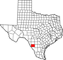 | |
| CDPs | ||
