Mason, Texas
| Mason, Texas | |
|---|---|
| City | |
|
Mason County Courthouse | |
| Nickname(s): Gem of the Hill Country | |
 Location of Mason, Texas | |
 Location of the City of Mason | |
| Coordinates: 30°44′52″N 99°13′55″W / 30.74778°N 99.23194°WCoordinates: 30°44′52″N 99°13′55″W / 30.74778°N 99.23194°W | |
| Country | United States |
| State | Texas |
| County | Mason |
| County Seat | May 20th 1861 |
| Government | |
| • Type | Mayor/Council |
| • Mayor | Brent Hinckley |
| • City Administrator | John Palacio |
| Area | |
| • Total | 3.7 sq mi (9.5 km2) |
| • Land | 3.7 sq mi (9.5 km2) |
| • Water | 0.0 sq mi (0.0 km2) |
| Elevation | 1,539 ft (469 m) |
| Population (2010) | |
| • Total | 2,114 |
| • Density | 579.7/sq mi (223.8/km2) |
| Time zone | Central (CST) (UTC-6) |
| • Summer (DST) | CDT (UTC-5) |
| ZIP code | 76856 |
| Area code(s) | 325 |
| FIPS code | 48-46968[1] |
| GNIS feature ID | 1362252[2] |
| Website | City of Mason |

Mason is the seat of Mason County, Texas, United States.[3] The town is an agricultural community on Comanche Creek southwest of Mason Mountain, on the Edwards Plateau and part of the Llano Uplift. The population was 2,114 at the 2010 census.
History
The first settler is thought to have been William S. Gamel in 1846. The settlement of Mason grew up around Fort Mason which was established by the United States War Department as a front-line defense against Kiowa, Lipan Apache and Comanche, on July 6, 1851. George W. Todd established a Fort Mason post office March 8, 1858, which became consigned to the civilian settlement on June 26, 1858.[4] The protection and commercial possibilities of the fort drew settlers. W. C. Lewis opened a general store that served soldiers and settlers. In 1860, James E. Ranck opened a second store and later became known as "The Father of Mason". He and Ben F. Gooch began leasing 5,000 acres (20 km2) of land to cotton sharecroppers. Mason was elected the county seat in 1861[5]
After the U.S. Civil War, returning Confederate veterans and German ranchers clashed in 1875 over cattle rustling and other crimes. The resulting killings were known as "The HooDoo Wars," In the midst of the war, Loyal Valley home owner Tim Williamson[6][7] was murdered by a dozen masked vigilantes who accused him of cattle theft. Williamson’s adopted son Texas Ranger Scott Cooley[7] sought revenge. Cooley and his desperadoes, which included Johnny Ringo,[8] created a reign of terror over the area. It was during this episode that Ringo committed his first murder, that of James Cheyney.[9][10]
The first courthouse and jail were built in 1869 of stone walls lined with post oak timbers. After the Hoo Doo War, a new two-story red sandstone jail was built in 1898 by L.T. Noyes of Houston. Noyes was a contractor with Diebold Safe and Lock Company.[11] A new courthouse was built in 1875, which burned down in 1877 destroying all county records. The 1878 courthouse was destroyed in 1900. The current granite courthouse was erected in 1909 by architect E. H. Hosford & Co. in the Classic Revival style.[12]
On October 3, 1918 October, eighteen months after United States Congress declared war on Germany, the Mason County Council of Defense drew up resolution to abandon the use of the German language in the county. The majority of County residents are of German heritage.[13]
The Broad Street Bridge, a reinforced concrete truss and the only one of its kind in Texas, was built across the Comanche Creek in 1918. The span is 102' long and composed of two 51' spans supported by concrete abutments with a pier at the center. The bridge was slated for replacement by the Texas Department of Transportation, but funding was canceled.[14][15]
Notable people
- Jacob Bickler (1849–1902) German immigrant, educator, founder of two Austin academies, taught summer school in Mason.
- Fred Gipson (1908–1973) Novelist: Old Yeller and its sequel Savage Sam, was a native of Mason. Both novels eventually became popular Walt Disney films. A bronze statue by Texas sculptor Garland A. Weeks depicting a boy and his dog was erected in his honor in front of the town's library.
- J. Marvin Hunter (1880–1957), author, journalist, and historian of the American West, worked with his father, John Warren Hunter, at the Mason Herald newspaper in the 1890s. Hunter later founded Frontier Times magazine and Frontier Times Museum in Bandera.
- Anna Mebus Martin (1820–1864) Chartered the Commercial Bank of Mason, wealthy business woman and rancher. Her family emigrated from Germany in 1858.
- Rebecca Tobey (b. 1948), American artist of animal sculptures
- Hugh Wolfe (1912-2010), football player
Climate
Mason experiences a humid subtropical climate, with hot summers and a generally mild winter. Temperatures range from 82 °F (27.8 C) in the summer to 45 °F (7.2 C) during winter.
| Climate data for Mason, Texas | |||||||||||||
|---|---|---|---|---|---|---|---|---|---|---|---|---|---|
| Month | Jan | Feb | Mar | Apr | May | Jun | Jul | Aug | Sep | Oct | Nov | Dec | Year |
| Record high °F (°C) | 88 (31) |
100 (38) |
98 (37) |
100 (38) |
105 (41) |
108 (42) |
107 (42) |
109 (43) |
108 (42) |
100 (38) |
92 (33) |
88 (31) |
109 (43) |
| Average high °F (°C) | 60 (16) |
65 (18) |
73 (23) |
80 (27) |
85 (29) |
91 (33) |
95 (35) |
94 (34) |
89 (32) |
80 (27) |
70 (21) |
61 (16) |
78.6 (25.9) |
| Daily mean °F (°C) | 45 (7) |
50 (10) |
57 (14) |
65 (18) |
72 (22) |
79 (26) |
82 (28) |
81 (27) |
76 (24) |
66 (19) |
56 (13) |
47 (8) |
64.7 (18) |
| Average low °F (°C) | 31 (−1) |
35 (2) |
42 (6) |
50 (10) |
59 (15) |
67 (19) |
69 (21) |
68 (20) |
63 (17) |
52 (11) |
42 (6) |
33 (1) |
50.9 (10.6) |
| Record low °F (°C) | 6 (−14) |
3 (−16) |
11 (−12) |
25 (−4) |
36 (2) |
46 (8) |
54 (12) |
51 (11) |
36 (2) |
26 (−3) |
14 (−10) |
3 (−16) |
3 (−16) |
| Average precipitation inches (mm) | .91 (23.1) |
1.97 (50) |
1.74 (44.2) |
2.05 (52.1) |
3.31 (84.1) |
4 (100) |
2 (50) |
2.52 (64) |
3 (80) |
3.01 (76.5) |
2.07 (52.6) |
1.37 (34.8) |
27.95 (711.4) |
| Source: The Weather Channel [16] | |||||||||||||
Demographics
| Historical population | |||
|---|---|---|---|
| Census | Pop. | %± | |
| 1870 | 296 | — | |
| 1880 | 575 | 94.3% | |
| 1950 | 2,456 | — | |
| 1960 | 1,910 | −22.2% | |
| 1970 | 1,806 | −5.4% | |
| 1980 | 2,153 | 19.2% | |
| 1990 | 2,041 | −5.2% | |
| 2000 | 2,134 | 4.6% | |
| 2010 | 2,114 | −0.9% | |
| Est. 2015 | 2,139 | [17] | 1.2% |
As of the census[1] of 2000, there were 2,134 people, 914 households, and 585 families residing in the city. The population density was 579.7 people per square mile (223.9/km²). There were 1,103 housing units at an average density of 299.6/sq mi (115.7/km²). The racial makeup of the city was 58.1% White, 0.19% African American, 0.61% Native American, 0.05% Asian, 8.25% from other races, and 2.76% from two or more races. Hispanic or Latino of any race were 30.04% of the population.
There were 914 households out of which 28.0% had children under the age of 18 living with them, 50.3% were married couples living together, 10.5% had a female householder with no husband present, and 35.9% were non-families. 34.0% of all households were made up of individuals and 22.8% had someone living alone who was 65 years of age or older. The average household size was 2.30 and the average family size was 2.94.
In the city the population was spread out with 24.3% under the age of 18, 5.2% from 18 to 24, 21.8% from 25 to 44, 25.3% from 45 to 64, and 23.5% who were 65 years of age or older. The median age was 44 years. For every 100 females there were 85.2 males. For every 100 females age 18 and over, there were 79.4 males.
The median income for a household in the city was $26,344, and the median income for a family was $39,310. Males had a median income of $26,736 versus $14,461 for females. The per capita income for the city was $16,525. About 15.9% of families and 18.2% of the population were below the poverty line, including 26.9% of those under age 18 and 19.7% of those age 65 or over.
Education
The city of Mason is served by the Mason Independent School District and home to the Mason High School Punchers.
Geography
Mason is located at 30°44′52″N 99°13′55″W / 30.74778°N 99.23194°W (30.747796, −99.231880).[19]
According to the United States Census Bureau, the city has a total area of 3.7 square miles (9.5 km²), all of it land.
Geology
Largest Topaz
The largest gem quality topaz found in North America came from Mason County.[20] It weighs just shy of three pounds. For much of its life it has been in the Smithsonian Institution, but recently it has returned to Mason County for display in the Museum on the Square.
Transportation
- U.S. Highway 87
- Texas State Highway 29
- Ranch Road 1871
- Ranch Road 386
See also
References
- 1 2 "American FactFinder". United States Census Bureau. Retrieved 2008-01-31.
- ↑ "US Board on Geographic Names". United States Geological Survey. 2007-10-25. Retrieved 2008-01-31.
- ↑ "Find a County". National Association of Counties. Retrieved 2011-06-07.
- ↑ "Loyal Valley Postmasters". Jim Wheat. Retrieved 2 December 2010.Jim Wheat
- ↑ Rhoades, Alice J. "Mason, Texas". Handbook of Texas Online. Texas State Historical Association. Retrieved 2 December 2010.
- ↑ "Tim Williamson". Find A Grave. Retrieved 2 December 2010.
- 1 2 Johnson, David; Miller, Rick (2009). The Mason County ""Hoo Doo"" War, 1874–1902 (A.C. Greene Series). University of North Texas Press. ISBN 978-1-57441-262-8.
- ↑ Johnson, David; Parsons, Chuck (2008). John Ringo, King of the Cowboys: His Life and Times from the Hoo Doo War to Tombstone, Second Edition (A. C. Greene). University of North Texas Press. ISBN 978-1-57441-243-7.
- ↑ Hadeler, Glenn. "The Mason County Hoo Doo Wars". TexFiles. Retrieved 2 December 2010. TexFiles
- ↑ "Johnny Ringo and the Hoo Doo War". Retrieved 30 April 2010.
- ↑ Blackburn, Edward A (2005). Wanted: Historic County Jails of Texas. TAMU Press. pp. 225–226. ISBN 978-1-58544-308-6.
- ↑ "Mason County Courthouse". Texas Escapes. Texas Escapes – Blueprints For Travel, LLC. Retrieved 2 December 2010.
- ↑ Rhoades, Alice J. "Mason County, Texas". Handbook of Texas Online. Texas State Historical Association. Retrieved 5 April 2011.
- ↑ "2007 Texas' Most Endangered Places". Preservation Texas. Retrieved 2 December 2010.
- ↑ "Broad Street Bridge". Texas Escapes. Texas Escapes – Blueprints For Travel, LLC. Retrieved 2 December 2010.
- ↑ "Monthly Averages for Mason, Texas". The Weather Channel.
- ↑ "Annual Estimates of the Resident Population for Incorporated Places: April 1, 2010 to July 1, 2015". Retrieved July 2, 2016.
- ↑ "Census of Population and Housing". Census.gov. Retrieved June 4, 2015.
- ↑ "US Gazetteer files: 2010, 2000, and 1990". United States Census Bureau. 2011-02-12. Retrieved 2011-04-23.
- ↑ Swanson, Eric R (1995). Geo-Texas: A Guide to the Earth Sciences. TAMU Press. pp. 88–89. ISBN 978-0-89096-682-2.
External links
- Mason Chamber of Commerce
- Mason County News
- Mason County Historical Commission
- Gems of the Hill Country
Municipalities and communities of Mason County, Texas, United States | ||
|---|---|---|
| City | 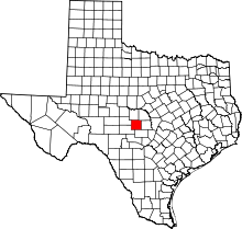 | |
| Unincorporated communities | ||
