Piatra Roșie Dacian fortress
 The hill fort | |
 Shown within Romania | |
| Location | Dealul Piatra Roșie, Luncani, Hunedoara, Romania |
|---|---|
| Coordinates | 45°36′08″N 23°08′51″E / 45.602264°N 23.147403°ECoordinates: 45°36′08″N 23°08′51″E / 45.602264°N 23.147403°E |
| Altitude | 807 m (2,648 ft) |
| History | |
| Events | Trajan's Dacian Wars |
| Site notes | |
| Condition | Ruined |
| Website | www.piatra-rosie.ro |
| Reference no. | 906 |
| Reference no. | HD-I-s-A-03200 [1] |
Piatra Roşie, which means Red Rock, was a Dacian hill fort two days march to the west from Costeşti-Cetăţuie fortress, at Luncani in Boşorod municipality. It was built in two phases. In the first phase a long (102 m) rectangular main citadel was built at the height of land[2] with watch towers on each end and two outlying watch towers. Later the larger area inside the watch towers was enclosed with walls.[3] It appears that the hilltop was flattened in the process in order to produce a usable space.[4]
 Panoramic view from the fortress
 Paved road
 Tower
Tower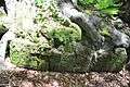 Roots
Roots Fallen blocks
 Red rock
 Fortress plan
Artefacts
 Dacian artefact from site.
 Dacian shield (1st century BC) found on site - on display in the Roman Museum Manching.
 Dacian roasting spit (1st century BC) found on site - on display in the Roman Museum Manching.
References
- ↑ "National Register of Historic Monuments in Romania, Hunedoara County" (PDF). www.inmi.ro. Retrieved 18 October 2012.
- ↑ Aerial photograph shows hill at Luncani. Oltean, Ioana Adina (2007) Dacia: landscape, colonisation and romanisation Psychology Press, London, page 81, ISBN 0-415-41252-8
- ↑ MacKendrick, Paul Lachlan (1975) The Dacian Stones Speak University of North Carolina Press, Chapel Hill, North Carolina, pages 58–60, ISBN 0-8078-1226-9
- ↑ Oltean, Ioana Adina (2007) Dacia: landscape, colonisation and romanisation Psychology Press, London, page 95, ISBN 0-415-41252-8
External links
| Wikimedia Commons has media related to Piatra Roșie Dacian fortress. |
- Cetățile dacice din Munții Orăștiei - Luncani - Piatra Roșie
- Virtual reconstruction of the fortress
- Cetatea Luncani - Piatra Roșie
Dacia topics | |||||||||||||||||||||||||||||
|---|---|---|---|---|---|---|---|---|---|---|---|---|---|---|---|---|---|---|---|---|---|---|---|---|---|---|---|---|---|
| Tribes | |||||||||||||||||||||||||||||
| Kings | |||||||||||||||||||||||||||||
| |||||||||||||||||||||||||||||
Wars with the Roman Empire |
| ||||||||||||||||||||||||||||
| Roman Dacia |
| ||||||||||||||||||||||||||||
| Research |
| ||||||||||||||||||||||||||||
| |||||||||||||||||||||||||||||
This article is issued from Wikipedia - version of the 10/23/2016. The text is available under the Creative Commons Attribution/Share Alike but additional terms may apply for the media files.