Perry, South Carolina
| Perry, South Carolina | |
|---|---|
| Town | |
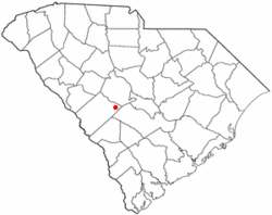 Location of Perry, South Carolina | |
| Coordinates: 33°37′40″N 81°18′40″W / 33.62778°N 81.31111°WCoordinates: 33°37′40″N 81°18′40″W / 33.62778°N 81.31111°W | |
| Country | United States |
| State | South Carolina |
| County | Aiken |
| Area | |
| • Total | 1.2 sq mi (3.0 km2) |
| • Land | 1.2 sq mi (3.0 km2) |
| • Water | 0.0 sq mi (0.0 km2) |
| Elevation | 440 ft (134 m) |
| Population (2010) | |
| • Total | 233 |
| • Density | 200/sq mi (77.4/km2) |
| Time zone | Eastern (EST) (UTC-5) |
| • Summer (DST) | EDT (UTC-4) |
| ZIP code | 29137 |
| Area code(s) | 803 |
| FIPS code | 45-55960[1] |
| GNIS feature ID | 1231644[2] |
Perry is a town in Aiken County, South Carolina, United States. The population was 233 at the 2010 census.[3] It is part of the Augusta, Georgia metropolitan area.
Geography
Perry is located at 33°37′40″N 81°18′40″W / 33.62778°N 81.31111°W (33.627689, -81.311114)[4] in eastern Aiken County. It is 3 miles (5 km) east of the town of Wagener and 27 miles (43 km) east of the city of Aiken, the county seat. The town of Salley is 4 miles (6 km) to the south. A place called the Indian Head (springs) located just east of Perry on the Old Indian Trail. Site of an ancient Native American and colonial activity. It was on the Richard Davis tract of 1767.
According to the United States Census Bureau, the town has a total area of 1.2 square miles (3.0 km2), all of it land.[3]
Demographics
| Historical population | |||
|---|---|---|---|
| Census | Pop. | %± | |
| 1890 | 69 | — | |
| 1900 | 76 | 10.1% | |
| 1910 | 179 | 135.5% | |
| 1920 | 189 | 5.6% | |
| 1930 | 166 | −12.2% | |
| 1940 | 141 | −15.1% | |
| 1950 | 133 | −5.7% | |
| 1960 | 196 | 47.4% | |
| 1970 | 209 | 6.6% | |
| 1980 | 273 | 30.6% | |
| 1990 | 241 | −11.7% | |
| 2000 | 237 | −1.7% | |
| 2010 | 233 | −1.7% | |
| Est. 2015 | 236 | [5] | 1.3% |
As of the census[1] of 2000, there were 237 people, 94 households, and 62 families residing in the town. The population density was 198.7 people per square mile (76.9/km²). There were 124 housing units at an average density of 104.0 per square mile (40.2/km²). The racial makeup of the town was 55.27% White, 44.30% African American and 0.42% Native American.
There were 94 households out of which 34.0% had children under the age of 18 living with them, 38.3% were married couples living together, 23.4% had a female householder with no husband present, and 33.0% were non-families. 29.8% of all households were made up of individuals and 7.4% had someone living alone who was 65 years of age or older. The average household size was 2.52 and the average family size was 3.16.
In the town the population was spread out with 31.2% under the age of 18, 7.6% from 18 to 24, 27.4% from 25 to 44, 24.5% from 45 to 64, and 9.3% who were 65 years of age or older. The median age was 33 years. For every 100 females there were 80.9 males. For every 100 females age 18 and over, there were 79.1 males.
The median income for a household in the town was $23,750, and the median income for a family was $31,250. Males had a median income of $30,625 versus $23,000 for females. The per capita income for the town was $13,171. About 27.1% of families and 30.4% of the population were below the poverty line, including 51.3% of those under the age of eighteen and none of those sixty five or over.
References
- 1 2 "American FactFinder". United States Census Bureau. Retrieved 2008-01-31.
- ↑ "US Board on Geographic Names". United States Geological Survey. 2007-10-25. Retrieved 2008-01-31.
- 1 2 "Geographic Identifiers: 2010 Demographic Profile Data (G001): Perry town, South Carolina". U.S. Census Bureau, American Factfinder. Retrieved August 5, 2013.
- ↑ "US Gazetteer files: 2010, 2000, and 1990". United States Census Bureau. 2011-02-12. Retrieved 2011-04-23.
- ↑ "Annual Estimates of the Resident Population for Incorporated Places: April 1, 2010 to July 1, 2015". Retrieved July 2, 2016.
- ↑ "Census of Population and Housing". Census.gov. Retrieved June 4, 2015.
Municipalities and communities of Aiken County, South Carolina, United States | ||
|---|---|---|
| Cities | 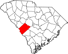 | |
| Towns | ||
| CDPs | ||
| Unincorporated communities | ||
| Footnotes | ‡This populated place also has portions in an adjacent county or counties | |