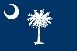
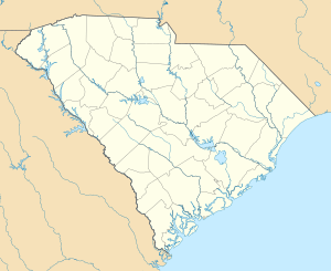
South Carolina
| State of South Carolina | |||||
|---|---|---|---|---|---|
| |||||
| Nickname(s): The Palmetto State | |||||
|
Motto(s): Dum spiro spero* (Latin), While I Breathe I Hope Animis opibusque parati† (Latin), Prepared in Mind and Resources | |||||
 | |||||
| Official language | English | ||||
| Demonym | South Carolinian | ||||
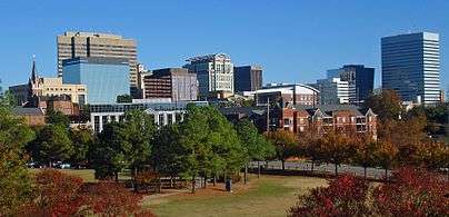
| Capital (and largest city) | Columbia | ||||
| Largest metro | Greenville-Anderson-Mauldin | ||||
| Area | |||||
| • Total |
32,020[1] sq mi (82,931 km2) | ||||
| • Width | 200 miles (320 km) | ||||
| • Length | 260 miles (420 km) | ||||
| • % water | 6 | ||||
| • Latitude | 32° 2′ N to 35° 13′ N | ||||
| • Longitude | 78° 32′ W to 83° 21′ W | ||||
| Population | |||||
| • Total | 4,896,146 (2015 est)[2] | ||||
| • Density |
155/sq mi (60.0/km2) Ranked 19th | ||||
| • Median household income | $44,625 (38th) | ||||
| Elevation | |||||
| • Highest point |
Sassafras Mountain[3][4] 3,560 ft (1,085 m) | ||||
| • Mean | 350 ft (110 m) | ||||
| • Lowest point |
Atlantic Ocean[3] sea level | ||||
| Before statehood | Province of South Carolina | ||||
| Admission to Union | May 23, 1788 (8th) | ||||
| Governor | Nikki Haley (R) | ||||
| Lieutenant Governor | Henry McMaster (R) | ||||
| Legislature | |||||
| • Upper house | Senate | ||||
| • Lower house | House of Representatives | ||||
| U.S. Senators |
Lindsey Graham (R) Tim Scott (R) | ||||
| U.S. House delegation | 6 Republicans, 1 Democrat (list) | ||||
| Time zone | Eastern: UTC -5/-4 | ||||
| ISO 3166 | US-SC | ||||
| Abbreviations | SC | ||||
| Website |
www | ||||

South Carolina ![]() i/ˌsaʊθ kærəˈlaɪnə/ is a state in the southeastern region of the United States. The state is bordered to the north by North Carolina, to the south and west by Georgia across the Savannah River, and to the east by the Atlantic Ocean.
i/ˌsaʊθ kærəˈlaɪnə/ is a state in the southeastern region of the United States. The state is bordered to the north by North Carolina, to the south and west by Georgia across the Savannah River, and to the east by the Atlantic Ocean.
South Carolina was the first state to ratify the Articles of Confederation and became the eighth state to ratify the U.S. Constitution, doing so on May 23, 1788. South Carolina became the first state to vote to secede from the Union on December 20, 1860. After the American Civil War, it was readmitted into the United States on June 25, 1868.[note 1]
South Carolina is the 40th most extensive and the 23rd most populous U.S. state. Its GDP as of 2013 was $183.6 billion, with an annual growth rate of 3.13%.[11] South Carolina comprises 46 counties. The capital and largest city is Columbia with a 2013 population of 133,358; the Greenville-Anderson-Mauldin metropolitan area had a 2013 population of 850,965.
Etymology
The name Carolina dates back to October 30, 1629, when King Charles I granted a patent to Sir Robert Heath for the lands south of 36 degrees and north of 31 degrees, "under the name, in honor of that king, of Carolina."[12] Carolus is Latin for 'Charles'.
South Carolina as part of the Carolinas is known as South Cackalacky, just as its neighboring State to the North is known as North Cackalacky[13]
Geography


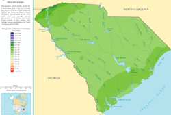
South Carolina is composed of five geographic areas, or physiographic provinces, whose boundaries roughly parallel the Atlantic coastline. South Carolina consist of the subtropical coniferous forest biome that is found through the entire state. The Atlantic Coastal Plain, which can be divided into the Outer and Inner Coastal Plains. From north to south the coast is divided into three separate areas, the Grand Strand, the Santee River Delta, and the Sea Islands. Further inland are the Sandhills, ancient dunes from what used to be South Carolina's coast millions of years ago. The Fall Line, which marks the limit of navigable rivers, runs along the boundary of the Sandhills and the Piedmont, which has rolling hills and clay soils. In the northwest corner of the state are the Blue Ridge Mountains, the smallest geographical region in the state.
The state's coastline contains many salt marshes and estuaries, as well as natural ports such as Georgetown and Charleston. An unusual feature of the coastal plain is a large number of Carolina bays, the origins of which are uncertain. The bays tend to be oval, lining up in a northwest to southeast orientation. The terrain is flat and the soil is composed entirely of recent sediments such as sand, silt, and clay. Areas with better drainage make excellent farmland, though some land is swampy. The natural areas of the coastal plain are part of the Middle Atlantic coastal forests ecoregion.[14]
Just west of the coastal plain is the Sandhills region. The Sandhills are remnants of coastal dunes from a time when the land was sunken or the oceans were higher.
The Upstate region contains the roots of an ancient, eroded mountain chain. It is generally hilly, with thin, stony clay soils, and contains few areas suitable for farming. Much of the Piedmont was once farmed. Due to the changing economics of farming, much of the land is now reforested in Loblolly pine for the lumber industry. These forests are part of the Southeastern mixed forests ecoregion.[14] At the southeastern edge of the Piedmont is the fall line, where rivers drop to the coastal plain. The fall line was an important early source of water power. Mills built to harness this resource encouraged the growth of several cities, including the capital, Columbia. The larger rivers are navigable up to the fall line, providing a trade route for mill towns.
The northwestern part of the Piedmont is also known as the Foothills. The Cherokee Parkway is a scenic driving route through this area. This is where Table Rock State Park is located.
Highest in elevation is the Blue Ridge Region, containing an escarpment of the Blue Ridge Mountains, which continue into North Carolina and Georgia, as part of the southern Appalachian Mountains. Sassafras Mountain, South Carolina's highest point at 3,560 feet (1,090 m), is located in this area.[15] Also located in this area is Caesars Head State Park. The environment here is that of the Appalachian-Blue Ridge forests ecoregion.[14] The Chattooga River, located on the border between South Carolina and Georgia, is a favorite whitewater rafting destination.
Lakes
South Carolina has several major lakes covering over 683 square miles (1,770 km2). The following are the lakes listed by size.[16]
- Lake Marion 110,000 acres (450 km2)
- Lake Strom Thurmond (also known as Clarks Hill Lake) 71,100 acres (290 km2)
- Lake Moultrie 60,000 acres (240 km2)
- Lake Hartwell 56,000 acres (230 km2)
- Lake Murray 50,000 acres (200 km2)
- Russell Lake 26,650 acres (110 km2)
- Lake Keowee 18,372 acres (70 km2)
- Lake Wylie 13,400 acres (50 km2)
- Lake Wateree 13,250 acres (50 km2)
- Lake Greenwood 11,400 acres (50 km2)
- Lake Jocassee 7,500 acres (30 km2)
- Lake Bowen
Earthquakes
Earthquakes in South Carolina demonstrate the greatest frequency along the central coastline of the state, in the Charleston area. South Carolina averages 10–15 earthquakes a year below magnitude 3 (FEMA). The Charleston Earthquake of 1886 was the largest quake ever to hit the Southeastern United States. This 7.2 magnitude earthquake killed 60 people and destroyed much of the city.[17] Faults in this region are difficult to study at the surface due to thick sedimentation on top of them. Many of the ancient faults are within plates rather than along plate boundaries.
Climate


South Carolina has a humid subtropical climate (Köppen climate classification Cfa), although high-elevation areas in the Upstate area have fewer subtropical characteristics than areas on the Atlantic coastline. In the summer, South Carolina is hot and humid, with daytime temperatures averaging between 86–93 °F (30–34 °C) in most of the state and overnight lows averaging 70–75 °F (21–24 °C) on the coast and from 66–73 °F (19–23 °C) inland. Winter temperatures are much less uniform in South Carolina.
Coastal areas of the state have very mild winters, with high temperatures approaching an average of 60 °F (16 °C) and overnight lows around 40 °F (5–8 °C). Inland, the average January overnight low is around 32 °F (0 °C) in Columbia and temperatures well below freezing in the Upstate. While precipitation is abundant the entire year in almost the entire state, the coast tends to have a slightly wetter summer, while inland, March tends to be the wettest month and winter the driest season, with November being the driest month. The highest recorded temperature is 113 °F (45 °C) in Johnston and Columbia on June 29, 2012, and the lowest recorded temperature is −19 °F (−28 °C) at Caesars Head on January 21, 1985.
Snowfall in South Carolina is somewhat uncommon in most of the state, while coastal areas receive less than an inch (2.5 cm) annually on average. It is not uncommon for areas along the coast (especially the southern coast) to receive no recordable snowfall in a given year. The interior receives a little more snow, although nowhere in the state averages more than 12 inches (30 cm) of snow annually. The mountains of extreme northwestern South Carolina tend to have the most substantial snow accumulation. Freezing rain and ice tend to be more common than snow in many areas of the state. Road bridges in South Carolina are commonly marked, "Bridge ices before road."
South Carolina is also prone to tropical cyclones and tornadoes. Two of the strongest hurricanes to strike South Carolina in recent history were Hurricane Hazel (1954) and Hurricane Hugo (1989).
| Monthly normals and extremes for various South Carolina cities | ||||||||||||||||||||||||||||||||||||||||||||||||||||||||||||||||||||||||||||||||||||||||||||||||||||||||||||||||||||||||||||||||||||||||||||||||||||||||||||||||||||||||||||||||||||||||||||||||||||||||||||||||||||||||||||||||||||||||||||||||||||||||||||||||||||||||||||||||||||||||||||||||||||||||||||||||||||||||||||||||||||||||||||||||||||||||||||||||||||||||||||||||||||||||||
|---|---|---|---|---|---|---|---|---|---|---|---|---|---|---|---|---|---|---|---|---|---|---|---|---|---|---|---|---|---|---|---|---|---|---|---|---|---|---|---|---|---|---|---|---|---|---|---|---|---|---|---|---|---|---|---|---|---|---|---|---|---|---|---|---|---|---|---|---|---|---|---|---|---|---|---|---|---|---|---|---|---|---|---|---|---|---|---|---|---|---|---|---|---|---|---|---|---|---|---|---|---|---|---|---|---|---|---|---|---|---|---|---|---|---|---|---|---|---|---|---|---|---|---|---|---|---|---|---|---|---|---|---|---|---|---|---|---|---|---|---|---|---|---|---|---|---|---|---|---|---|---|---|---|---|---|---|---|---|---|---|---|---|---|---|---|---|---|---|---|---|---|---|---|---|---|---|---|---|---|---|---|---|---|---|---|---|---|---|---|---|---|---|---|---|---|---|---|---|---|---|---|---|---|---|---|---|---|---|---|---|---|---|---|---|---|---|---|---|---|---|---|---|---|---|---|---|---|---|---|---|---|---|---|---|---|---|---|---|---|---|---|---|---|---|---|---|---|---|---|---|---|---|---|---|---|---|---|---|---|---|---|---|---|---|---|---|---|---|---|---|---|---|---|---|---|---|---|---|---|---|---|---|---|---|---|---|---|---|---|---|---|---|---|---|---|---|---|---|---|---|---|---|---|---|---|---|---|---|---|---|---|---|---|---|---|---|---|---|---|---|---|---|---|---|---|---|---|---|---|---|---|---|---|---|---|---|---|---|---|---|---|---|---|---|---|---|---|---|---|---|---|---|---|---|---|---|---|---|---|---|---|---|---|---|---|---|---|---|---|---|---|---|---|---|---|---|---|---|
Greenville
| ||||||||||||||||||||||||||||||||||||||||||||||||||||||||||||||||||||||||||||||||||||||||||||||||||||||||||||||||||||||||||||||||||||||||||||||||||||||||||||||||||||||||||||||||||||||||||||||||||||||||||||||||||||||||||||||||||||||||||||||||||||||||||||||||||||||||||||||||||||||||||||||||||||||||||||||||||||||||||||||||||||||||||||||||||||||||||||||||||||||||||||||||||||||||||
Columbia
| ||||||||||||||||||||||||||||||||||||||||||||||||||||||||||||||||||||||||||||||||||||||||||||||||||||||||||||||||||||||||||||||||||||||||||||||||||||||||||||||||||||||||||||||||||||||||||||||||||||||||||||||||||||||||||||||||||||||||||||||||||||||||||||||||||||||||||||||||||||||||||||||||||||||||||||||||||||||||||||||||||||||||||||||||||||||||||||||||||||||||||||||||||||||||||
Charleston
| ||||||||||||||||||||||||||||||||||||||||||||||||||||||||||||||||||||||||||||||||||||||||||||||||||||||||||||||||||||||||||||||||||||||||||||||||||||||||||||||||||||||||||||||||||||||||||||||||||||||||||||||||||||||||||||||||||||||||||||||||||||||||||||||||||||||||||||||||||||||||||||||||||||||||||||||||||||||||||||||||||||||||||||||||||||||||||||||||||||||||||||||||||||||||||
Hurricanes and tropical cyclones
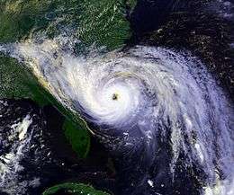
The state is occasionally affected by tropical cyclones. This is an annual concern during hurricane season, which lasts from June 1 to November 30. The peak time of vulnerability for the southeast Atlantic coast is from early August to early October, during the Cape Verde hurricane season. Memorable hurricanes to hit South Carolina include Hazel (1954) and Hugo (1989), both Category 4 hurricanes.[29]
South Carolina averages around 50 days of thunderstorm activity a year. This is less than some of the states further south, and it is slightly less vulnerable to tornadoes than the states which border on the Gulf of Mexico. Some notable tornadoes have struck South Carolina, and the state averages around 14 tornadoes annually. Hail is common with many of the thunderstorms in the state, as there is often a marked contrast in temperature of warmer ground conditions compared to the cold air aloft.[29]
History
Discovery and exploration
About 30 Native American tribes lived in what is now South Carolina at the time the first Europeans arrived in the region. The tribes were differentiated by language and occupied geographic territories. Among the most important were the Catawba (Siouan language), Cherokee (Iroquoian languages), and Yamasee (Muskhogean language). It is believed that the first humans settled in the current South Carolina about 15,000 years ago. However, the Topper Site in Allendale County, has been tentatively dated to about 30,000 years ago.
The first European to land was Francisco Gordillo in 1521, from Spain. Five years later, in 1526, another Spaniard, Lucas Vázquez de Ayllón, founded the first European settlement in the territory that now constitutes the United States. This settlement was named San Miguel de Gualdape and was founded with 600 settlers, including African slaves, but was abandoned three months later. The region would later be claimed by both the Spanish and the French. The French made several attempts at colonization, which failed because of the hostility of Indian tribes and a lack of provisions.
England claimed the current South Carolina at the beginning of the seventeenth century. In 1629, King Charles I gave the southern colonies to Robert Heath. This colony included the regions that now constitute North Carolina, South Carolina, Georgia and Tennessee. Heath named this colony Carolana, a Latin word which means 'Land of Charles'.
British colony

The colony of Carolina was settled by wealthy English aristocrats, mostly migrating from Barbados, where they had already set up sugar plantations.[30] King Charles II gave eight aristocrats a royal charter to settle Carolina (Carolina is Latin for "Charlesian") because earlier they had helped him regain his throne. Parts of Carolina (mostly the coastal areas) had been colonized earlier by Spain (see Fort Caroline), but battles between the Spanish and the Native Americans resulted in the Spanish people retreating to Florida, Cuba, Mexico, and Central and South America.
Carolina was settled to make profit from trade and also by selling land. John Locke, an English philosopher, wrote a constitution for the colony that covered topics such as land divisions and social rankings. In the early years, not many people bought land there, so the proprietors lowered the price on some portions.
Carolina did not develop as planned. It split into northern and southern Carolina, creating two different colonies. It separated because of political reasons as the settlers wanted political power. In 1719 settlers in southern Carolina seized control from its proprietors. Then, in 1729, Carolina became two royal colonies—North Carolina and South Carolina. Farmers from inland Virginia settled northern Carolina. They grew tobacco, and sold timber and tar, both categories of naval stores needed by England. The northern Carolina coast lacked a good harbor, so many of the farmers used Virginia's ports to conduct their trade.
Southern Carolina prospered from the fertility of the Low Country and the harbors, such as that at Charles Town (later Charleston). It allowed religious toleration, encouraging settlement by merchants from the successful French Huguenot and Sephardic Jewish communities of London.[31] Settlements spread, and trade in deerskin, lumber, and beef thrived. Rice cultivation was developed on a large scale with the help of skills and techniques of slaves imported from rice-growing regions of Africa. They created the large earthworks of dams and canals required to irrigate the rice fields. In addition, indigo became a commodity crop, also developed with the skills of African slaves.
The cultivation and processing of Indigo plant, a plant source of blue dye, was developed here by a young English woman, Eliza Lucas, a planter's daughter who had come with her father, also a military officer, from the Caribbean. She took over managing the plantation when he was assigned elsewhere. Indigo became an important commodity crop for the dyeing of textiles. Slave labor was integral to the economic success of rice and indigo as commodity crops. In South Carolina, slaves made up a majority of the population after 1708, and the demand for labor was so high that many were imported from Africa.
After the Stono Rebellion of 1739, the colony prohibited importing African slaves through Charleston for ten years, having observed they were more likely to cause rebellions than slaves from the Caribbean, who were already "seasoned" or those born in the colony. Slaves and their descendants comprised a majority of the population of the state through the American Civil War and to the turn of the 20th century.
The American Revolution

On March 26, 1776, the colony adopted the Constitution of South Carolina.[32] John Rutledge was elected as the state's first president. He was succeeded by Rawlins Lowndes who served March 6, 1778 – January 9, 1779. On February 5, 1778, South Carolina became the first state to ratify the Articles of Confederation,[33] the initial governing document of the United States.
In 1780, South Carolinian loyalists to the British crown helped British troops recapture South Carolina from the previously successful rebels. On January 17, 1781, the Battle of Cowpens won by the American forces, and this victory marked the beginning of the decline in British fortunes. In 1782 the British decided to evacuate their troops by the end of the year, taking thousands of Loyalists and their slaves with them, as well as slaves to whom they had given freedom for escaping from rebels and joining their lines.
The American Revolution caused a shock to slavery in the South. Many thousands of slaves fled to British authorities to obtain freedom; and many of those left with the British in the last days of the war. Others secured their freedom by escaping to perceived friendlier locations during the turmoil. Estimates are that 25,000 slaves (30% of those in South Carolina) fled, migrated or died during the disruption of the war.[34]
The current United States Constitution was proposed for adoption by the states on September 17, 1787, and South Carolina was the 8th state to ratify it, on May 23, 1788.
Federal period
South Carolina politics between 1783 and 1795 were marred by rivalry between a Federalist elite supporting Alexander Hamilton and the central government in Philadelphia, and a large proportion of common people. The latter were often members of 'Republican Societies,' and they supported the Republican-Democrats, headed by Thomas Jefferson and James Madison (who were, of course, part of the planter elite). This party wanted more democracy in the US, especially in South Carolina. Sephardic Jews had prospered in contributing to the state and by 1800, South Carolina had the largest population of Jews in the United States, mostly based in Charleston and Savannah.[31]
Most people supported the French Revolution (1789–1795), as the French had been allies and Americans were proud of their own revolution. In addition, due to substantial French Huguenot immigration during the early 18th century of the colonial years, Charleston was one of the most French-influenced cities in the USA. Leading South Carolina figures, such as governors Charles Pinckney and William Moultrie, backed with money and actions the French plans to further their political, strategic, and commercial goals in North America. This pro-French stance and attitude of South Carolina ended soon because of the XYZ Affair, a diplomatic affair that resulted in quasi-war between France and the US.
Antebellum
From 1790 until 1865, wealthy landowners and slave owners were firmly in exclusive control of South Carolina. A person was not eligible to sit in the State House of Representatives unless he was legally seized and possessed in his own right of a settled freehold estate of 500 acres of land and 10 Negroes, or at least 150 pounds sterling, clear of debt. If the person was a non-resident, he was required to own a settled freehold estate of 500 pounds sterling, clear of debt.[35] To sit in the State Senate, a person was required to own a settled freehold estate of 300 pounds sterling, clear of debt.[35] The governor was elected by the legislature.[36]
Antebellum South Carolina did more to advance nullification and secession than any other Southern state. Its first attempt at nullification was in 1822, following discovery of a conspiracy for a slave rebellion led by Denmark Vesey, a freed slave. As part of its response, the state passed a Negro Seamen Act, requiring foreign and northern black sailors to be prohibited from interacting with people in South Carolina ports. As it violated international treaties, this law was declared unconstitutional by Supreme Court Justice William Johnson. His ruling was not enforced.
In 1832, a South Carolina state convention passed the Ordinance of Nullification, declaring the federal tariff laws of 1828 and 1832 unconstitutional, null and not to be enforced in the state of South Carolina after February 1, 1833.
This led to the Nullification Crisis, in which U.S. President Andrew Jackson (as of 2015, the only president to have been born in South Carolina) was authorized through the Force Bill to use whatever military force necessary to enforce federal law in the state. This was the first U.S. legislation denying individual states the right to secede. As a result of Jackson's threat of force, the South Carolina state convention was re-convened and repealed the Ordinance of Nullification in March.
Anti-abolitionist feelings ran strong in South Carolina, where the economy depended on slave labor and which had a majority-slave population. In 1856, Democrat South Carolina congressman Preston Brooks entered the United States Senate chamber and, with a metal-tipped cane, beat Massachusetts Republican Senator Charles Sumner. He drew blood and injured Sumner badly enough that the latter was unable to serve for several months. Brooks was retaliating for a speech Sumner had given in which he attacked slavery and insulted South Carolinians. Brooks resigned his seat but received a hero's welcome on returning home and was promptly re-elected.
American Civil War

On December 20, 1860, when it became clear that Abraham Lincoln, an opponent of the expansion of slavery into new territories, would become the next U.S. president, South Carolina became the first U.S. state to declare its secession from the Union. On April 12, 1861, Confederate batteries began shelling Fort Sumter in Charleston Harbor, and the American Civil War began. The U.S. Navy effectively blockaded Charleston and seized the Sea Islands. Planters had taken their families (and sometimes slaves) to points inland for refuge.
The Union Army set up an experiment in freedom for the ex-slaves, in which they started education and farmed land for themselves. South Carolinian troops participated in major Confederate campaigns, but no major battles were fought inland. General William Tecumseh Sherman marched through the state in early 1865, destroying numerous plantations, and captured the state capital of Columbia on February 17. Fires began that night and by next morning, most of the central city was destroyed. South Carolina suffered 18,666 military deaths during the American Civil War, which was nearly one-third of the white male population of fighting age.[37]
Reconstruction
After the war, South Carolina was restored to the United States during Reconstruction. Under presidential Reconstruction (1865–66), freedmen (former slaves) were given limited rights. Under Radical reconstruction (1867–1877), a Republican coalition of freedmen, carpetbaggers and scalawags was in control, supported by Union Army forces. They established public education, welfare institutions, and home rule for counties, expanding democracy.
Until the 1868 presidential election, South Carolina's legislature, not the voters, chose the state's electors for the presidential election. South Carolina was the last state to choose its electors in this manner. On October 19, 1871 President Ulysses S. Grant suspended habeas corpus in nine South Carolina counties under the authority of the Ku Klux Klan Act.[38] Led by Grant's Attorney General Amos T. Akerman, hundreds of Klansmen were arrested while 2000 Klansmen fled the state.[38] This was done in order to suppress Klan violence against African-American and white voters in the South.[38] In the mid to late 1870s, white Democrats used paramilitary groups such as the Red Shirts to intimidate and terrorize black voters. They regained political control of the state under conservative white "Redeemers" and pro-business Bourbon Democrats. In 1877, the federal government withdrew its troops as part of the Compromise of 1877 that ended Reconstruction.
Populist and agrarian movements

The state became a hotbed of racial and economic tensions during the Populist and Agrarian movements of the 1890s. A Republican-Populist biracial coalition took power away from White Democrats temporarily. To prevent that from happening again, Democrats gained passage of a new constitution in 1895 that effectively disfranchised almost all blacks and many poor whites by new requirements for poll taxes, residency, and literacy tests that dramatically reduced the voter rolls. By 1896, only 5,500 black voters remained on the voter registration rolls, although they constituted a majority of the state's population.[39] The 1900 census demonstrated the extent of disenfranchisement: the 782,509 African American citizens comprised more than 58% of the state's population, but they were essentially without any political representation in the Jim Crow society.[40]
The 1895 constitution overturned local representative government, reducing the role of the counties to agents of state government, effectively ruled by the General Assembly, through the legislative delegations for each county. As each county had one state senator, that person had considerable power. The counties lacked representative government until home rule was passed in 1975.[41]
Governor "Pitchfork Ben Tillman", a Populist, led the effort to disenfranchise the blacks and poor whites, although he controlled Democratic state politics from the 1890s to 1910 with a base among poor white farmers. During the constitutional convention in 1895, he supported another man's proposal that the state adopt a one-drop rule, as well as prohibit marriage between whites and anyone with any known African ancestry.
Some members of the convention realized that prominent white families with some African ancestry could be affected by such legislation. In terms similar to a debate in Virginia in 1853 on a similar proposal (which was dropped), George Dionysius Tillman said the following in opposition:
If the law is made as it now stands respectable families in Aiken, Barnwell, Colleton, and Orangeburg will be denied the right to intermarry among people with whom they are now associated and identified. At least one hundred families would be affected to my knowledge. They have sent good soldiers to the Confederate Army, and are now landowners and taxpayers. Those men served creditably, and it would be unjust and disgraceful to embarrass them in this way. It is a scientific fact that there is not one full-blooded Caucasian on the floor of this convention. Every member has in him a certain mixture of… colored blood. The pure-blooded white has needed and received a certain infusion of darker blood to give him readiness and purpose. It would be a cruel injustice and the source of endless litigation, of scandal, horror, feud, and bloodshed to undertake to annul or forbid marriage for a remote, perhaps obsolete trace of Negro blood. The doors would be open to scandal, malice and greed; to statements on the witness stand that the father or grandfather or grandmother had said that A or B had Negro blood in their veins. Any man who is half a man would be ready to blow up half the world with dynamite to prevent or avenge attacks upon the honor of his mother in the legitimacy or purity of the blood of his father.[42][43][44][45]
The state postponed such a one-drop law for years. Virginian legislators adopted a one-drop law in 1924, forgetting that their state had many people of mixed ancestry among those who identified as white.
20th century
Early in the 20th century, South Carolina developed a thriving textile industry. The state also converted its agricultural base from cotton to more profitable crops; attracted large military bases through its powerful Democratic congressional delegation, part of the one-party South following disfranchisement of blacks at the turn of the century; and created tourism industries. During the early part of the 20th century, thousands of African Americans left South Carolina and other southern states for jobs and better opportunities in northern, Midwestern and western cities. In total from 1910 to 1970, 6.5 million blacks left the South in the Great Migration. By 1930 South Carolina had a white majority[46] for the first time since 1708.
The struggle of the Civil Rights Movement took place in South Carolina as well as other places in the South.
South Carolina was one of several states that initially rejected the Nineteenth Amendment (1920) giving women the right to vote. The South Carolina legislature later ratified the amendment on July 1, 1969.
21st century
As of 2015, South Carolina had one of the lowest percentages among all states of women in state legislature, at 13.5% (only Louisiana, Oklahoma, and Wyoming had a lower percentage; the national average is 24.3%; with the highest percentage being in Colorado at 41%).[47] In 2011, South Carolina ranked first in the country in the rate of women killed by men.[48]
As the 21st century progresses, South Carolina attracts new business by having a 5% corporate income tax rate, no state property tax, no local income tax, no inventory tax, no sales tax on manufacturing equipment, industrial power or materials for finished products; no wholesale tax, no unitary tax on worldwide profits.[49]
Starting January 1, 2013, South Carolina was one of the first states that no longer pays for 'early elective' deliveries of babies, under either Medicaid and private insurance. The term early elective is defined as a labor induction or Cesarean section between 37–39 weeks that is not medically based. This change is intended to result in healthier babies and fewer unnecessary costs for South Carolina.[50]
On November 20, 2014, South Carolina became the 35th state to legalize same-sex marriages.[51]
Demographics
The United States Census Bureau estimates that the population of South Carolina was 4,896,146 on July 1, 2015, a 5.85% increase since the 2010 United States Census.[2]
| Historical population | |||
|---|---|---|---|
| Census | Pop. | %± | |
| 1790 | 249,073 | — | |
| 1800 | 345,591 | 38.8% | |
| 1810 | 415,115 | 20.1% | |
| 1820 | 502,741 | 21.1% | |
| 1830 | 581,185 | 15.6% | |
| 1840 | 594,398 | 2.3% | |
| 1850 | 668,507 | 12.5% | |
| 1860 | 703,708 | 5.3% | |
| 1870 | 705,606 | 0.3% | |
| 1880 | 995,577 | 41.1% | |
| 1890 | 1,151,149 | 15.6% | |
| 1900 | 1,340,316 | 16.4% | |
| 1910 | 1,515,400 | 13.1% | |
| 1920 | 1,683,724 | 11.1% | |
| 1930 | 1,738,765 | 3.3% | |
| 1940 | 1,899,804 | 9.3% | |
| 1950 | 2,117,027 | 11.4% | |
| 1960 | 2,382,594 | 12.5% | |
| 1970 | 2,590,516 | 8.7% | |
| 1980 | 3,121,820 | 20.5% | |
| 1990 | 3,486,703 | 11.7% | |
| 2000 | 4,012,012 | 15.1% | |
| 2010 | 4,625,364 | 15.3% | |
| Est. 2015 | 4,896,146 | 5.9% | |
| Source: 1910–2010[52] 2015 estimate[2] | |||
As of the 2013 census estimate, the racial make up of the state is 68.3% White (63.9% non-Hispanic white), 27.9% Black or African American, 0.5% American Indian and Alaska Native, 1.5% Asian, 0.1% Native Hawaiian and other Pacific Islander, 1.7% from two or more races. 5.3% of the total population was of Hispanic or Latino origin of any race.[53]
| Racial composition | 1990[54] | 2000[55] | 2010[56] | 2015[57] |
|---|---|---|---|---|
| White | 69.0% | 67.2% | 66.2% | 68.4% |
| Black | 29.8% | 29.5% | 27.9% | 27.6% |
| Asian | 0.6% | 0.9% | 1.3% | 1.6% |
| Native American | 0.2% | 0.3% | 0.4% | 0.5% |
| Native Hawaiian and other Pacific Islander | – | – | 0.1% | 0.1% |
| Two or more races | – | 1.0% | 1.7% | 1.8% |

According to the United States Census Bureau, as of 2014, South Carolina had an estimated population of 4,896,146, which is an increase of 63,664 from the prior year and an increase of 270,782, or 5.85%, since the year 2010. Immigration from outside the United States resulted in a net increase of 36,401 people, and migration within the country produced a net increase of 115,084 people. According to the University of South Carolina's Arnold School of Public Health, Consortium for Latino Immigration Studies, South Carolina's foreign-born population grew faster than any other state between 2000 and 2005.[58][59]
An August 2011 Public Policy Polling survey found that 21% of South Carolina voters thought that same-sex marriage should be legal, while 69% thought it should be illegal and 10% were not sure. A separate question on the same survey found that 48% of South Carolina voters supported the legal recognition of same-sex couples, with 19% supporting same-sex marriage, 29% supporting civil unions but not marriage, 51% favoring no legal recognition and 2% not sure.[60]
Religion
In 2010:
- Evangelical Protestant 1,410,988 adherents
- Mainline Protestant 482,103 adherents
- Black Protestant 256,178 adherents
- Catholic 181,743 adherents
- Other 76,874 adherents
- Baha'i Faith 17,559 adherents
- Judaism 6,511 adherents
- Islam 5,792 adherents
- Orthodox 5,557 adherents
- Unclaimed 2,211,921[61]
According to the Association of Religion Data Archives(ARDA), in 2010 the largest denominations were the Southern Baptist Convention with 913,763 adherents, the United Methodist Church with 274,111 adherents, and the Roman Catholic Church with 181,743 adherents. Fourth largest is the African Methodist Episcopal Church with 564 congregations and 121,000 members and fifth largest is the Presbyterian Church (USA) with 320 congregations and almost 100,000 members.[61]
As of 2010, South Carolina is the American state with the highest per capita Baha'i population with 17,559 adherents,[62] making it the second largest religion in the state.[63]
Major cities
In 2016, the US Census Bureau released 2015 population estimates for South Carolina's most populous cities.[64]
| | |||||||||
|---|---|---|---|---|---|---|---|---|---|
| Rank | Name | County | Pop. | ||||||
 Columbia 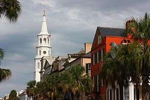 Charleston |
1 | Columbia | Richland | 133,803 |  North Charleston  Mount Pleasant | ||||
| 2 | Charleston | Charleston | 132,609 | ||||||
| 3 | North Charleston | Charleston | 108,304 | ||||||
| 4 | Mount Pleasant | Charleston | 81,317 | ||||||
| 5 | Rock Hill | York | 71,548 | ||||||
| 6 | Greenville | Greenville | 64,579 | ||||||
| 7 | Summerville | Dorchester | 48,848 | ||||||
| 8 | Sumter | Sumter | 40,816 | ||||||
| 9 | Goose Creek | Berkeley | 40,633 | ||||||
| 10 | Hilton Head Island | Beaufort | 40,512 | ||||||
Economy
.jpg)
According to the U.S. Bureau of Economic Analysis, South Carolina's gross state product (GSP) in current dollars was $97 billion in 1997, and $153 billion in 2007. Its per-capita real gross domestic product (GDP) in chained 2000 dollars was $26,772 in 1997, and $28,894 in 2007; that represents 85% of the $31,619 per-capita real GDP for the United States overall in 1997, and 76% of the $38,020 for the U.S. in 2007. The state debt in 2012 was calculated by one source to be $22.9bn, or $7,800 per taxpayer.[66]
Major agricultural outputs of the state are: tobacco, poultry, cattle, dairy products, soybeans, hay, rice, and swine. Industrial outputs include: textile goods, chemical products, paper products, machinery, automobiles and automotive products and tourism.[67][68] According to the Bureau of Labor Statistics, as of March 2012, South Carolina has 1,852,700 nonfarm jobs of which 12% are in manufacturing, 11.5% are in leisure and hospitality, 19% are in trade, transportation and utilities, and 11.8% are in education and health services. The service sector accounts for 83.7% of the South Carolina economy.[69]

During the economic downturn in the Late 2000s Recession, South Carolina's Unemployment Rate peaked at 12.0% for November and December 2009. It is continuing a steady decline with an unemployment rate of 8.9% as of March 2012.[70]
Many large corporations have moved their locations to South Carolina. Boeing opened an aircraft manufacturing facility in Charleston in 2011, which serves as one of two final assembly sites for the 787 Dreamliner. South Carolina is a right-to-work state[71] and many businesses utilize staffing agencies to temporarily fill positions. This labor force is appealing to companies because of lower wages and no responsibility of maintaining healthcare benefits for its temporary employees. Domtar, located in Rock Hill, is the only Fortune 500 company headquartered in South Carolina.[72] The Fortune 1000 list includes SCANA, Sonoco Products and ScanSource.
South Carolina also benefits from foreign investment. There are 1,950 foreign-owned firms operating in South Carolina employing almost 135,000 people.[73] Foreign Direct Investment (FDI) brought 1.06 billion dollars to the state economy in 2010.[74] Since 1994, BMW has had a production facility in Spartanburg County near Greer.
The arts
South Carolina has many venues for visual and performing arts. The Gibbes Museum of Art in Charleston, the Greenville County Museum of Art, the Columbia Museum of Art, Spartanburg Art Museum, and the South Carolina State Museum in Columbia among others provide access to visual arts to the state. There are also numerous historic sites and museums scattered throughout the state paying homage to many events and periods in the state's history from Native American inhabitation to the present day.
South Carolina also has performing art venues including the Peace Center in Greenville, the Koger Center for the Arts in Columbia, and the Newberry Opera House, among others to bring local, national, and international talent to the stages of South Carolina. There are several large venues in the state that can house major events, such as Colonial Life Arena in Columbia, Bon Secours Wellness Arena in Greenville, and North Charleston Coliseum.
One of the nation's major performing arts festivals, Spoleto Festival USA, is held annually in Charleston. There are also countless local festivals throughout the state highlighting many cultural traditions, historical events, and folklore.
According to the South Carolina Arts Commission, creative industries generate $9.2 billion annually and support over 78,000 jobs in the state.[75] A 2009 statewide poll by the University of South Carolina Institute for Public Service and Policy Research found that 67% of residents had participated in the arts in some form during the past year and on average citizens had participated in the arts 14 times in the previous year.
Transportation
Major highways
Major interstate highways passing through include: I-20 which runs from Florence in the east through Columbia to the southwestern border near Aiken; I-26 which runs from Charleston in the southeast through Columbia to Spartanburg and the northern border in Spartanburg County; I-77 which runs from York County in the north to Columbia; I-85 which runs from Cherokee County in the north through Spartanburg and Greenville to the southwestern border in Oconee County; I-385 which runs from Greenville and intersects with I-26 near Clinton; and I-95 which runs from the northeastern border in Dillon County to Florence and on to the southern border in Jasper County.
Rail
Passenger
Amtrak operates four passenger routes in South Carolina: the Crescent, the Palmetto, the Silver Meteor, and the Silver Star. The Crescent route serves the Upstate cities, the Silver Star serves the Midlands cities, and the Palmetto and Silver Meteor routes serve the low country cities.
Station stops
| Station | Connections |
|---|---|
| Camden | |
| North Charleston | |
| Columbia | |
| Clemson | |
| Denmark | |
| Dillon | |
| Florence | |
| Greenville | |
| Kingstree | |
| Spartanburg | |
| Yemassee |
Freight
CSX Transportation and Norfolk Southern are the only Class I railroad companies in South Carolina, as other freight companies in the state are short lines.
Major and regional airports
There are seven significant airports in South Carolina, all of which act as regional airport hubs. The busiest by passenger volume is Charleston International Airport.[76] Just across the border in North Carolina is Charlotte/Douglas International Airport, the 30th busiest airport in the world, in terms of passengers.[77]
- Columbia Metropolitan Airport – Columbia
- Charleston International Airport – North Charleston
- Greenville-Spartanburg International Airport – Greenville/Spartanburg
- Florence Regional Airport – Florence
- Myrtle Beach International Airport – Myrtle Beach
- Hilton Head Airport – Hilton Head Island/Beaufort
- Rock Hill/York County Airport – Rock Hill
Government and politics
South Carolina's state government consists of the Executive, Legislative, and Judicial branches. Also relevant are the state constitution, law enforcement agencies, federal representation, state finances, and state taxes.
South Carolina has historically had a weak executive branch and a strong legislature. Before 1865, governors in South Carolina were appointed by the General Assembly, and held the title "President of State." The 1865 Constitution changed this process, requiring a popular election. Local governments were also weak. But, the 1867 Constitution, passed during the Reconstruction era, extended democratization by establishing home rule for counties, which were established from the former designated districts of the state.
The 1895 state constitution overturned this, reducing the role of counties and strengthening the relative role of the state legislature; essentially the counties were agents of the state and ruled by the General Assembly through the legislative delegation for each county.[41] They are geographically comprehensive; all areas of the state are included in counties. As each county had one state senator, that position was particularly powerful. This status continued until 1973, when the state constitution was amended to provide for home rule for the counties. During this time the state had changed, with increasing urbanization, but rural counties retained proportionally more power as the legislature was based in representatives elected from counties rather than population districts.[78]
The federal court case, Reynolds v. Sims (1964), "established the one-man, one-vote concept for electoral representation at the state level. Legislators were now supposed to represent more or less equal numbers of people."[78] Residents of urban areas had been found to be markedly underrepresented in the legislature under the county-based system. Reapportionment made obvious the need for other changes to county structure, leading to the legislature passing the constitutional amendment. The Home Rule Act of 1975 implemented the amendment giving more power to the counties. With urbanization their governments have become increasingly important in the state.[78]
Several changes to the state constitution have affected the office of the governor and the cabinet. In 1926 the governor's term was extended from two to four years; in 1982 the governor was allowed to run for a second succeeding term. In 1993, the state passed an amendment requiring a limited cabinet (all of whom must be popularly elected).
As of January 2, 2016, there were 2,948,772 registered voters.[79][80]
Education
As of 2010, South Carolina is one of three states that has not agreed to use competitive international math and language standards.[81]
In 2014, the state supreme court ruled that the state had failed to provide a "minimally adequate" education to children in all parts of the state as required by the state's constitution.[82]
South Carolina has 1,144 K–12 schools in 85 school districts, with an enrollment of 712,244 as of fall 2009.[83][84] As of the 2008–2009 school year, South Carolina spent $9,450 per student which places it 31st in the country for per student spending.[85]
In 2015, the national average SAT score was 1490. South Carolina students averaged 1442.[86]
Institutions of higher education
South Carolina has a diverse group of institutions of higher education, from large state-funded research universities to small colleges that cultivate a liberal arts, religious or military tradition, including the following:
- Listed in order of date of founding
- The College of Charleston, founded in 1770 and chartered in 1785, is the oldest institution of higher learning in South Carolina, the 13th oldest in the United States, and the first municipal college in the country. The college is in company with the Colonial Colleges as one the original and foundational institutions of higher education in the United States. Its founders include three signers of the United States Declaration of Independence and three signers of the United States Constitution. The college's historic campus, which is listed on the U.S. Department of the Interior's National Register of Historic Places, forms an integral part of Charleston's colonial-era urban center. The Graduate School of the College of Charleston, offers a number of degree programs and coordinates support for its nationally recognized faculty research efforts.
- The University of South Carolina is a flagship, public, co-educational, research university, with seven satellite campuses, located in Columbia. The institution was founded in 1801 as South Carolina College, and its original campus, The Horseshoe, is listed on the National Register of Historic Places. The university's main campus covers over 359 acres (1.5 km2) in the urban core less than one city block from the South Carolina State House. The University of South Carolina maintains an enrollment of over 32,800 students on the Columbia campus.

- Furman University is a private, coeducational, non-sectarian, liberal arts university in Greenville. Founded in 1826, Furman enrolls approximately 2,600 undergraduate and 500 graduate students. Furman is the largest private institution in South Carolina. The university is primarily focused on undergraduate education (only two departments, education and chemistry, offer graduate degrees).
- Erskine College is a private, coeducational liberal arts college located in Due West, South Carolina. The college was founded in 1839 and is affiliated with the Associate Reformed Presbyterian Church, which maintains a theological seminary on the campus.
- The Citadel, The Military College of South Carolina is a state-supported, comprehensive college located in Charleston. Founded in 1842, the college is best known for its undergraduate Corps of Cadets military program for men and women, which combines academics, physical challenges and military discipline. In addition to the cadet program, civilian programs are offered through The Citadel Graduate College with its evening certificate, undergraduate and graduate programs. The Citadel enrolls 2,200 undergraduate cadets in its residential military program and 1,200 civilian students in the evening programs.
- Wofford College is a small liberal arts college located in Spartanburg. Wofford was founded in 1854 with a bequest of $100,000 from the Rev. Benjamin Wofford (1780–1850), a Methodist minister and Spartanburg native who sought to create a college for "literary, classical, and scientific education in my native district of Spartanburg." Wofford is one of the few four-year institutions in the southeastern United States founded before the American Civil War and still operating on its original campus.
- Newberry College is a small liberal arts college located in Newberry.Newberry was founded in 1856 and is a co-educational, private liberal-arts college of the Evangelical Lutheran Church in America (ELCA) located on a historic 90-acre (36 ha) campus in Newberry, South Carolina. The college has 1,042 students and a 14:1 student-teacher ratio. According to U.S. News & World Report's America's Best Colleges, Newberry College ranks among the nation's top colleges in the southern region.
- Claflin University, founded in 1869 by the American Missionary Association, is the oldest historically black college in the state. After the Democratic-dominated legislature closed the university in 1877, before passing a law to restrict admission to whites, it designated Claflin as the only state college for blacks.
- Lander University is a public liberal arts university located in Greenwood. Lander was founded in 1872 as Willamston Female College.[87] The school relocated to Greenwood in 1904 and was renamed Lander College in honor of its founder, Samuel Lander. In 1973 Lander became part of the state's higher education system and is now a co-educational institution. The university is focused on undergraduate education and currently enrolls approximately 2,800 undergraduates.
- Presbyterian College (PC) is a private liberal arts college founded in 1880 in Clinton. Presbyterian College is affiliated with the Presbyterian Church USA, and enrolls around 1300 undergraduate students. In 2007, Washington Monthly ranked PC as the No. 1 Liberal Arts College in the nation.[88]
- Winthrop University, founded in 1886 as an all-female teaching school in Rock Hill, became a co-ed institution in 1974. Winthrop is now a public university that has an enrollment of just over 6,000 students. It is one of the fastest growing universities in the state, with several new academic and recreational buildings being added to the main campus in the past five years, as well as several more planned for the near future. The Richard W. Riley College of Education is still the school's most well-known area of study.
- Clemson University, founded in 1889, is a public, coeducational, land-grant research university located in Clemson. The school currently enrolls more than 18,000 students from all 50 states and from more than 70 countries. Clemson is also the home to the South Carolina Botanical Garden.
- North Greenville University, founded in 1891, is a comprehensive university located in Tigerville. It is affiliated with South Carolina Baptist Convention and the Southern Baptist Convention, and is accredited by the Commission on Colleges of the Southern Association of Colleges and Schools. It has a current enrollment of around 2260 undergraduates.
- South Carolina State University, founded in 1896, is a historically black university located in Orangeburg. SCSU has a current enrollment of nearly 5,000, and offers undergraduate, graduate and post-graduate degrees. SCSU boasts the only Doctor of Education program in the state.
- Anderson University, founded in 1911, is a selective comprehensive university located in Anderson, offering bachelor's and master's degrees in approximately 50 areas of study. Anderson University currently enrolls around 2,300 students.
- Webster University, founded in 1915 in St. Louis, MO, with 5 extended campuses in SC, offers undergraduate and graduate degrees.
- Bob Jones University, founded in 1927, is a non-denominational University founded on fundamentalist Christian beliefs (e.g., inspiration and inerrancy of the Scriptures, the creation of man by the direct act of God, the fall of man, the "young earth" and flood geology, and man's need for personal faith in the finished work of the Lord Jesus Christ). BJU also offers over 60 undergraduate majors and has over 70 graduate programs.[89]
- Coastal Carolina University, founded in 1954, Coastal became an independent state-supported liberal arts university in 1993. The university enrolls approximately 10,000 students on its 307-acre (1.24 km2) campus in Conway, part of the Myrtle Beach metropolitan area. Baccalaureate programs are offered in 51 major fields of study, along with graduate programs in education, business administration (MBA), and coastal marine and wetland studies.
- Charleston Southern University, founded in 1969, is a liberal arts university, and is affiliated with the South Carolina Baptist Convention. Charleston Southern (CSU) is located on 300 acres, formerly the site of a rice and indigo plantation, in the City of North Charleston one of South Carolina's largest accredited, independent universities, enrolling approximately 3,200 students.
- Francis Marion University,(formerly Francis Marion College), is a state-supported liberal arts university located near Florence, South Carolina. It was founded in 1970. It achieved its university status in 1992.
Universities and colleges ranked by endowment, 2010[90]
| State Rank |
National Rank |
Institution | Location | Public or Private |
Endowment Funds | Percentage Change YOY |
|---|---|---|---|---|---|---|
| 1 | 142 | Furman University | Greenville | Private | $650,000,000 | 7.8% |
| 2 | 151 | University of South Carolina | Columbia & regional campuses |
Public | $625,186,000 | 6.0% |
| 3 | 153 | Clemson University | Clemson | Public | $623,200,000 | 9.5% |
| 4 | 236 | Medical University of South Carolina | Charleston | Public | $272,319,000 | 13.7% |
| 5 | 270 | The Citadel | Charleston | Public | $244,000,000 | 8.1% |
| 6 | 324 | Wofford College | Spartanburg | Private | $166,619,000 | 10.2% |
| 7 | 447 | Presbyterian College | Clinton | Private | $97,590,000 | 11.0% |
| 8 | 530 | Converse College | Spartanburg | Private | $78,240,000 | 6.4% |
| 9 | 782 | Winthrop University | Rock Hill | Public | $43,600,000 | 13.6% |
| 10 | 658 | Coker College | Hartsville | Private | $37,660,000 | 4.9% |
Health care
For overall health care, South Carolina is ranked 33rd out of the 50 states, according to the Commonwealth Fund, a private health foundation working to improve the health care system.[91] The state's teen birth rate was 53 births per 1,000 teens, compared to the average of 41.9 births for the US, according to the Kaiser Family Foundation.[92] The state's infant mortality rate was 9.4 deaths per 1,000 births compared to the US average of 6.9 deaths.[93]
There were 2.6 physicians per 1,000 people compared to the US average of 3.2 physicians.[94] There was $5,114 spent on health expenses per capita in the state, compared to the US average of $5,283.[95] There were 26 percent of children and 13 percent of elderly living in poverty in the state, compared to 23 percent and 13 percent, respectively, doing so in the US.[96] And, 34 percent of children were overweight or obese, compared to the US average of 32 percent.[97]
Sports
Although no major league professional sports teams are based in South Carolina, the Carolina Panthers do have training facilities in the state. The state is also home to numerous minor league professional teams. College teams represent their particular South Carolina institutions, and are the primary options for football, basketball and baseball attendance in the state. South Carolina is also a top destination for golf and water sports.
South Carolina is also home to one of NASCAR's first tracks and its first paved speedway, Darlington Raceway northwest of Florence.
Federal lands in South Carolina

- Charles Pinckney National Historic Site at Mt. Pleasant
- Congaree National Park in Hopkins
- Cowpens National Battlefield near Chesnee
- Fort Moultrie National Monument at Sullivan's Island
- Fort Sumter National Monument in Charleston Harbor
- Kings Mountain National Military Park at Blacksburg
- Ninety Six National Historic Site in Ninety Six
- Overmountain Victory National Historic Trail
- Fort Jackson near Columbia
- Joint Base Charleston near Charleston
- Shaw Air Force Base near Sumter
See also
- Outline of South Carolina – organized list of topics about South Carolina
- Index of South Carolina-related articles
- List of cities in South Carolina
- LGBT rights in South Carolina
Notes
- ↑ In Texas vs. White (1869), the Supreme Court ruled that the ordinances of secession (including that of South Carolina) were invalid, and thus those states had never left the Union. However, South Carolina did not regain representation in Congress until that date.
- ↑ Mean monthly maxima and minima (i.e. the expected highest and lowest temperature readings at any point during the year or given month) calculated based on data at said location from 1981 to 2010.
- ↑ Official records for Greenville kept April 1884 to 10 December 1941 at downtown, 11 December 1941 to 14 October 1962 at Greenville Downtown Airport, and at Greenville–Spartanburg Int'l near Greer since 15 October 1962. For more information, see Threadex
- ↑ Mean monthly maxima and minima (i.e. the expected highest and lowest temperature readings at any point during the year or given month) calculated based on data at said location from 1981 to 2010.
- ↑ Official records for Columbia were kept at downtown from June 1887 to December 1947, and at Columbia Airport since January 1948. For more information, see Threadex
References
- ↑ "United States Summary: 2000" (PDF). United States Census Bureau. 2000. p. Table 17. Retrieved January 20, 2012.
- 1 2 3 "Table 1. Annual Estimates of the Resident Population for the United States, Regions, States, and Puerto Rico: April 1, 2010 to July 1, 2014" (CSV). U.S. Census Bureau. December 31, 2014. Retrieved December 31, 2014.
- 1 2 "Elevations and Distances in the United States". United States Geological Survey. 2001. Retrieved October 24, 2011.
- ↑ Elevation adjusted to North American Vertical Datum of 1988.
- ↑ "S.C. Code of Laws Title 1 Chapter 1 General Provisions". Retrieved November 15, 2009.
- ↑ South Carolina, State of (1984). "S.C. Code of Laws, SECTION 1-1-690. Official State beverage.". Retrieved July 15, 2007.
- ↑ South Carolina, State of (1995). "S.C. Code of Laws, SECTION 1-1-692. Official State hospitality beverage.". Retrieved July 15, 2007.
- ↑ South Carolina, State of (1984). "S.C. Code of Laws, SECTION 1-1-680. Official State fruit.". Retrieved July 15, 2007.
- ↑ South Carolina General Assembly. "AN ACT TO AMEND THE CODE OF LAWS OF SOUTH CAROLINA, 1976, BY ADDING SECTION 1-1-681 SO AS TO DESIGNATE COLLARD GREENS AS THE OFFICIAL STATE VEGETABLE". Retrieved January 1, 2012.
- ↑ South Carolina, State of (2006). "S.C. Code of Laws, SECTION 1-1-682. Official state snack food.". Retrieved July 15, 2007.
- ↑ "Widespread Economic Growth in 2013". Bureau of Economic Analysis. 2013. Retrieved May 30, 2014.
- ↑ N. C. Board of Agriculture (1902). A sketch of North Carolina. Charleston: Lucas-Richardson Co. p. 4. Retrieved May 26, 2014.
- ↑ "A word to capture the Carolinas". Retrieved November 2, 2016.
- 1 2 3 Olson, D. M, E. Dinerstein; et al. (2001). "Terrestrial Ecoregions of the World: A New Map of Life on Earth". BioScience. 51 (11): 933–938. doi:10.1641/0006-3568(2001)051[0933:TEOTWA]2.0.CO;2.
- ↑ "Elevations and Distances in the United States". U.S Geological Survey. April 29, 2005. Retrieved November 7, 2006.
- ↑ "South Carolina SC – Lakes". Sciway.net. Retrieved July 31, 2010.
- ↑ Abridged from Seismicity of the United States, 1568–1989 (Revised), by Carl W. Stover and Jerry L. Coffman, U.S. Geological Survey Professional Paper 1527, United States Government Printing Office, Washington: 1993.
- ↑ "NowData - NOAA Online Weather Data". National Oceanic and Atmospheric Administration. Retrieved 2016-09-04.
- ↑ "Station Name: SC GREER". National Oceanic and Atmospheric Administration. Retrieved 2016-09-04.
- ↑ "WMO Climate Normals for GREENVILLE/G-SPARTANBURG, SC 1961–1990". National Oceanic and Atmospheric Administration. Retrieved 2016-09-04.
- ↑ "NowData – NOAA Online Weather Data". National Oceanic and Atmospheric Administration. Retrieved 2016-09-04.
- ↑ "Station Name: SC COLUMBIA". National Oceanic and Atmospheric Administration. Retrieved 2016-09-04.
- ↑ "WMO Climate Normals for COLUMBIA/METRO ARPT SC 1961–1990". National Oceanic and Atmospheric Administration. Retrieved 2016-09-04.
- 1 2 Mean monthly maxima and minima (i.e. the expected highest and lowest temperature readings at any point during the year or given month) calculated based on data at said location from 1981 to 2010.
- 1 2 "NowData - NOAA Online Weather Data". National Oceanic and Atmospheric Administration. Retrieved 2016-09-04.
- ↑ "Station Name: SC CHARLESTON INTL AP". National Oceanic and Atmospheric Administration. Retrieved 2014-05-09.
- ↑ "WMO Climate Normals for CHARLESTON/MUNICIPAL, SC 1961–1990". National Oceanic and Atmospheric Administration. Retrieved 2016-09-04.
- ↑ "Station Name: SC CHARLESTON CITY". National Oceanic and Atmospheric Administration. Retrieved 2014-05-09.
- 1 2 NOAA National Climatic Data Center. Retrieved on October 24, 2006.
- ↑ "Historical Facts on George Washington visit to Barbados in 1751". Retrieved April 6, 2010.
- 1 2 Nell Porter Brown, "A 'portion of the People'", Harvard Magazine, January–February 2003
- ↑ "The Avalon Project : Constitution of South Carolina – March 26, 1776". Avalon.law.yale.edu. June 30, 1906. Retrieved December 19, 2012.
- ↑ "South Carolina State and Local Government". The Green Papers. Retrieved October 25, 2016.
- ↑ Peter Kolchin, American Slavery: 1619–1877, New York: Hill and Wang, 1994, p.73
- 1 2 S.C. Const. of 1790, art. I, § 6.
- ↑ S.C. Const. of 1790, art. II, § 1.
- ↑ Edgar, Walter B. (1998). South Carolina: A History. Columbia, South Carolina: University of South Carolina Press. p. 375.
- 1 2 3 McFeely (1981), Grant: A Biography, pp. 367–374
- ↑ Richard H. Pildes, "Democracy, Anti-Democracy, and the Canon", Constitutional Commentary, Vol.17, 2000, p.12. Retrieved March 10, 2008.
- ↑ Historical Census Browser, 1900 US Census, University of Virginia. Retrieved March 15, 2008.
- 1 2 Charlie B. Tyler, "The South Carolina Governance Project", University of South Carolina, 1998, pp. 221–222
- ↑ "All Niggers, More or Less!," The News and Courier, Oct. 17 1895, 5
- ↑ Joel Williamson, New People: Miscegenation and Mulattoes in the United States (New York, 1980) 93
- ↑ Lerone Bennett Jr., Before the Mayflower: A History of Black America, 6th rev. ed. (New York, 1993) 319
- ↑ Theodore D. Jervey, The Slave Trade: Slavery and Color (Columbia: The State Company, 1925), p. 199
- ↑ "South Carolina: The Decline of Agriculture and the Rise of Jim Crowism", infoplease (Columbia Electronic Encyclopedia), 2012
- ↑ "Women in state legislatures for 2015". ncsl.org. Retrieved April 9, 2015.
- ↑ "South Carolina worst in country". The State newspaper. September 25, 2013. Retrieved August 23, 2014.
- ↑ Pro Business Environment SC Department of Commerce, Accessed on May 10, 2012
- ↑ "Non Payment Policy for Deliveries Prior to 39 weeks: Birth Outcomes Initiative | SC DHHS". Retrieved December 20, 2012.
- ↑ WCNC Same-sex marriage begins in South Carolina 2014/11/19
- ↑ Resident Population Data. "Resident Population Data – 2010 Census". 2010.census.gov. Retrieved December 31, 2014.
- ↑ "South Carolina QuickFacts from the US Census Bureau". Quickfacts.census.gov. Retrieved December 19, 2012.
- ↑ "Historical Census Statistics on Population Totals By Race, 1790 to 1990, and By Hispanic Origin, 1970 to 1990, For The United States, Regions, Divisions, and States". United States Census Bureau. Retrieved October 9, 2014.
- ↑ Population of South Carolina: Census 2010 and 2000 Interactive Map, Demographics, Statistics, Quick Facts
- ↑ "2010 Census Data". United States Census Bureau. Retrieved October 9, 2014.
- ↑ "South Carolina". Census Bureau. Census Bureau. Retrieved October 1, 2016.
- ↑ "The Economic and Social Implications of the Growing Latino Population in South Carolina," A Study for the South Carolina Commission for Minority Affairs prepared by The Consortium for Latino Immigration Studies, University of South Carolina, August 2007. Retrieved June 4, 2008.
- ↑ ""Mexican Immigrants: The New Face of the South Carolina Labor Force," Moore School of Business, Division of Research, IMBA Globilization Project, University of South Carolina, March 2006.
- ↑ Public Policy Polling: "SC against gay marriage, Tea Party; Dems want Hillary in '16," September 9, 2011, Retrieved September 9, 2011
- 1 2 "The Association of Religion Data Archives | State Membership Report". www.thearda.com. Retrieved December 5, 2013.
- ↑ "Religious Congregations & Membership Study". Rcms2010.org. Retrieved August 23, 2014.
- ↑ http://www.postandcourier.com/article/20140621/PC1204/140629879/1002/bahai-faith-states-second-largest-religion-teaches-oneness-of-people-and-faiths
- ↑ "American FactFinder". Factfinder2.census.gov. Retrieved October 1, 2016.
- ↑ "South Carolina (USA): State, Major Cities, Towns & Places". City Population. July 1, 2015. Retrieved October 1, 2016.
- ↑ statedatalab.org: "The 24th worst state" Truth in Accounting
- ↑ Gross Domestic Product by State, June 5, 2008. Retrieved March 15, 2009.
- ↑ Bls.gov Retrieved May 10, 2012
- ↑ Economy at a Glance South Carolina, Accessed on May 10, 2012
- ↑ Databases, Tables & Calculators by Subject, May 5, 2012. Retrieved May 10, 2012
- ↑ "List of Right To Work States | Right to Work States Meaning". Righttoworkstates.org. Retrieved December 19, 2012.
- ↑ Exxon Mobil Corporation, Retrieved May 10, 2012
- ↑ South Carolina Tennessee, Retrieved May 10, 2012
- ↑ FDI in south Carolina a five year report, Retrieved May 10, 2012
- ↑ "The South Carolina Arts Commission - Economic Impact". southcarolinaarts.com.
- ↑ 2007 PRELIMl passenger ranking
- ↑ "Airports Council International". Aci.aero. Retrieved January 27, 2011.
- 1 2 3 Tyler (1998), "The South Carolina Governance Project", p. 222
- ↑ "South Carolina Voter Registration Demographics". South Carolina State Election Commission. Retrieved February 19, 2016.
- ↑ "Voter Registration ('By County and Precinct')". South Carolina State Election Commission. Retrieved February 19, 2016.
- ↑ Hunt, Albert R. (August 23, 2009). "A $5 billion bet on better education". New York Times. Retrieved May 23, 2010.
- ↑ Click, Carolyne; Hinshaw, Dawn (November 12, 2014). "SC Supreme Court finds for poor districts in 20-year-old school equity suit". The State. Retrieved March 25, 2016.
- ↑ South Carolina – Fast Facts Retrieved May 10, 2012
- ↑ NEA Rankings and Estimates Page 11, Retrieved May 10, 2012
- ↑ NEA Rankings and Estimates Page 54, Retrieved May 10, 2012
- ↑ "Average SAT Scores By State (US)". LEAP blog. Retrieved March 25, 2016.
- ↑ "About Lander University". Retrieved May 19, 2013.
- ↑ "Our Third Annual College Rankings". Washingtonmonthly.com. Retrieved July 31, 2010.
- ↑ Fast Facts - Bob Jones University Archived January 31, 2009, at the Wayback Machine.
- ↑ As of June 30, 2010. "U.S. and Canadian Institutions Listed by Fiscal Year 2010 Endowment Market Value and Percentage Change in Endowment Market Value from FY 2009 to FY 2010" (PDF). 2010 NACUBO-Commonfund Study of Endowments. National Association of College and University Business Officers. Retrieved February 17, 2010.
- ↑ Commonwealth Fund, State Scorecard Archived June 10, 2015, at the Wayback Machine.
- ↑ "Kaiser State Health Facts, 2006". Statehealthfacts.org. Retrieved July 31, 2010.
- ↑ US Census, US National Center for Health Statistics, 2005 Archived copy at the Portuguese Web Archive (July 10, 2009).
- ↑ "Kaiser State Health Facts, based on Amer. Medical Association data, 2008". Statehealthfactsonline.org. July 1, 2008. Retrieved July 31, 2010.
- ↑ "Kaiser State Health Facts, based on Center for Medicare and Medicaid Statistics, 2007". Statehealthfactsonline.org. Retrieved July 31, 2010.
- ↑ "Kaiser State Health Facts, 2008–2008". Statehealthfactsonline.org. Retrieved July 31, 2010.
- ↑ "Kaiser State Health Facts, based on Nat Survey of Children's Health, 2009". Statehealthfactsonline.org. Retrieved July 31, 2010.
Further reading
- Textbooks and surveys
- Bass, Jack (1970). Porgy Comes Home: South Carolina After 300 Years. Sandlapper. OCLC 724061. ISBN 9999555071.
- Coker, P. C., III (1987). Charleston's Maritime Heritage, 1670–1865: An Illustrated History. Charleston, SC: Coker-Craft. ISBN 978-0-914432-03-6.
- Edgar, Walter (1998). South Carolina: A History. University of South Carolina Press. ISBN 1-57003-255-6.
- Edgar, Walter, ed. (2006). The South Carolina Encyclopedia. University of South Carolina Press. ISBN 1-57003-598-9.
- Rogers, George C., Jr. & Taylor, C. James (1994). A South Carolina Chronology, 1497–1992 (2nd ed.). Columbia, SC: University of South Carolina Press. ISBN 0-87249-971-5.
- Wallace, David Duncan (1951). South Carolina: A Short History, 1520–1948. ISBN 0-87249-079-3.
- WPA (1941). South Carolina: A Guide to the Palmetto State. ISBN 0-87249-603-1.
- Wright, Louis B. (1977). South Carolina: A Bicentennial History. ISBN 0-393-05560-4.
- Scholarly secondary studies
- Bass, Jack and Marilyn W. Thompson. Ol' Strom: An Unauthorized Biography of Strom Thurmond,. Longstreet Press, 1998. ISBN 1-56352-523-2.
- Busick, Sean R. A Sober Desire for History: William Gilmore Simms as Historian., 2005. ISBN 1-57003-565-2.
- Clarke, Erskine. Our Southern Zion: A History of Calvinism in the South Carolina Low Country, 1690–1990 (1996)ISBN 978-0-8173-0757-8.
- Channing, Steven. Crisis of Fear: Secession in South Carolina (1970)
- Cohodas, Nadine. Strom Thurmond and the Politics of Southern Change,. Simon & Schuster, 1993. ISBN 978-0-671-68935-3.
- Coit, Margaret L. John C. Calhoun: American Portrait (1950)ISBN 9780872497757.
- Crane, Verner W. The Southern Frontier, 1670–1732 (1956)ISBN 9780817350826.
- Ford Jr., Lacy K. Origins of Southern Radicalism: The South Carolina Upcountry, 1800–1860 (1991) ISBN 978-0-19-506961-7.
- Hindus, Michael S. Prison and Plantation: Crime, Justice, and Authority in Massachusetts and South Carolina, 1767–1878 (1980)ISBN 978-0807814178.
- Johnson Jr., George Lloyd. The Frontier in the Colonial South: South Carolina Backcountry, 1736–1800 (1997)ISBN 978-0313301797.
- Jordan, Jr., Frank E. The Primary State – A History of the Democratic Party in South Carolina, 1876–1962, Columbia, SC, 1967
- Keyserling, Harriet. Against the Tide: One Woman's Political Struggle. University of South Carolina Press, 1998. ISBN 978-1-57003-271-4.
- Kantrowitz, Stephen. Ben Tillman & the Reconstruction of White Supremacy (2002)ISBN 978-0-8078-4839-5.
- Lau, Peter F. Democracy Rising: South Carolina And the Fight for Black Equality Since 1865 (2006)ISBN 978-0813123936.
- Peirce, Neal R. The Deep South States of America: People, Politics, and Power in the Seven Deep South States; (1974)ISBN 9780393054965.
- Rogers, George C. Evolution of a Federalist: William Loughton Smith of Charleston (1758–1812) (1962)
- Rosengarten, Dale and Ted. (2003) A Portion of the People: Three Hundred Years of Southern Jewish Life. Columbia: University of South Carolina Press
- Schultz Harold S. Nationalism and Sectionalism in South Carolina, 1852–1860 (1950)
- Simon, Bryant. A Fabric of Defeat: The Politics of South Carolina Millhands, 1910–1948 (1998)ISBN 0-8078-4704-6.
- Simkins, Francis Butler. The Tillman Movement in South Carolina (1926)
- Simkins, Francis Butler. Pitchfork Ben Tillman: South Carolinian (1944)
- Simkins, Francis Butler, and Robert Hilliard Woody. South Carolina during Reconstruction (1932).
- Sinha, Manisha. The Counterrevolution of Slavery: Politics and Ideology in Antebellum South Carolina (2000)
- Smith, Samuel C. A Cautious Enthusiasm: Mystical Piety and Evangelicalism in Colonial South Carolina. Columbia, SC: University of South Carolina Press, 2013.
- Smith, Warren B. White Servitude in Colonial South Carolina (1961)ISBN 9780872490789.
- Tullos, Allen Habits of Industry: White Culture and the Transformation of the Carolina Piedmont (1989)ISBN 9780807842478.
- Williamson Joel R. After Slavery: The Negro in South Carolina during Reconstruction, 1861–1877 (1965)
- Wood, Peter H. Black Majority: Negroes in Colonial South Carolina from 1670 Through the Stono Rebellion (1996)ISBN 978-0393314823.
- Local studies
- Bass, Jack and Jack Nelson.The Orangeburg Massacre,. Mercer University Press, 1992.
- Burton, Orville Vernon. In My Father's House Are Many Mansions: Family and Community in Edgefield, South Carolina (1985), social history
- Carlton, David L. Mill and Town in South Carolina, 1880–1920 (1982)
- Clarke, Erskine. Dwelling Place: A Plantation Epic (2005)
- Danielson, Michael N. Profits and Politics in Paradise: The Development of Hilton Head Island,. University of South Carolina Press, 1995.
- Doyle, Don H. New Men, New Cities, New South: Atlanta, Nashville, Charleston, Mobile, 1860–1910 (1990)
- Huff, Jr., Archie Vernon. Greenville: The History of the City and County in the South Carolina Piedmont, University of South Carolina Press, 1995.
- Moore, John Hammond. Columbia and Richland County: A South Carolina Community, 1740–1990, University of South Carolina Press, 1993.
- Moredock, Will. Banana Republic: A Year in the Heart of Myrtle Beach,. Frontline Press, 2003.
- Pease, William H. and Jane H. Pease. The Web of Progress: Private Values and Public Styles in Boston and Charleston, 1828–1843 (1985),
- Robertson, Ben. Red Hills and Cotton,. USC Press (reprint), 1991.
- Rose, Willie Lee. Rehearsal for Reconstruction: The Port Royal Experiment (1964)
- Political science
- Carter, Luther F. and David Mann, eds. Government in the Palmetto State: Toward the 21st century,. University of South Carolina, 1993.ISBN 0-917069-01-3
- Graham, Cole Blease and William V. Moore. South Carolina Politics and Government. Univ. of Nebraska Press, 1994. ISBN 0-8032-7043-7
- Tyer, Charlie. ed. South Carolina Government: An Introduction,. USC Institute for Public Affairs, 2002. ISBN 0-917069-12-9
- Primary documents
- Salley, Alexander S. ed. Narratives of Early Carolina, 1650–1708 (1911) ISBN 0-7812-6298-4
- Woodmason, Charles. The Carolina Backcountry on the Eve of the Revolution Edited by Richard J. Hooker. (1953), a missionary reports ISBN 0-8078-4035-1
External links
- State of South Carolina government website
- South Carolina State Guide, from the Library of Congress
- South Carolina Department of Parks & Tourism
-
 Reynolds, Francis J., ed. (1921). "South Carolina". Collier's New Encyclopedia. New York: P.F. Collier & Son Company.
 - South Carolina at DMOZ
- Energy & Environmental Data for South Carolina
- USGS real-time, geographic, and other scientific resources of South Carolina
- US Census Bureau
- South Carolina Visitor & Travel Information
- South Carolina State Facts from USDA
-
 Geographic data related to South Carolina at OpenStreetMap
 |
|
| ||
| |
Atlantic Ocean | |||
| ||||
| | ||||
| |
Atlantic Ocean |
| Preceded by Maryland |
List of U.S. states by date of statehood Ratified Constitution on May 23, 1788 (8th) |
Succeeded by New Hampshire |
Coordinates: 34°N 81°W / 34°N 81°W